
MyTopo
Ascension Mountain California US Topo Map
Couldn't load pickup availability
Also explore the Ascension Mountain Forest Service Topo of this same quad for updated USFS data
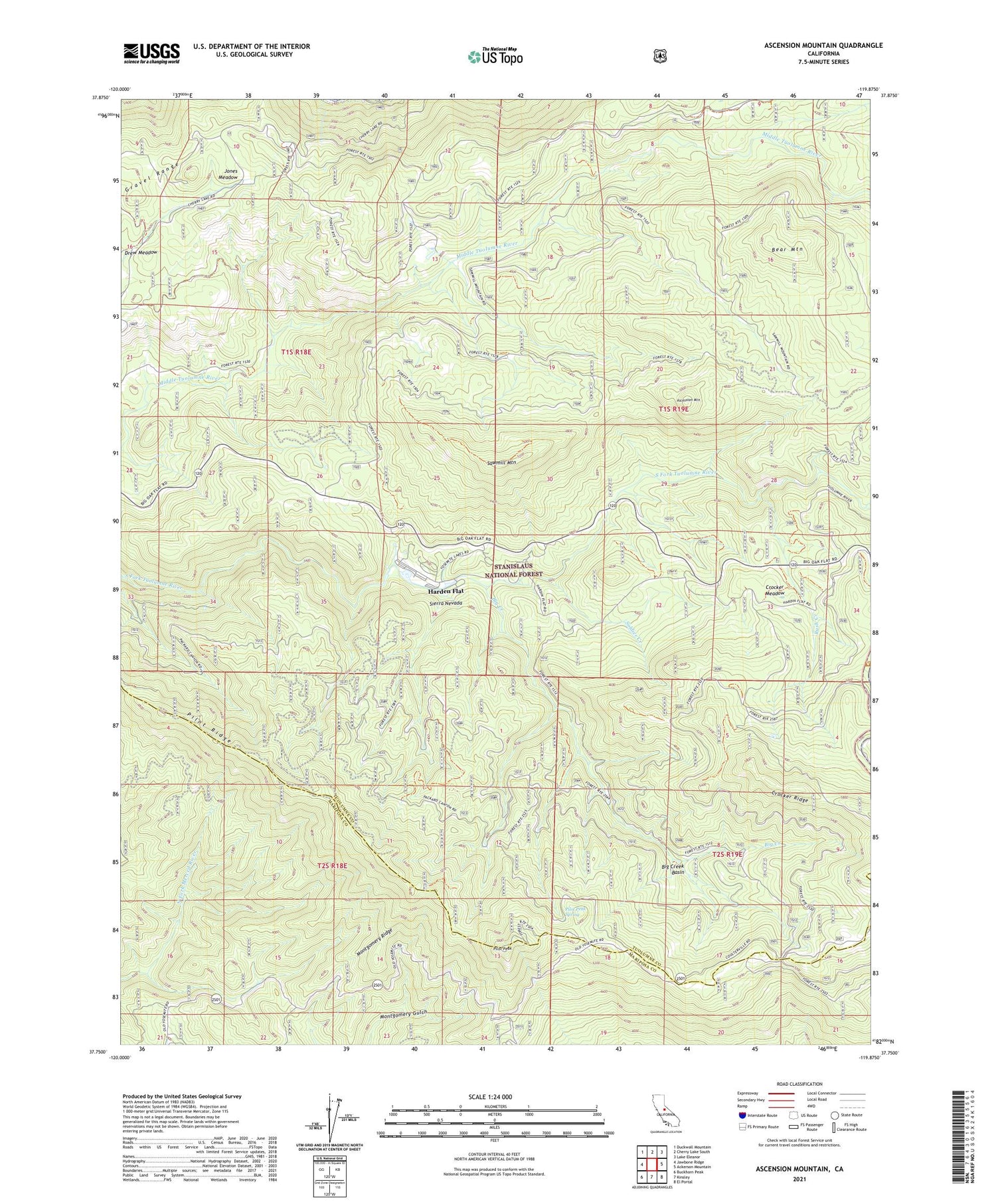
2021 topographic map quadrangle Ascension Mountain in the state of California. Scale: 1:24000. Based on the newly updated USGS 7.5' US Topo map series, this map is in the following counties: Tuolumne, Mariposa. The map contains contour data, water features, and other items you are used to seeing on USGS maps, but also has updated roads and other features. This is the next generation of topographic maps. Printed on high-quality waterproof paper with UV fade-resistant inks.
Quads adjacent to this one:
West: Jawbone Ridge
Northwest: Duckwall Mountain
North: Cherry Lake South
Northeast: Lake Eleanor
East: Ackerson Mountain
Southeast: El Portal
South: Kinsley
Southwest: Buckhorn Peak
This map covers the same area as the classic USGS quad with code o37119g8.
Contains the following named places: Ackerson Creek, Ascension Mountain, Bear Mountain, Berkeley-Tuolumne Campground, Big Creek, Big Creek Basin, Camp Towenga, Columbia Camp, Crocker Meadow, Five Star Mine, Goat Camp, Gravel Range, Harden Flat, Harden Ranch, Jones Meadow, Montgomery Ridge, Pilot Peak, Pilot Peak Spring, Pilot Ridge, Rush Creek, Sawmill Mountain, Sequoia, Soldier Creek, Spinning Wheel Forest Service Facility, Sunset Camp, Tuolumne Camp, Yosemite Lakes Park Campground


