MyTopo
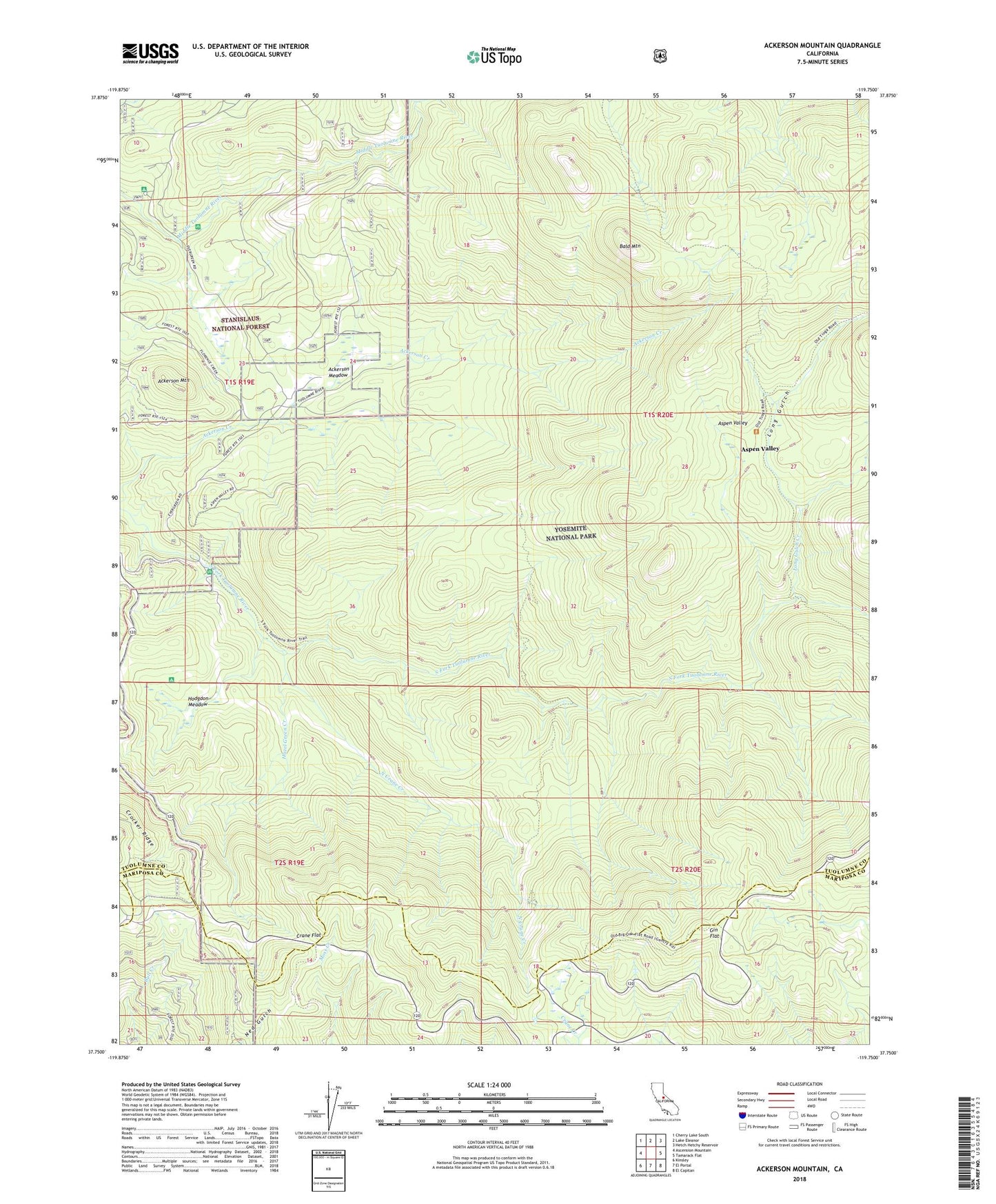
Ackerson Mountain California US Topo Map
Couldn't load pickup availability
Also explore the Ackerson Mountain Forest Service Topo of this same quad for updated USFS data
2021 topographic map quadrangle Ackerson Mountain in the state of California. Scale: 1:24000. Based on the newly updated USGS 7.5' US Topo map series, this map is in the following counties: Tuolumne, Mariposa. The map contains contour data, water features, and other items you are used to seeing on USGS maps, but also has updated roads and other features. This is the next generation of topographic maps. Printed on high-quality waterproof paper with UV fade-resistant inks.
Quads adjacent to this one:
West: Ascension Mountain
Northwest: Cherry Lake South
North: Lake Eleanor
Northeast: Hetch Hetchy Reservoir
East: Tamarack Flat
Southeast: El Capitan
South: El Portal
Southwest: Kinsley
This map covers the same area as the classic USGS quad with code o37119g7.
Contains the following named places: Ackerson Meadow, Ackerson Mountain, Aspen Valley, Bald Mountain, Big Oak Flat District Ranger Office, Carlon Campground, Carlon Station, Crane Flat, Crane Flat Lookout, Crane Flat Ranger Station, Crocker Ridge, Diamond O Boy Scout Camp, Gin Flat, Hazel Green Creek, Hazel Green Ranch, Hodgdon Meadow, Hodgdon Meadow Campground, Hodgdon Ranch, Long Gulch, Long Gulch Creek, Middlefork Campground, North Crane Creek, Peach Growers, Tunnel Tree, Tuolumne Grove