MyTopo
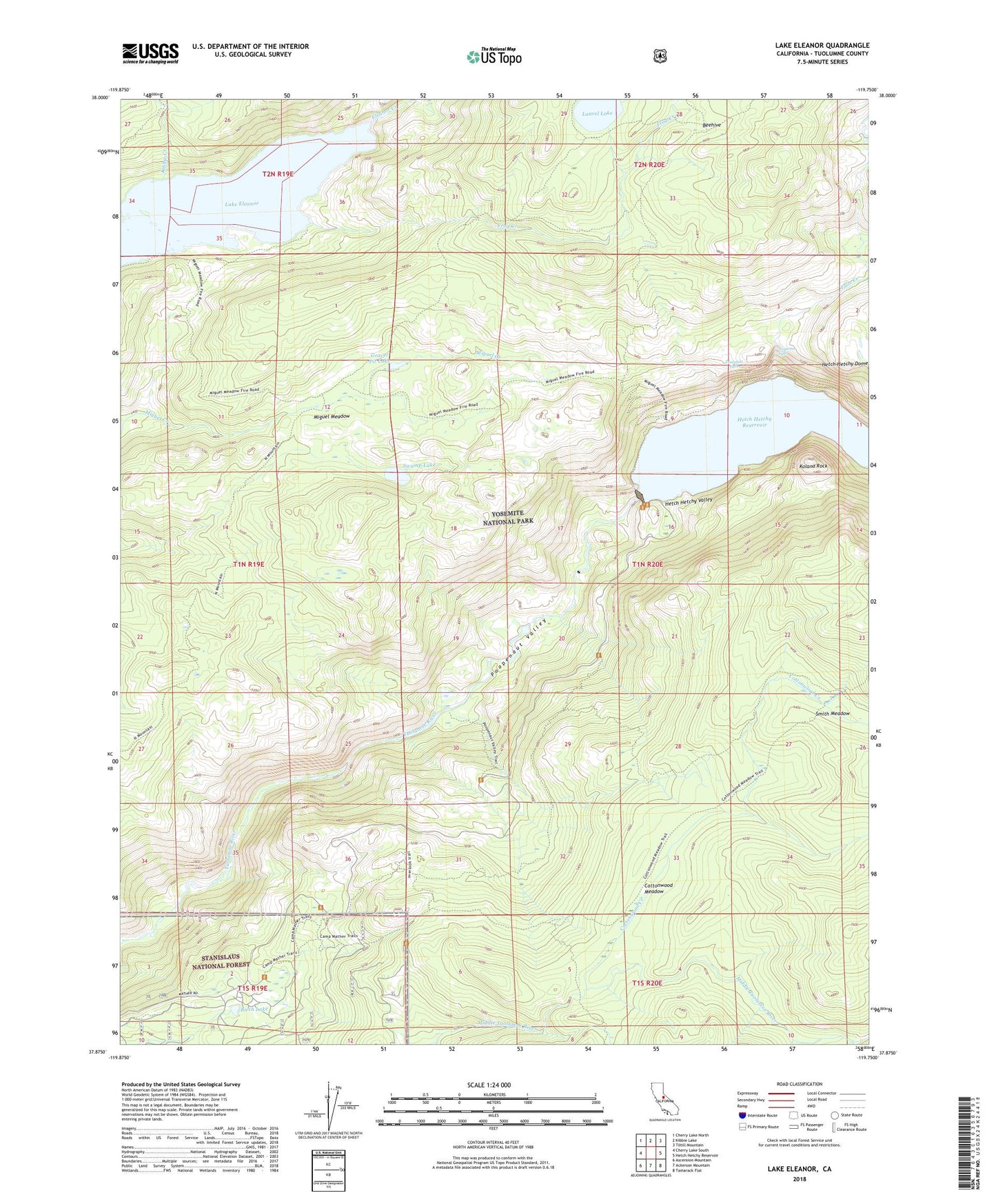
Lake Eleanor California US Topo Map
Couldn't load pickup availability
Also explore the Lake Eleanor Forest Service Topo of this same quad for updated USFS data
2021 topographic map quadrangle Lake Eleanor in the state of California. Scale: 1:24000. Based on the newly updated USGS 7.5' US Topo map series, this map is in the following counties: Tuolumne. The map contains contour data, water features, and other items you are used to seeing on USGS maps, but also has updated roads and other features. This is the next generation of topographic maps. Printed on high-quality waterproof paper with UV fade-resistant inks.
Quads adjacent to this one:
West: Cherry Lake South
Northwest: Cherry Lake North
North: Kibbie Lake
Northeast: Tiltill Mountain
East: Hetch Hetchy Reservoir
Southeast: Tamarack Flat
South: Ackerson Mountain
Southwest: Ascension Mountain
This map covers the same area as the classic USGS quad with code o37119h7.
Contains the following named places: Base Line Camp, Beehive, Birch Lake, Cottonwood Creek, Cottonwood Meadow, Evergreen Lodge, Falls Creek, Frog Creek, Grand Canyon of the Tuolumne River, Gravel Pit Lake, Hetch Hetchy Backpackers Campground, Hetch Hetchy Campground, Hetch Hetchy Dome, Hetch Hetchy Entrance, Hetch Hetchy Ranger Station, Hetch Hetchy Valley, Kibbie Creek, Kolana Rock, Lake Eleanor, Lake Eleanor District Ranger Office, Laurel Lake, Mather, Mather Post Office, Mather Ranger Station, Miguel Meadow, Miguel Meadow Ranger Station, O'Shaughnessy Dam, Poopenaut Valley, Smith Meadow, Swamp Lake, Tueeulala Falls, Tuolumne Wild and Scenic River, Wapama Falls