MyTopo
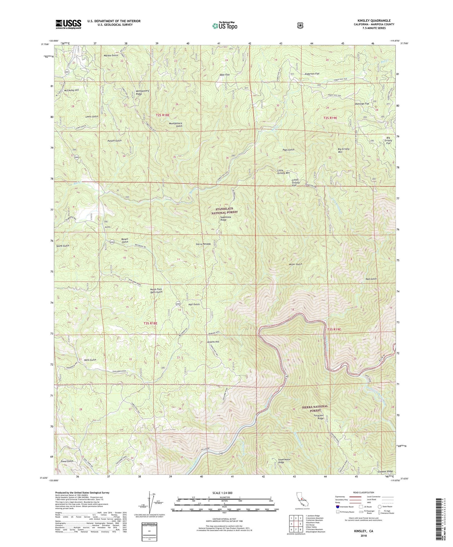
Kinsley California US Topo Map
Couldn't load pickup availability
Also explore the Kinsley Forest Service Topo of this same quad for updated USFS data
2021 topographic map quadrangle Kinsley in the state of California. Scale: 1:24000. Based on the newly updated USGS 7.5' US Topo map series, this map is in the following counties: Mariposa. The map contains contour data, water features, and other items you are used to seeing on USGS maps, but also has updated roads and other features. This is the next generation of topographic maps. Printed on high-quality waterproof paper with UV fade-resistant inks.
Quads adjacent to this one:
West: Buckhorn Peak
Northwest: Jawbone Ridge
North: Ascension Mountain
Northeast: Ackerson Mountain
East: El Portal
Southeast: Buckingham Mountain
South: Feliciana Mountain
Southwest: Bear Valley
This map covers the same area as the classic USGS quad with code o37119f8.
Contains the following named places: Anderson Flat, Big Grizzly Flat, Big Grizzly Mountain, Bonell Gulch, Deer Flat, Domingo Flat, Feliciana Creek, Ferguson Dump, Ferguson Ridge, Garibaldi Mine, Hayden Cabin Interpretive Site, Jenkins Hill, Jenkins Hill Trail, Jenkins Ranch, Kinsley, Little Grizzly Creek, Little Grizzly Flat, Little Grizzly Mountain, McCauley Hill, McCauley Ranch, Miller Gulch, Montgomery Gulch, Ned Gulch, North Fork Halls Gulch, Paps Gulch, Porath Gulch, Savage Trading Post, Skunk Gulch, Soapstone Ridge, South Fork, South Fork Merced River, Sweetwater Creek