MyTopo
Avena California US Topo Map
Couldn't load pickup availability
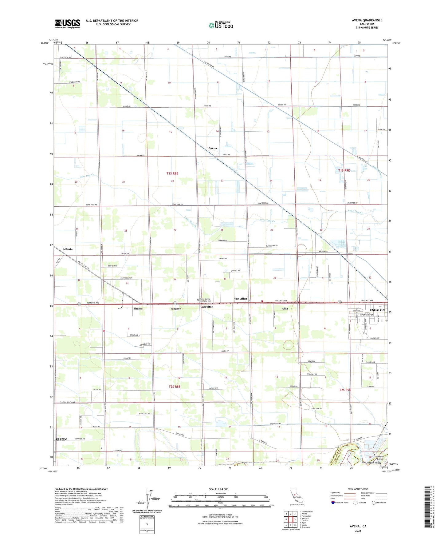
2021 topographic map quadrangle Avena in the state of California. Scale: 1:24000. Based on the newly updated USGS 7.5' US Topo map series, this map is in the following counties: San Joaquin, Stanislaus. The map contains contour data, water features, and other items you are used to seeing on USGS maps, but also has updated roads and other features. This is the next generation of topographic maps. Printed on high-quality waterproof paper with UV fade-resistant inks.
Quads adjacent to this one:
West: Manteca
Northwest: Stockton East
North: Peters
Northeast: Farmington
East: Escalon
Southeast: Riverbank
South: Salida
Southwest: Ripon
This map covers the same area as the classic USGS quad with code o37121g1.
Contains the following named places: Alba, Atlanta, Avena, Bartelink Dairy, Boscha Lake, C And G Farms, Carrolton, Colony Oak Elementary School, Creekside Dairy, Doornenbal Dairy, El Portal Middle School, Escalon Consolidated Fire Protection District Station 2, Escalon Division, Faria Dairy, Four Trees School, G and H Dairy, Gomes Dairy, Main District Canal, Red Rock Dairy, Ripon Consolidated Fire District Station 2, Ripon Division, River School, Saint John's Catholic Cemetery, Simms, Van Allen, Van Allen Elementary School, Vander Schaff Dairy, Vander Schaff Dairy Number 2, Wagner, Wagner Dairy, Weeda Dairy, Wildwood School, ZIP Code: 95320