MyTopo
Escalon California US Topo Map
Couldn't load pickup availability
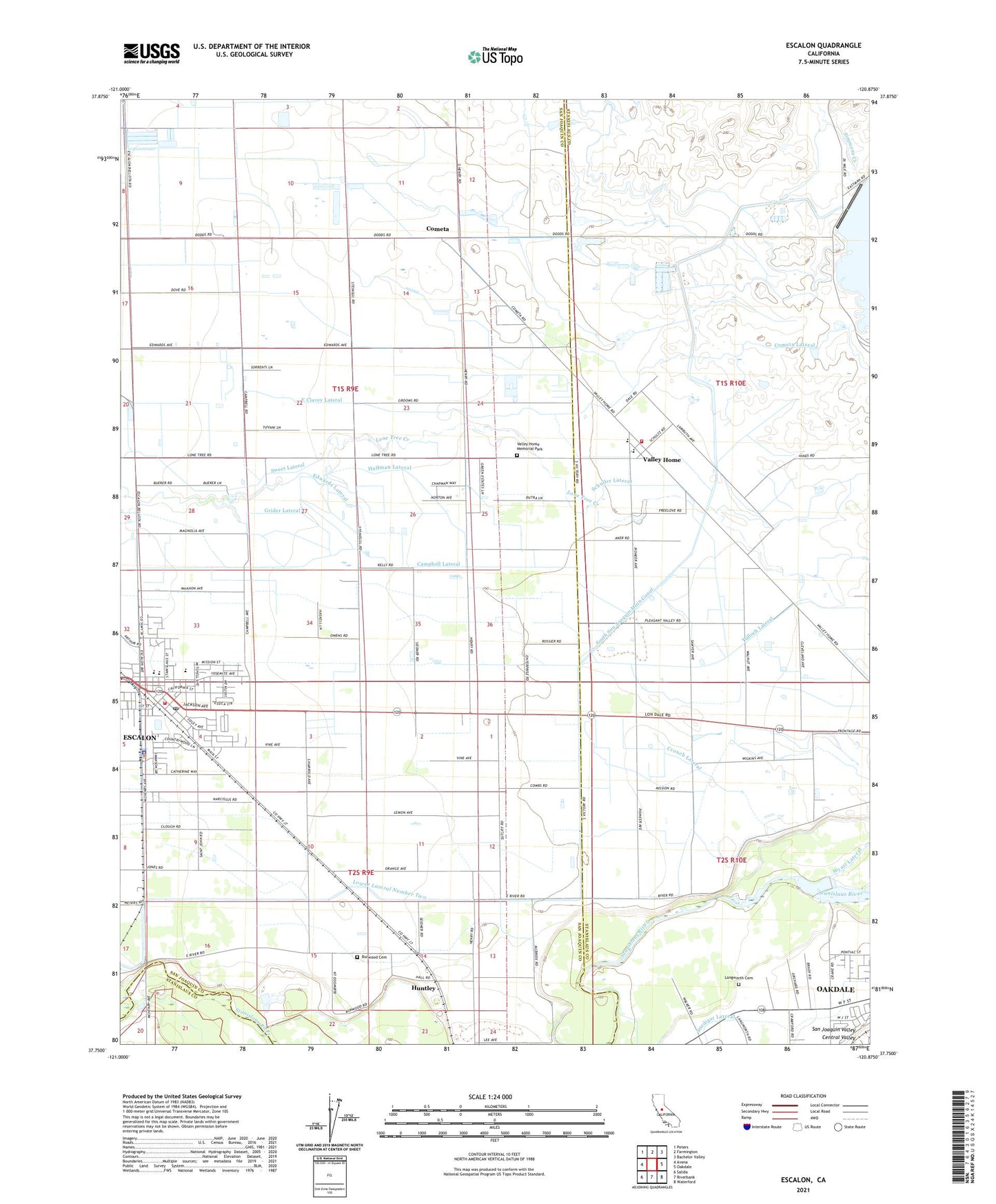
2021 topographic map quadrangle Escalon in the state of California. Scale: 1:24000. Based on the newly updated USGS 7.5' US Topo map series, this map is in the following counties: San Joaquin, Stanislaus. The map contains contour data, water features, and other items you are used to seeing on USGS maps, but also has updated roads and other features. This is the next generation of topographic maps. Printed on high-quality waterproof paper with UV fade-resistant inks.
Quads adjacent to this one:
West: Avena
Northwest: Peters
North: Farmington
Northeast: Bachelor Valley
East: Oakdale
Southeast: Waterford
South: Riverbank
Southwest: Salida
This map covers the same area as the classic USGS quad with code o37120g8.
Contains the following named places: Burwood Cemetery, Burwood School, Campbell Lateral, Chappel Lateral, City of Escalon, Clark Lateral, Cometa, Cometa Lateral, Crouch Lateral, Dent Elementary School, Diamond H Dairy, East Thalheim Lateral, Edwards Lateral, Eight Square Leagues On Stanislaus River, Enterprise School, Escalon, Escalon Airport, Escalon Branch Stockton-San Joaquin County Public Library, Escalon Community Ambulance, Escalon Consolidated Fire Protection District Station 1, Escalon High School, Escalon Police Department, Escalon Post Office, Fairbanks Lateral, Grider Lateral, Hinds Lateral, Hirshfield Lateral, Howard Lateral, Huffman Lateral, Huntley, KPLA-AM (Riverbank), Lambuth Lateral, Langworth Cemetery, Langworth Lateral, Langworth School, Leitch Lateral, Lone Tree School, Main Riverbank Pit, Moulton Lateral, Oakdale Rural Fire Protection District Valley Home Station, Reed Lateral, River Road Lateral, Root Lateral, Schuller Lateral, South San Joaquin Main Canal, Sweet Lateral, Thalheim Lateral, Valley Home, Valley Home Census Designated Place, Valley Home Memorial Park, Valley Home Post Office, Valley Home School, Woodward 66 Dam