MyTopo
Peters California US Topo Map
Couldn't load pickup availability
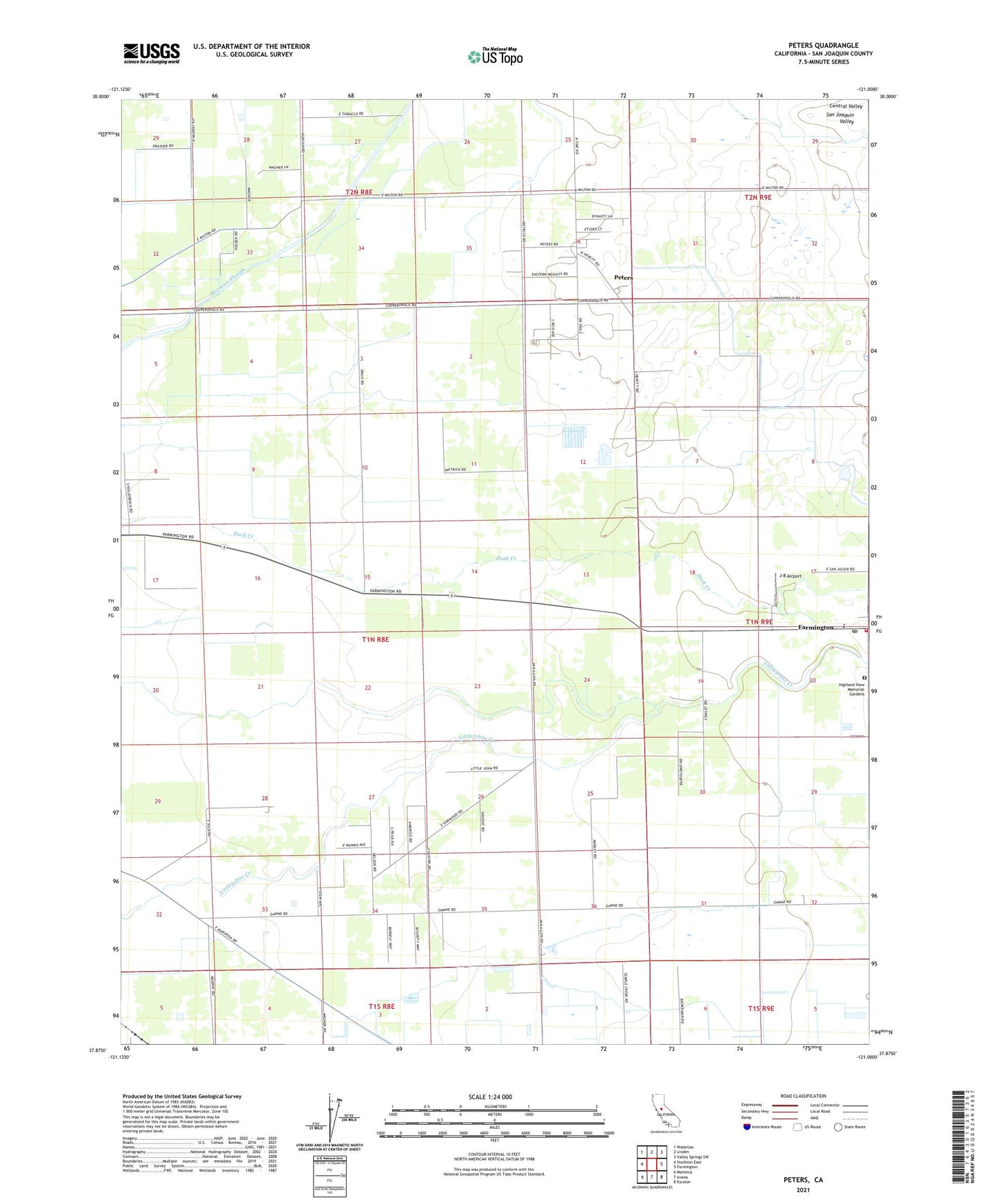
2021 topographic map quadrangle Peters in the state of California. Scale: 1:24000. Based on the newly updated USGS 7.5' US Topo map series, this map is in the following counties: San Joaquin. The map contains contour data, water features, and other items you are used to seeing on USGS maps, but also has updated roads and other features. This is the next generation of topographic maps. Printed on high-quality waterproof paper with UV fade-resistant inks.
Quads adjacent to this one:
West: Stockton East
Northwest: Waterloo
North: Linden
Northeast: Valley Springs SW
East: Farmington
Southeast: Escalon
South: Avena
Southwest: Manteca
This map covers the same area as the classic USGS quad with code o37121h1.
Contains the following named places: Everett School, Farmington, Farmington Census Designated Place, Farmington Elementary School, Farmington Post Office, Farmington Rural Fire Protection District, Highland View Memorial Gardens, Holden, J-B Airport, Linden-Farmington Division, Peters, Peters Census Designated Place, Weststeyn Dairy Number 2