MyTopo
Bear Harbor California US Topo Map
Couldn't load pickup availability
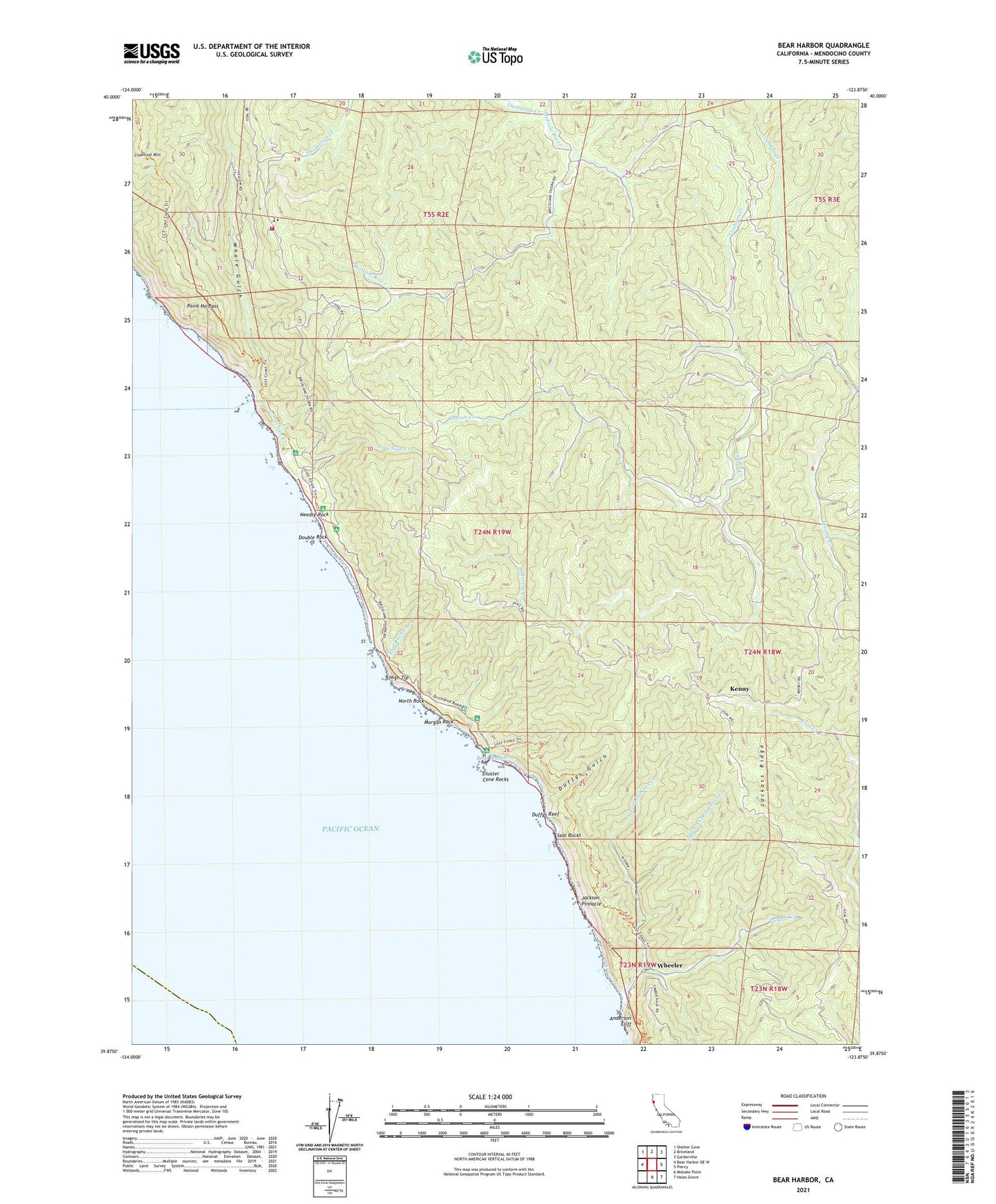
2021 topographic map quadrangle Bear Harbor in the state of California. Scale: 1:24000. Based on the newly updated USGS 7.5' US Topo map series, this map is in the following counties: Mendocino. The map contains contour data, water features, and other items you are used to seeing on USGS maps, but also has updated roads and other features. This is the next generation of topographic maps. Printed on high-quality waterproof paper with UV fade-resistant inks.
Quads adjacent to this one:
West: Bear Harbor OE W
Northwest: Shelter Cove
North: Briceland
Northeast: Garberville
East: Piercy
Southeast: Hales Grove
South: Mistake Point
This map covers the same area as the classic USGS quad with code o39123h8.
Contains the following named places: Anderson Creek, Bear Harbor, Bear Harbor Camp, Bear Harbor Ranch, Bear Landing, Cluster Cone Rocks, Couborn Creek, Double Rock, Duffys Gulch, Duffys Reef, East Branch North Fork Jackass Creek, Flat Rock Creek, High Tip, Jackass Creek, Jackass Ridge, Jackson Pinnacle, Jones Beach Camp, Kenny, Low Gap Camp, Low Gap Creek, Moody Creek, Morgan Rock, Needle Rock, Needle Rock Camp, Needle Rock Ranch, Needle Rock Visitors Center, North Fork Jackass Creek, North Rock, Orchard Camp, Our Lady of the Redwoods Abbey, Point No Pass, Railroad Camp, School Marm Grove, Seal Rocks, Sebbas Creek, Sinkyone State Wilderness, Sinkyone Wilderness State Park, Streamside Camp, Thompson Creek, Whale Gulch, Whale Gulch Elementary School, Whale Gulch Volunteer Fire Department, Wheeler, Wheeler Camp