MyTopo
Shelter Cove California US Topo Map
Couldn't load pickup availability
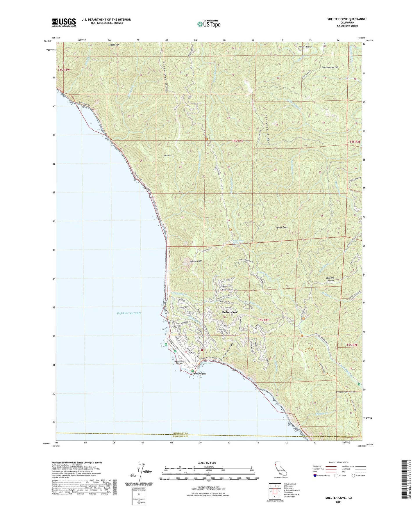
2021 topographic map quadrangle Shelter Cove in the state of California. Scale: 1:24000. Based on the newly updated USGS 7.5' US Topo map series, this map is in the following counties: Humboldt, Mendocino. The map contains contour data, water features, and other items you are used to seeing on USGS maps, but also has updated roads and other features. This is the next generation of topographic maps. Printed on high-quality waterproof paper with UV fade-resistant inks.
Quads adjacent to this one:
West: Shubrick Peak OE S
Northwest: Shubrick Peak
North: Honeydew
Northeast: Ettersburg
East: Briceland
Southeast: Bear Harbor
South: Bear Harbor OE W
This map covers the same area as the classic USGS quad with code o40124a1.
Contains the following named places: Big Finley Creek, Buck Creek, Chamisal Mountain, Chemise Creek, Dead Mans Gulch, Gitchell Creek, Grasshopper Hill, Horse Mountain, Horse Mountain Campground, Horse Mountain Creek, Horse Mountain Ridge, Humboldt Creek, Kaluna Cliff, Little Finley Creek, McKee Creek, Nadelos Campground, Nooning Ground, Paradise Ridge, Pepperwood Spring, Point Delgada, Queen Peak, Rocks and Islands Wilderness, Shelter Cove, Shelter Cove Airport, Shelter Cove Census Designated Place, Shelter Cove Volunteer Fire Department, Telegraph Creek, Tolkan Campground, Wailaki Campground