MyTopo
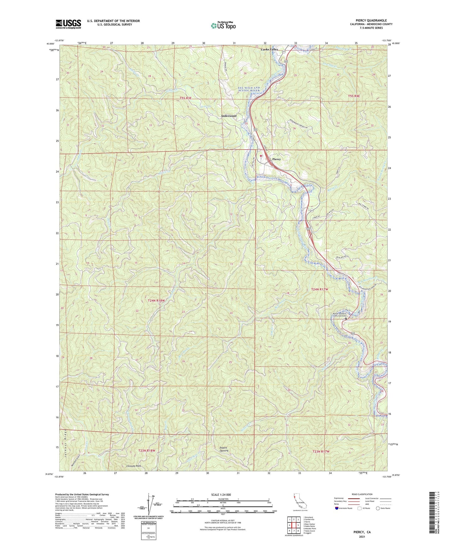
Piercy California US Topo Map
Couldn't load pickup availability
2021 topographic map quadrangle Piercy in the state of California. Scale: 1:24000. Based on the newly updated USGS 7.5' US Topo map series, this map is in the following counties: Mendocino. The map contains contour data, water features, and other items you are used to seeing on USGS maps, but also has updated roads and other features. This is the next generation of topographic maps. Printed on high-quality waterproof paper with UV fade-resistant inks.
Quads adjacent to this one:
West: Bear Harbor
Northwest: Briceland
North: Garberville
Northeast: Harris
East: Noble Butte
Southeast: Leggett
South: Hales Grove
Southwest: Mistake Point
This map covers the same area as the classic USGS quad with code o39123h7.
Contains the following named places: Andersonia, Bear Pen Creek, Bridges Creek, Chimney Rock, Chimney Rock Creek, Cub Creek, Dora Creek, Dugans Opening, Frank and Bess Smithe Redwood Grove, Indian Creek, Jones Creek, Lane Redwood Flat, Low Gap Creek, McCoy Creek, Medcalf Ranch, Minnie Stoddard Lilley Gravesite, Moody, North Fork McCoy Creek, Parker Creek, Piercy, Piercy Creek, Piercy Fire Protection District, Red Mountain Creek, Reynolds, Reynolds State Wayside Campground, Rice Ranch, Standley Creek, Waterfall Gulch, Wildcat Creek, ZIP Code: 95587