MyTopo
Bieber California US Topo Map
Couldn't load pickup availability
Also explore the Bieber Forest Service Topo of this same quad for updated USFS data
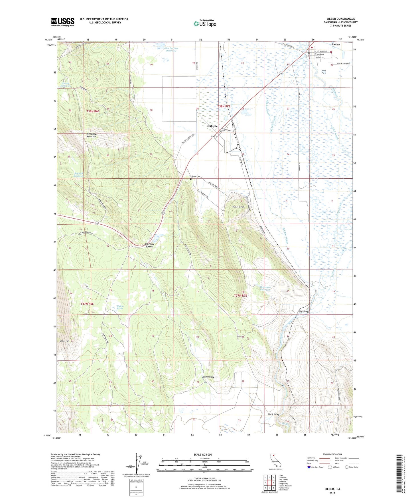
2021 topographic map quadrangle Bieber in the state of California. Scale: 1:24000. Based on the newly updated USGS 7.5' US Topo map series, this map is in the following counties: Lassen. The map contains contour data, water features, and other items you are used to seeing on USGS maps, but also has updated roads and other features. This is the next generation of topographic maps. Printed on high-quality waterproof paper with UV fade-resistant inks.
Quads adjacent to this one:
West: Pittville
Northwest: Day
North: Lookout
Northeast: Big Swamp
East: Hog Valley
Southeast: Dixie Peak
South: Little Valley
Southwest: Coble Mountain
This map covers the same area as the classic USGS quad with code o41121a2.
Contains the following named places: Bagwell Reservoir, Bieber, Bieber Post Office, Bieber Station, Big Valley, Big Valley Fire Protection District, Big Valley High School, Big Valley Intermediate School, Big Valley Summit, Bull Run Slough, Cal Fire Lassen Modoc Unit Bieber Fire Station, Clara Bieber Memorial Park, Dixon Hill, Egg Lake Slough, Four Corners, Gobel Slough, Grace Bible Church, Grace Christian Academy, Hardin Reservoir, Hillside Cemetery, Intermountain Conservation Camp, Johns Valley, Muck Valley, Mullens Spring, Nine Springs 1245 Dam, Nine Springs Reservoir, Nubieber, Nubieber Census Designated Place, Nubieber Post Office, Pit River, Ricketts Hill, Thompson Reservoir, ZIP Code: 96068