MyTopo
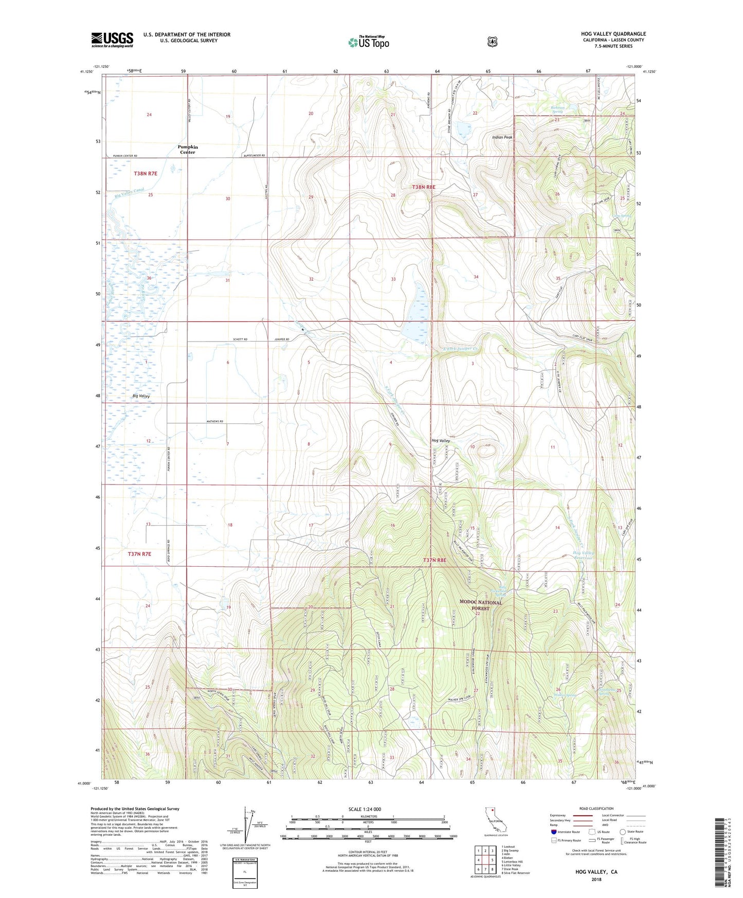
Hog Valley California US Topo Map
Couldn't load pickup availability
Also explore the Hog Valley Forest Service Topo of this same quad for updated USFS data
2021 topographic map quadrangle Hog Valley in the state of California. Scale: 1:24000. Based on the newly updated USGS 7.5' US Topo map series, this map is in the following counties: Lassen. The map contains contour data, water features, and other items you are used to seeing on USGS maps, but also has updated roads and other features. This is the next generation of topographic maps. Printed on high-quality waterproof paper with UV fade-resistant inks.
Quads adjacent to this one:
West: Bieber
Northwest: Lookout
North: Big Swamp
Northeast: Adin
East: Letterbox Hill
Southeast: Silva Flat Reservoir
South: Dixie Peak
Southwest: Little Valley
This map covers the same area as the classic USGS quad with code o41121a1.
Contains the following named places: Billy Packwood Spring, Cary Spring, Ditch Camp, East Fork Juniper Creek, Hog Valley, Hog Valley Reservoir, Indian Peak, Iverson 1239 Dam, Jim Packwood Spring, Juniper Creek, Leonard Number 2 1252 Dam, Pumpkin Center, Richman Spring, South Fork Juniper Creek, Walker Spring, ZIP Code: 96009