MyTopo
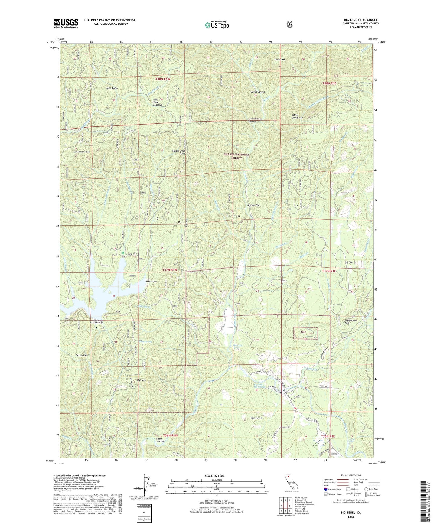
Big Bend California US Topo Map
Couldn't load pickup availability
Also explore the Big Bend Forest Service Topo of this same quad for updated USFS data
2021 topographic map quadrangle Big Bend in the state of California. Scale: 1:24000. Based on the newly updated USGS 7.5' US Topo map series, this map is in the following counties: Shasta. The map contains contour data, water features, and other items you are used to seeing on USGS maps, but also has updated roads and other features. This is the next generation of topographic maps. Printed on high-quality waterproof paper with UV fade-resistant inks.
Quads adjacent to this one:
West: Shoeinhorse Mountain
Northwest: Lake McCloud
North: Grizzly Peak
Northeast: Dead Horse Summit
East: Skunk Ridge
Southeast: Chalk Mountain
South: Roaring Creek
Southwest: Goose Gap
This map covers the same area as the classic USGS quad with code o41121a8.
Contains the following named places: Alder Creek, Arvison Flat, Arvison Flat Guard Station, Baker Creek, Bear Camp, Big Bend, Big Bend Census Designated Place, Big Bend Hot Springs, Big Bend Indian Cemetery, Big Bend Post Office, Big Bend Rancheria, Big Bend US Forest Service Station, Big Bend Volunteer Fire Company 70, Big Cedar Camp, Big Flat, Blue Jay Creek, Camp Pit, Cedar Salt Log Creek, Cox Ranch, Deadlun Campground, Deadlun Creek, Deer Ranch, Devils Canyon, Devils Mountain, Dutchman Peak, East Fork Nelson Creek, Grasshopper Flat, Hawkins Landing Campground, Hunt Hot Spring, Indian Springs Elementary School, Initial Creek, Iron Canyon 97-124 Dam, Iron Canyon Reservoir, Kinner Falls, Kinner Ranch, Kosk Creek, Kosk School, Lengel Place, Little Devils Canyon, Little Devils Mountain, Little Gap Creek, Little Joe Flat, Little Meadows, Little Shotgun Creek, Lofton, McGill Creek, Mica Gulch, Nelson Creek, Nelson Flat, Nelson Flat Trail, Oak Mountain, Powers, Rayner, Reynolds Creek, Rough and Ready Creek, Shotgun Creek, Smith Flat, Snowslide Creek, Stump Creek, Stump Creek Butte, Willow Spring, Winston Bell, ZIP Code: 96011