MyTopo
Roaring Creek California US Topo Map
Couldn't load pickup availability
Also explore the Roaring Creek Forest Service Topo of this same quad for updated USFS data
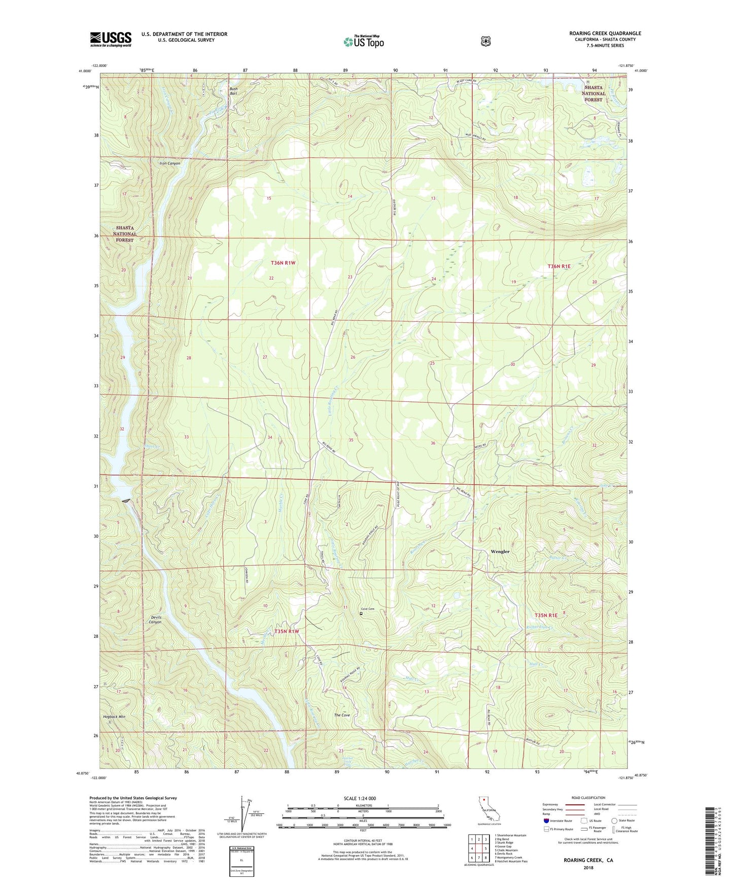
2022 topographic map quadrangle Roaring Creek in the state of California. Scale: 1:24000. Based on the newly updated USGS 7.5' US Topo map series, this map is in the following counties: Shasta. The map contains contour data, water features, and other items you are used to seeing on USGS maps, but also has updated roads and other features. This is the next generation of topographic maps. Printed on high-quality waterproof paper with UV fade-resistant inks.
Quads adjacent to this one:
West: Goose Gap
Northwest: Shoeinhorse Mountain
North: Big Bend
Northeast: Skunk Ridge
East: Chalk Mountain
Southeast: Hatchet Mountain Pass
South: Montgomery Creek
Southwest: Devils Rock
This map covers the same area as the classic USGS quad with code o40121h8.
Contains the following named places: Browns Creek, Bush Bar School, Bush Barl, Butter Creek, Cape Horn Creek, Cove Cemetery, Cove School, Devils Canyon, Flat Woods, Hall Creek, Hatchet Creek Falls, Hogback Mountain, Iron Canyon, Iron Canyon Creek, Jake Creek, James B Black Powerhouse, Little Roaring Creek, Lookout Hogback OPG and E, Marble Creek, Pineland School, Pit 5 Conduit Embankment 97-108 Dam, Pit Five Powerhouse, Pit Six Dam, Pit Six Reservoir, Richardson Creek, Roaring Creek, Roaring Creek Rancheria, Short Creek, The Cove, Tunnel Reservoir, Wengler, ZIP Code: 96065