MyTopo
Chalk Mountain California US Topo Map
Couldn't load pickup availability
Also explore the Chalk Mountain Forest Service Topo of this same quad for updated USFS data
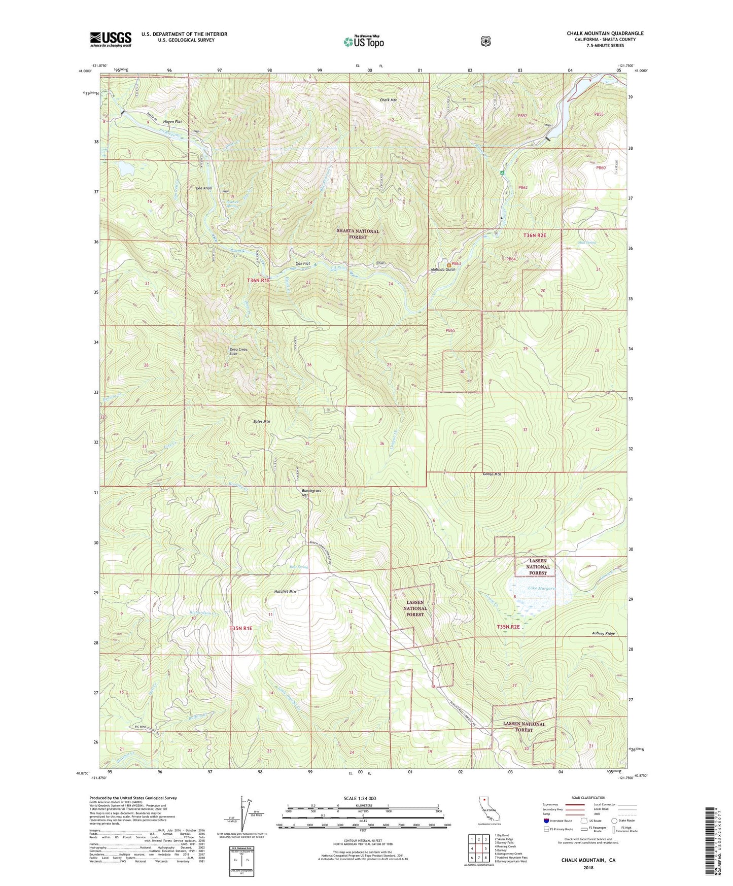
2022 topographic map quadrangle Chalk Mountain in the state of California. Scale: 1:24000. Based on the newly updated USGS 7.5' US Topo map series, this map is in the following counties: Shasta. The map contains contour data, water features, and other items you are used to seeing on USGS maps, but also has updated roads and other features. This is the next generation of topographic maps. Printed on high-quality waterproof paper with UV fade-resistant inks.
Quads adjacent to this one:
West: Roaring Creek
Northwest: Big Bend
North: Skunk Ridge
Northeast: Burney Falls
East: Burney
Southeast: Burney Mountain West
South: Hatchet Mountain Pass
Southwest: Montgomery Creek
This map covers the same area as the classic USGS quad with code o40121h7.
Contains the following named places: Aubrey Ridge, Bales Mountain, Bear Spring, Bedrock Spring, Bee Knoll, Blackberry Creek, Buffum Creek, Bunchgrass Mountain, Cantrell Creek, Canyon Creek, Chalk Mountain, Deep Creek, Deep Creek Campground, Deep Creek Slide, Fox Creek, Goose Mountain, Hagen Flat, Hatchet Mountain, Hawk Creek, Haynes Reservoir 2223 Dam, KARZ-FM (Burney), Lake Margaret, Malinda Gulch, Mud Spring, Oak Flat, Pit Five Dam, Pit Four Dam, Pit Four Powerhouse, Pit Four Reservoir, Pit Number 4 97-100 Dam, Pit Number 5 Diversion 97-107 Dam, Ruling Creek, Screwdriver Creek, Swift Creek