MyTopo
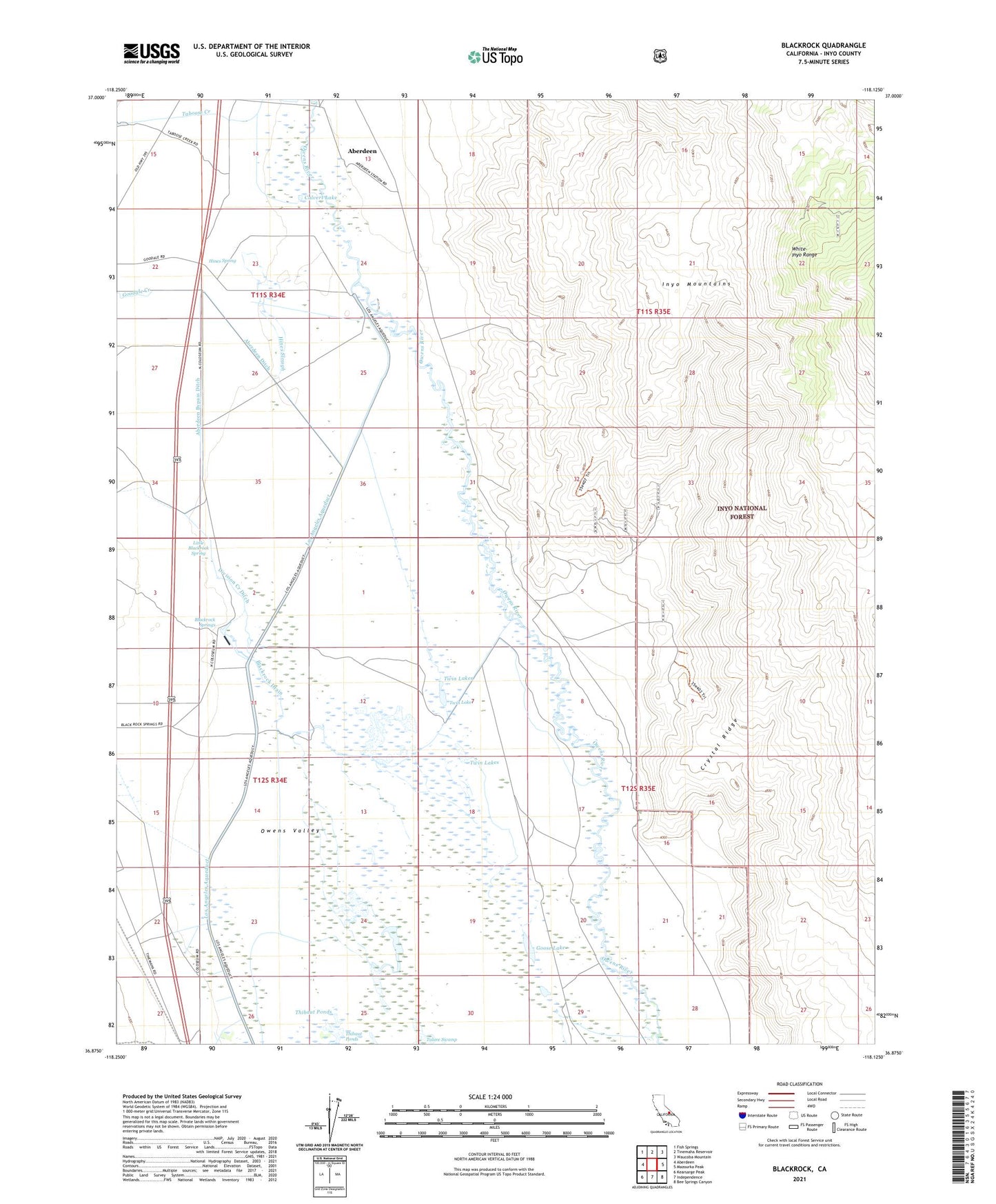
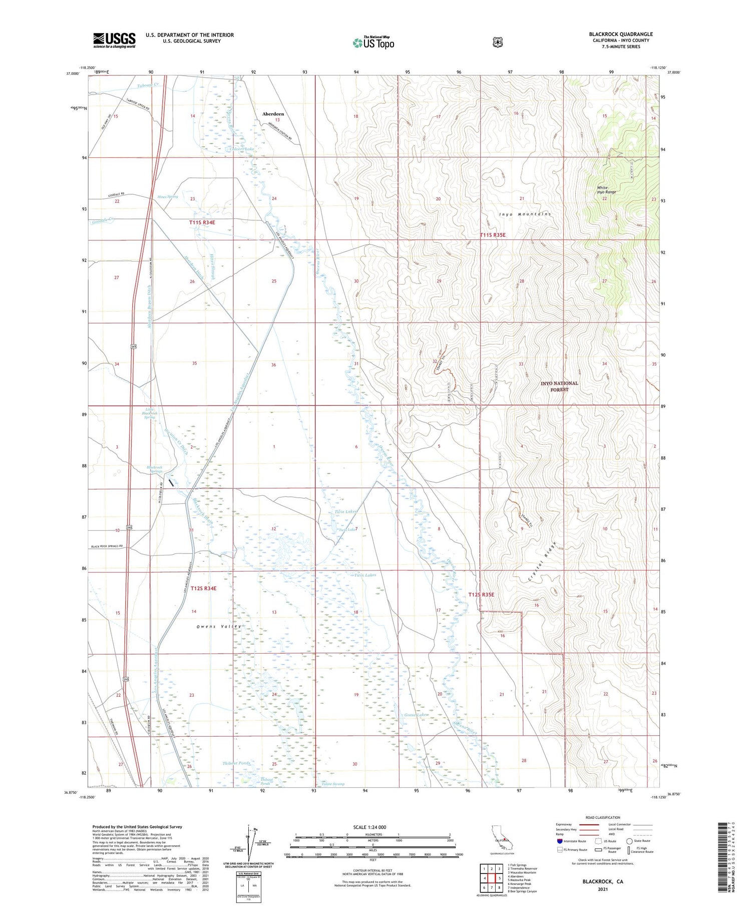
Blackrock California US Topo Map
Couldn't load pickup availability
Also explore the Blackrock Forest Service Topo of this same quad for updated USFS data
2021 topographic map quadrangle Blackrock in the state of California. Scale: 1:24000. Based on the newly updated USGS 7.5' US Topo map series, this map is in the following counties: Inyo. The map contains contour data, water features, and other items you are used to seeing on USGS maps, but also has updated roads and other features. This is the next generation of topographic maps. Printed on high-quality waterproof paper with UV fade-resistant inks.
Quads adjacent to this one:
West: Aberdeen
Northwest: Fish Springs
North: Tinemaha Reservoir
Northeast: Waucoba Mountain
East: Mazourka Peak
Southeast: Bee Springs Canyon
South: Independence
Southwest: Kearsarge Peak
This map covers the same area as the classic USGS quad with code o36118h2.
Contains the following named places: Aberdeen Bypass Ditch, Aberdeen Ditch, Black Jack Mine, Black Rock Fish Hatchery, Blackrock, Blackrock Drain, Blackrock Springs, Blue Boy Prospect, California Rose Number 2 Prospect, Calvert Lake, Chrysopolis, Crystal Ridge, Division Creek Ditch, Elkhorn Numbers 1-8 Placer Mines, Empire Mine, Eureka Consolidated Quartz Mine, George III Prospect, Gold Bugs Numbers 1-2 Prospects, Goodale Creek, Goose Lake, Green Group Prospects, Hines Slough, Hines Spring, Iron Wedge Prospect, Jack Black Mine, Johnnie Number 7 Prospect, Little Blackrock Spring, Little Joker Prospect, Lucky Larry Group Prospects, Manlan Numbers 1-9 Prospects, Maxim Mill, Mendosino Mine, Monte Cristo Prospect, Old River Arrastre-Black Jack Gold Numbers 1-10 Prospects, Old River Arrastre-Owl Prospect, Pyrite Extension Prospect, Sawmill Creek, Sixtynine Numbers 1-6 Prospects, Squaw Mine, Taboose Creek, Taboose Ranch, Thibaut Creek, Thibaut Ponds, Twin Lakes, Winerton Well