MyTopo
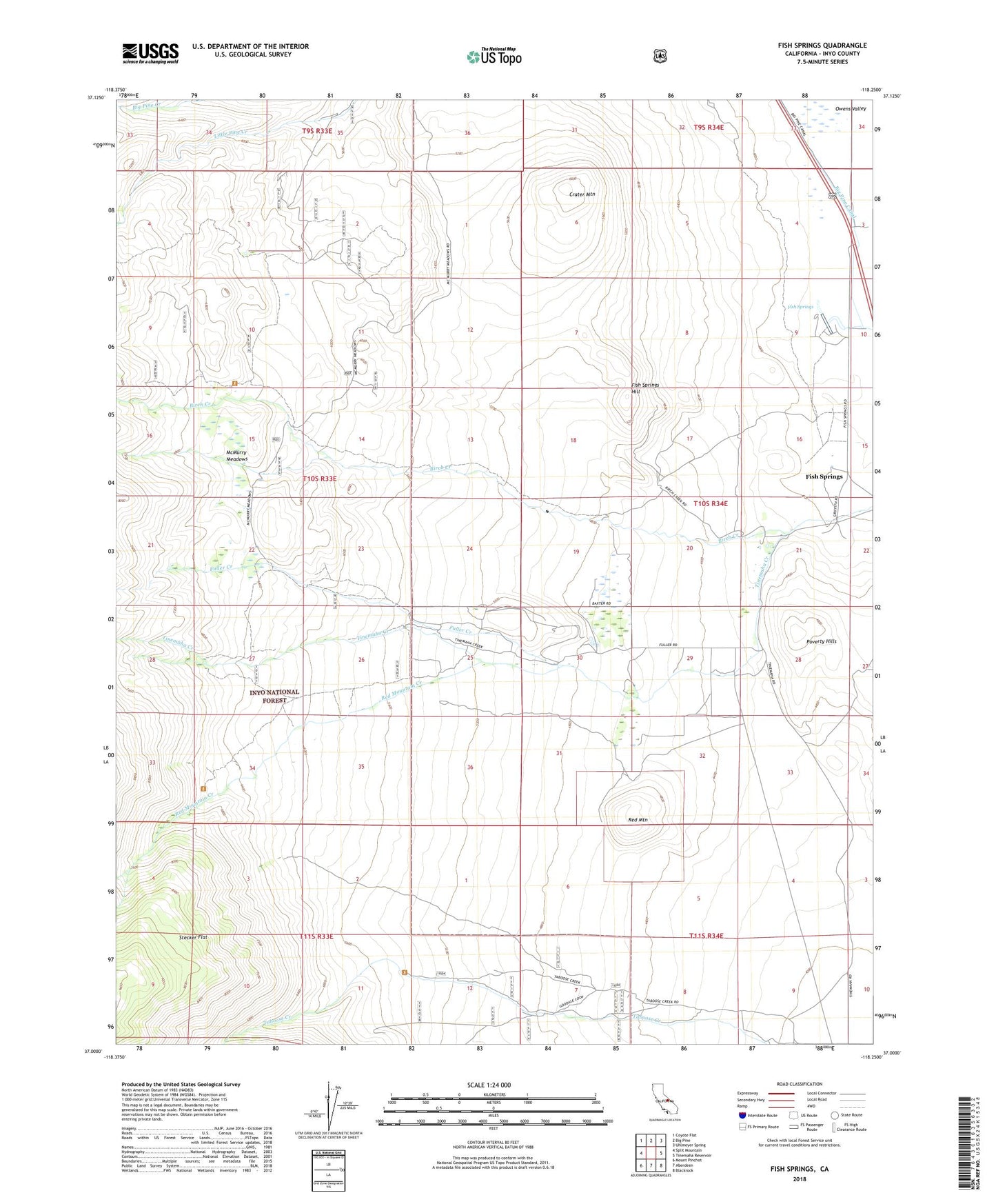
Fish Springs California US Topo Map
Couldn't load pickup availability
Also explore the Fish Springs Forest Service Topo of this same quad for updated USFS data
2021 topographic map quadrangle Fish Springs in the state of California. Scale: 1:24000. Based on the newly updated USGS 7.5' US Topo map series, this map is in the following counties: Inyo. The map contains contour data, water features, and other items you are used to seeing on USGS maps, but also has updated roads and other features. This is the next generation of topographic maps. Printed on high-quality waterproof paper with UV fade-resistant inks.
Quads adjacent to this one:
West: Split Mountain
Northwest: Coyote Flat
North: Big Pine
Northeast: Uhlmeyer Spring
East: Tinemaha Reservoir
Southeast: Blackrock
South: Aberdeen
Southwest: Mount Pinchot
This map covers the same area as the classic USGS quad with code o37118a3.
Contains the following named places: Birch Creek, Birch Lake Trailhead, Brook Quarry, Cleveland Mines, Cometti Mine, Crater Mountain, Fish Springs, Fish Springs Hill, Fish Springs Quarry, Fish Springs School, Fish Springs State Fish Hatchery, Fuller Creek, McMurry Meadows, Poverty Hills, Red Mountain, Red Mountain Creek, Stecker Flat, Taboose Pass Trailhead