MyTopo
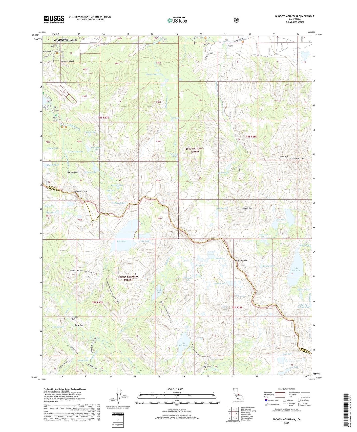
Bloody Mountain California US Topo Map
Couldn't load pickup availability
Also explore the Bloody Mountain Forest Service Topo of this same quad for updated USFS data
2021 topographic map quadrangle Bloody Mountain in the state of California. Scale: 1:24000. Based on the newly updated USGS 7.5' US Topo map series, this map is in the following counties: Mono, Fresno. The map contains contour data, water features, and other items you are used to seeing on USGS maps, but also has updated roads and other features. This is the next generation of topographic maps. Printed on high-quality waterproof paper with UV fade-resistant inks.
Quads adjacent to this one:
West: Crystal Crag
Northwest: Mammoth Mountain
North: Old Mammoth
Northeast: Whitmore Hot Springs
East: Convict Lake
Southeast: Mount Abbot
South: Graveyard Peak
Southwest: Sharktooth Peak
Contains the following named places: Arrowhead Lake, Barney Lake, Bighorn Lake, Bloody Lake, Bloody Mountain, Boys Club of San Gabriel, Bunny Lake, Cascade Valley, Cecil Lake, Cloverleaf Lake, Cold Water Campground, Cold Water Creek, Deer Lakes, Duck Lake, Duck Pass Trailhead, Edith Lake, Emerald Lake, Franklin Lake, Gentian Meadow, Gibbs Cemetery, Glen Lake, Glennette Lake, Hammil Lake, Heart Lake, Lake Dorothy, Lake Genevieve, Lake Virginia, Lake Wit-So-Nah-Pah, Laurel Lakes, Laurel Lakes Trailhead, Laurel Mountain, Lee Lake, Long Canyon, Los Angeles Y M C A Camp, Lost Lake, Mammoth Consolidated Mine, Mammoth Consolidated Mine Interpretive Site, Mammoth Crest, Mammoth Motorcross Track, Mammoth Rock, Mammoth Rock Trail, Marsh Lake, Mill City, Mill City Historic Site, Minnow Creek, Monte Cristo Mine, Old Mammoth Mine, Pika Lake, Pine City Campground, Purple Creek, Purple Lake, Ram Lake, Red Lake, Scoop Lake, Sevehah Cliff, Sherwin Lakes, Sherwin Lakes Trail, Sherwin Lakes Trailhead, Skelton Lake, Sky Meadows, TJ Lake Trailhead, Tully Hole, Valentine Lake, Valentine Lake Trailhead, Way Lake, Woods Lakes