MyTopo
Whittemore Ridge California US Topo Map
Couldn't load pickup availability
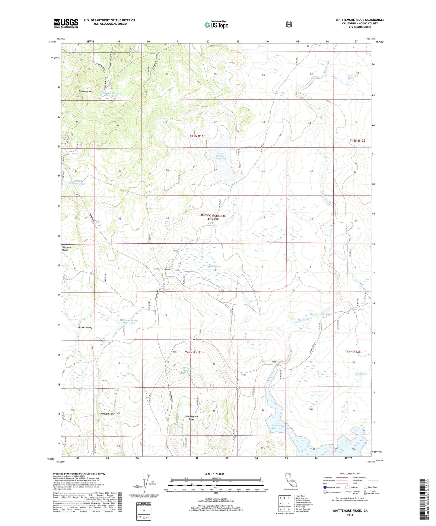
2021 topographic map quadrangle Whittemore Ridge in the state of California. Scale: 1:24000. Based on the newly updated USGS 7.5' US Topo map series, this map is in the following counties: Modoc. The map contains contour data, water features, and other items you are used to seeing on USGS maps, but also has updated roads and other features. This is the next generation of topographic maps. Printed on high-quality waterproof paper with UV fade-resistant inks.
Quads adjacent to this one:
West: Boles Meadow East
Northwest: Hager Basin
North: South Mountain
Northeast: McGinty Reservoir
East: Dead Horse Reservoir
Southeast: Mahogany Ridge
South: Big Sage Reservoir
Southwest: Jacks Butte
This map covers the same area as the classic USGS quad with code o41120f6.
Contains the following named places: Corral Spring, Cow Head Spring, DeCamp Stock Tank, Dorris Brothers Reservoir, Goose Lake, Graves Valley, Ingalls Swamp, Ingalls Swamp Ranch, Ingals Swamp 141-002 Dam, Layton Spring, Logan Slough, Logan Spring, Porcupine Rim, Timbered Mountain, Timbered Mountain Stock Tank, Whittemore Ridge, Whittemore Spring, Williams Valley, Williams Valley Stock Tank