
MyTopo
Bouldin Island California US Topo Map
Couldn't load pickup availability
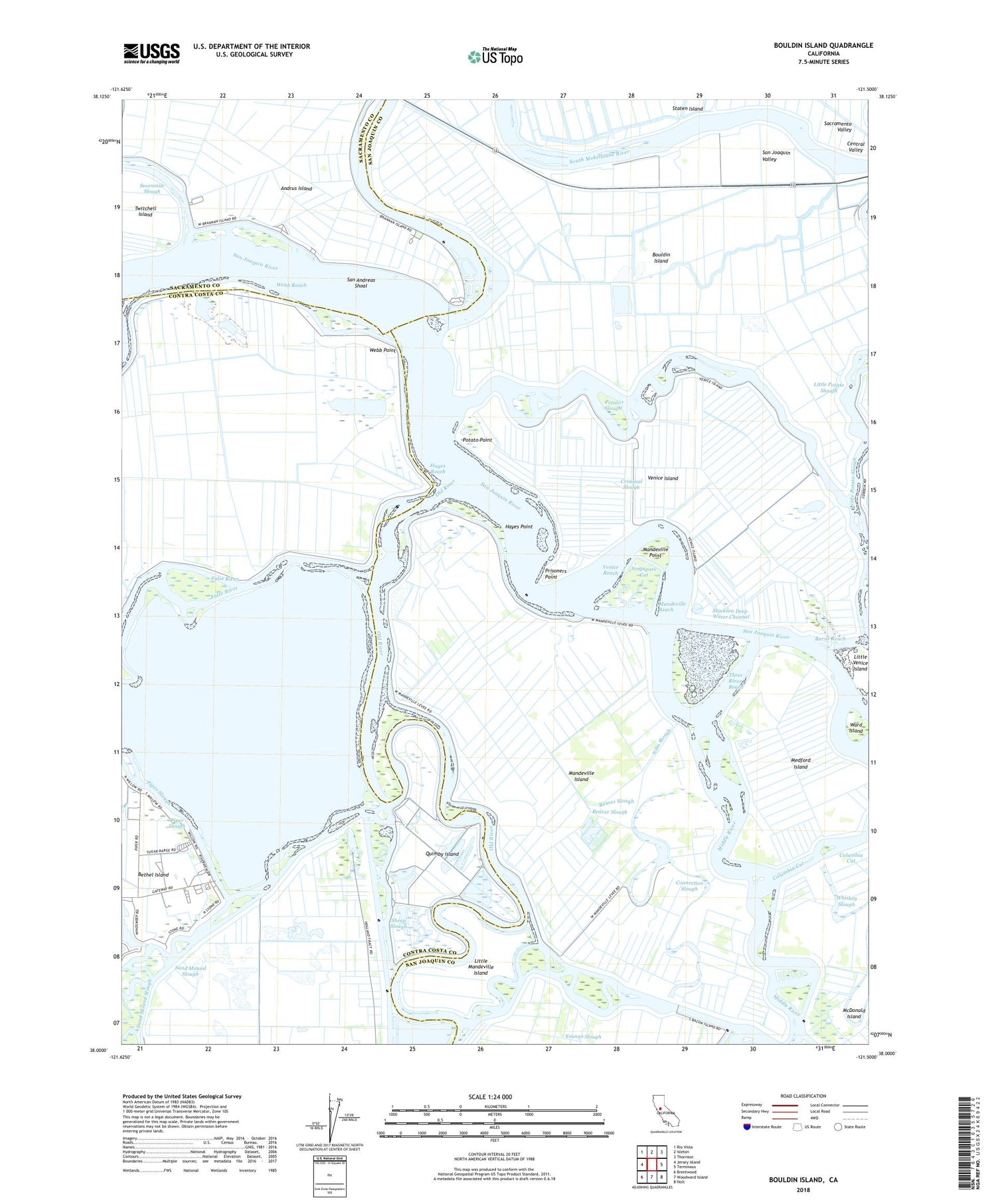
2021 topographic map quadrangle Bouldin Island in the state of California. Scale: 1:24000. Based on the newly updated USGS 7.5' US Topo map series, this map is in the following counties: San Joaquin, Contra Costa, Sacramento. The map contains contour data, water features, and other items you are used to seeing on USGS maps, but also has updated roads and other features. This is the next generation of topographic maps. Printed on high-quality waterproof paper with UV fade-resistant inks.
Quads adjacent to this one:
West: Jersey Island
Northwest: Rio Vista
North: Isleton
Northeast: Thornton
East: Terminous
Southeast: Holt
South: Woodward Island
Southwest: Brentwood
This map covers the same area as the classic USGS quad with code o38121a5.
Contains the following named places: Beaver Slough, Blakes Landing, Bouldin Island, Burns Reach, Central Landing, Columbia Cut, Connection Slough, Criminal Slough, Hayes Point, Hayes Reach, Holland Cut, Little Mandeville Island, Little Venice Island, Mandeville Cut, Mandeville Island, Mandeville Point, Mandeville Reach, Mandeville Tip County Park, Medford Island, Middle River, Mokelumne River, Nibs Slough, Old River, Potato Point, Potato Slough, Prisoners Point, Prisoners Point Bend Light, Quimby Island, Rhode Island, Roosevelt Cut, Sacramento County Sheriff - Brannan Island Service Center, San Andreas Shoal, Sand Mound Slough, Sheep Slough, Short Slough, Singapore Cut, Stockton Deep Water Channel, Three River Reach, Turner Lake, Turner Slough, Venice Cut, Venice Ferry, Venice Island, Venice Reach, Venice-Mandeville School, Ward Island, Webb Point, Webb Reach, Webb Tract


