MyTopo
Holt California US Topo Map
Couldn't load pickup availability
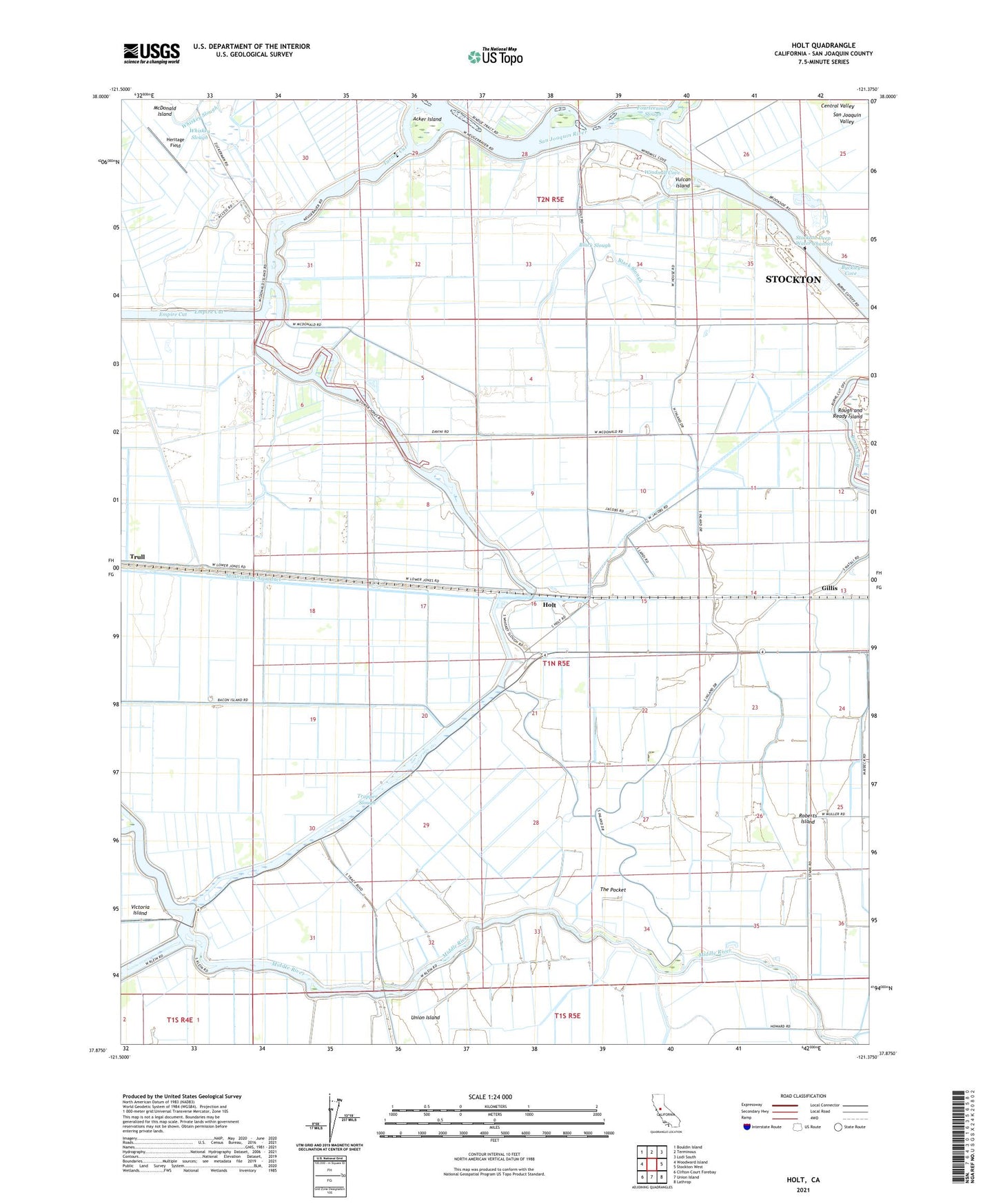
2021 topographic map quadrangle Holt in the state of California. Scale: 1:24000. Based on the newly updated USGS 7.5' US Topo map series, this map is in the following counties: San Joaquin. The map contains contour data, water features, and other items you are used to seeing on USGS maps, but also has updated roads and other features. This is the next generation of topographic maps. Printed on high-quality waterproof paper with UV fade-resistant inks.
Quads adjacent to this one:
West: Woodward Island
Northwest: Bouldin Island
North: Terminous
Northeast: Lodi South
East: Stockton West
Southeast: Lathrop
South: Union Island
Southwest: Clifton Court Forebay
This map covers the same area as the classic USGS quad with code o37121h4.
Contains the following named places: Acker Island, Black Slough, Blackslough Landing, Buckley Cove, Buckley Cove Park, Burns Cutoff, Christensen Landing, Drexler Tract, Eldorado Landing, Elmwood Tract, Fish Camp Landing, Gillis, Heritage Field, Holt, Holt Elementary School, Holt Union School, Honker Lake Tract, Kingston School, Lacto, Lower Jones Tract, McDonald Island Ferry, Mokelumne Aqueduct, Quito, Roberts Island, Stockton Division, The Pocket, Trapper Slough, Turner Cut, Union Point, Upper Jones Tract, Vulcan Island, Windmill Cove, Wright Tract, ZIP Code: 95206