MyTopo
Brentwood California US Topo Map
Couldn't load pickup availability
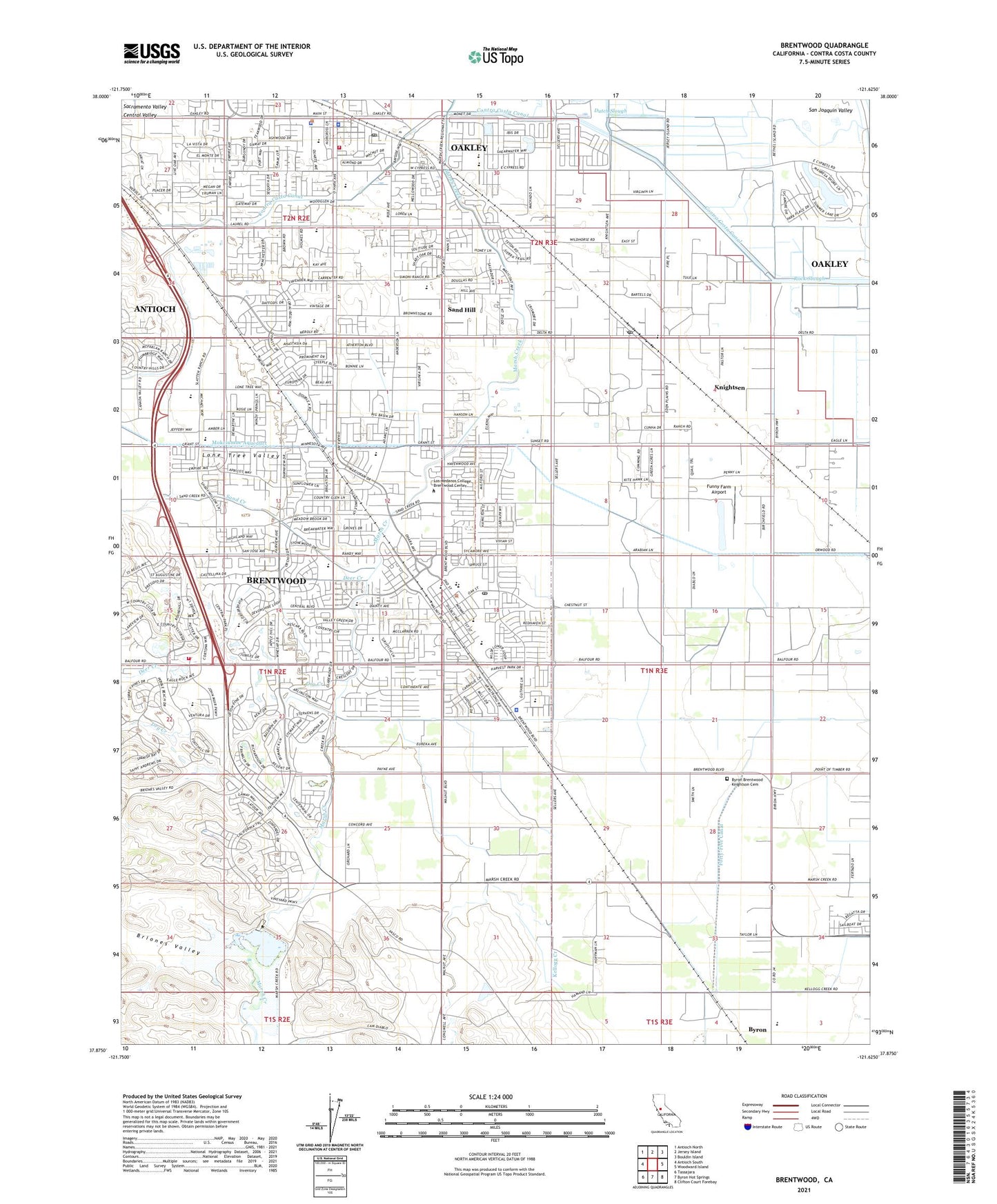
2021 topographic map quadrangle Brentwood in the state of California. Scale: 1:24000. Based on the newly updated USGS 7.5' US Topo map series, this map is in the following counties: Contra Costa. The map contains contour data, water features, and other items you are used to seeing on USGS maps, but also has updated roads and other features. This is the next generation of topographic maps. Printed on high-quality waterproof paper with UV fade-resistant inks.
Quads adjacent to this one:
West: Antioch South
Northwest: Antioch North
North: Jersey Island
Northeast: Bouldin Island
East: Woodward Island
Southeast: Clifton Court Forebay
South: Byron Hot Springs
Southwest: Tassajara
This map covers the same area as the classic USGS quad with code o37121h6.
Contains the following named places: Arbor, Asahi Nursery, Bethel Missionary Baptist Church, Brentwood, Brentwood Baptist Church, Brentwood Branch Contra Costa County Library, Brentwood City Hall, Brentwood Community Methodist Church, Brentwood Elementary School, Brentwood Gas Field, Brentwood Park, Brentwood Police Department, Brentwood Post Office, Brentwood Shopping Center, Briones Valley, Byron Brentwood Knightson Cemetery, Byron Census Designated Place, Byron Elementary School, Church of Christ, City of Brentwood, City of Oakley, Contra Costa County Sheriff's Office - Delta Station, Deer Creek, Delta Air Park, Delta Community Church of God, Dry Creek, Dry Creek 1007-004 Dam, Dutch Slough Gas Field, East Contra Costa Division, East Contra Costa Fire Protection District Station 52, East Contra Costa Fire Protection District Station 53, East Contra Costa Fire Protection District Station 54, East Contra Costa Fire Protection District Station 94, Eden Plains Nursery, Edna Hill Middle School, Excelsior School, First Baptist Church, First United Pentecostal Church, Funny Farm Airport, Garin Elementary School, Gehringer Elementary School, Ghiggeri - Stonebarger Farm, Grace Bible Fellowship Church, Iron House School, Knightsen, Knightsen Census Designated Place, Knightsen Elementary School, Knightsen Post Office, Knoll Organic Farms, La Paloma High School, Laurel Elementary School, Liberty High School, Lions Community Center, Lone Tree Valley, Los Meganos, Main Canal, Marsh Creek 1007-002 Dam, Marsh Creek Reservoir, Marsh Creek State Park, McClarren Park, Neighborhood Church, New Beginnings Christian Center, Oakley, Oakley Branch Contra Costa County Library, Oakley City Hall, Oakley Elementary School, Oakley Park, Oakley Police Department, Oakley Post Office, Oakley Town Center Shopping Center, O'Hara Park Middle School, Pease Ranch, Perez Nursery, Saint Alban's Episcopal Church, Saint Anthony's Catholic Church, Sand Creek, Sand Hill, Simoni and Massoni Farms, Smith Family Farms, Soul's Harbor Church, Stone House, Sunset Park, Terada Farms, Valley Oak Nursery, Vaquero Farms, Village Nurseries Landscape Center, ZIP Codes: 94513, 94548, 94561