MyTopo
Woodward Island California US Topo Map
Couldn't load pickup availability
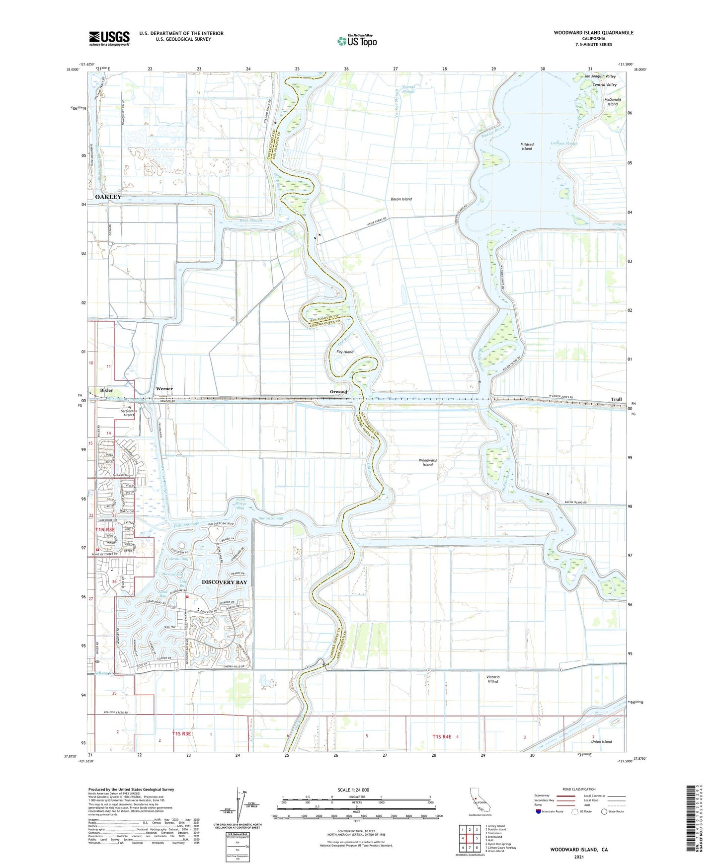
2021 topographic map quadrangle Woodward Island in the state of California. Scale: 1:24000. Based on the newly updated USGS 7.5' US Topo map series, this map is in the following counties: Contra Costa, San Joaquin. The map contains contour data, water features, and other items you are used to seeing on USGS maps, but also has updated roads and other features. This is the next generation of topographic maps. Printed on high-quality waterproof paper with UV fade-resistant inks.
Quads adjacent to this one:
West: Brentwood
Northwest: Jersey Island
North: Bouldin Island
Northeast: Terminous
East: Holt
Southeast: Union Island
South: Clifton Court Forebay
Southwest: Byron Hot Springs
This map covers the same area as the classic USGS quad with code o37121h5.
Contains the following named places: Bacon Island, Bixler, Byron California Discovery Bay Post Office, Byron Tract, Cabrillo Bay, Contra Costa County Boys Ranch, Discovery Bay, Discovery Bay Census Designated Place, Discovery Bay Country Club, Discovery Bay Elementary School, East Contra Costa Fire Protection District Station 58, East Contra Costa Fire Protection District Station 59, Empire Cut, Fay Island, Hayes Slough, Holland Tract, Holman Slough, Indian Slough, Kellogg Creek, Las Serpientes Airport, Latham Slough, Lido Bay, Mansion House Ranch, Marina Bay, Middle River, Mildred Island, Mildred Island Ferry, North Canal, North Victoria Canal, Orwood, Orwood Tract, Palm Tract, Rindge School, Rock Slough, Saint Marys Bay, Sand Bay, Trull, Veale Tract, Victoria Canal, Victoria Island, Werner, Werner Dredger Cut, Willow Lake, Woodward Canal, Woodward Island, Woodward Island Ferry, Woodward Ranch, Youngs Slough, ZIP Code: 95234