MyTopo
Browns Valley California US Topo Map
Couldn't load pickup availability
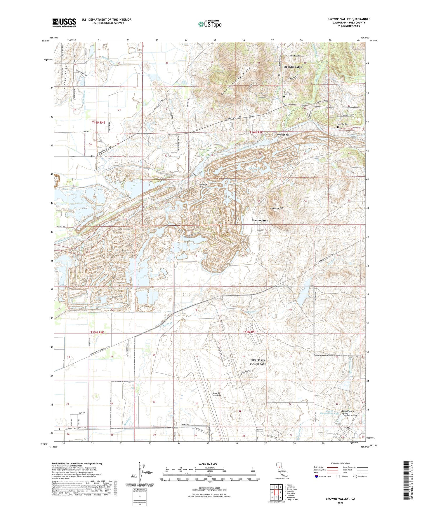
2021 topographic map quadrangle Browns Valley in the state of California. Scale: 1:24000. Based on the newly updated USGS 7.5' US Topo map series, this map is in the following counties: Yuba. The map contains contour data, water features, and other items you are used to seeing on USGS maps, but also has updated roads and other features. This is the next generation of topographic maps. Printed on high-quality waterproof paper with UV fade-resistant inks.
Quads adjacent to this one:
West: Yuba City
Northwest: Honcut
North: Loma Rica
Northeast: Oregon House
East: Smartsville
Southeast: Camp Far West
South: Wheatland
Southwest: Olivehurst
This map covers the same area as the classic USGS quad with code o39121b4.
Contains the following named places: Beale Air Force Base, Beale Air Force Base Fire Department Station 1, Blackwelder Dam, Blackwelder Lake, Brophy School, Browns Valley, Browns Valley Cemetery, Browns Valley Elementary School, Browns Valley Post Office, Daguerre Point, Daguerre Point Dam, Donnebroug Mine, Dry Creek, East Yuba-Beale AFB Division, Hallwood Pit, Hammonton, Hammonton Air Strip, Hammonton Pit, Lanes Ranch, Little Dry Creek, Long Bar Cemetery, Lower Blackwelder Dam, Lower Blackwelder Lake, Marigold, Marysville Lake, McCartie Hill, Miller Dam, Miller Lake, O'Briens Ranch, Owsleys Bar, Pennsylvania Mine, Sid Smith Ranch, Tenmile House, Trainer Hills, Yuba Gold Field, ZIP Code: 95901