MyTopo
Loma Rica California US Topo Map
Couldn't load pickup availability
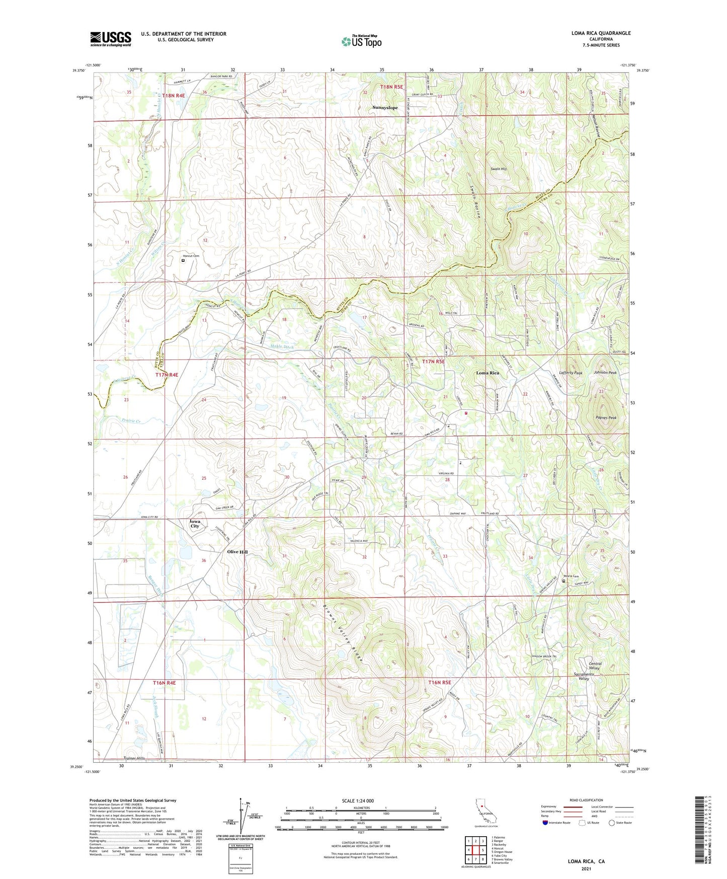
2021 topographic map quadrangle Loma Rica in the state of California. Scale: 1:24000. Based on the newly updated USGS 7.5' US Topo map series, this map is in the following counties: Yuba, Butte. The map contains contour data, water features, and other items you are used to seeing on USGS maps, but also has updated roads and other features. This is the next generation of topographic maps. Printed on high-quality waterproof paper with UV fade-resistant inks.
Quads adjacent to this one:
West: Honcut
Northwest: Palermo
North: Bangor
Northeast: Rackerby
East: Oregon House
Southeast: Smartsville
South: Browns Valley
Southwest: Yuba City
This map covers the same area as the classic USGS quad with code o39121c4.
Contains the following named places: Browns Valley Ridge, Early Creek, Foothill Elementary School, Fruitland Union School, Honcut Cemetery, Iowa City, Johnson Peak, Kings School, Lafferty Peak, Loma Rica, Loma Rica - Browns Valley Community Service District Fire Station, Loma Rica Census Designated Place, Loma Rica Elementary School, Mahle Ditch, Marysville Northeast Division, Nelson Ravine, Olive Hill, Olive Hill Ditch, Paynes Peak, Peoria Cemetery, Prairie Creek, Smethurst Mine, Spring Valley School, Stone House, Sunnyslope, Swain Hill, Swain Ravine, Sweet Vengeance Mine, Tennessee Creek