MyTopo
Buffalo Creek California US Topo Map
Couldn't load pickup availability
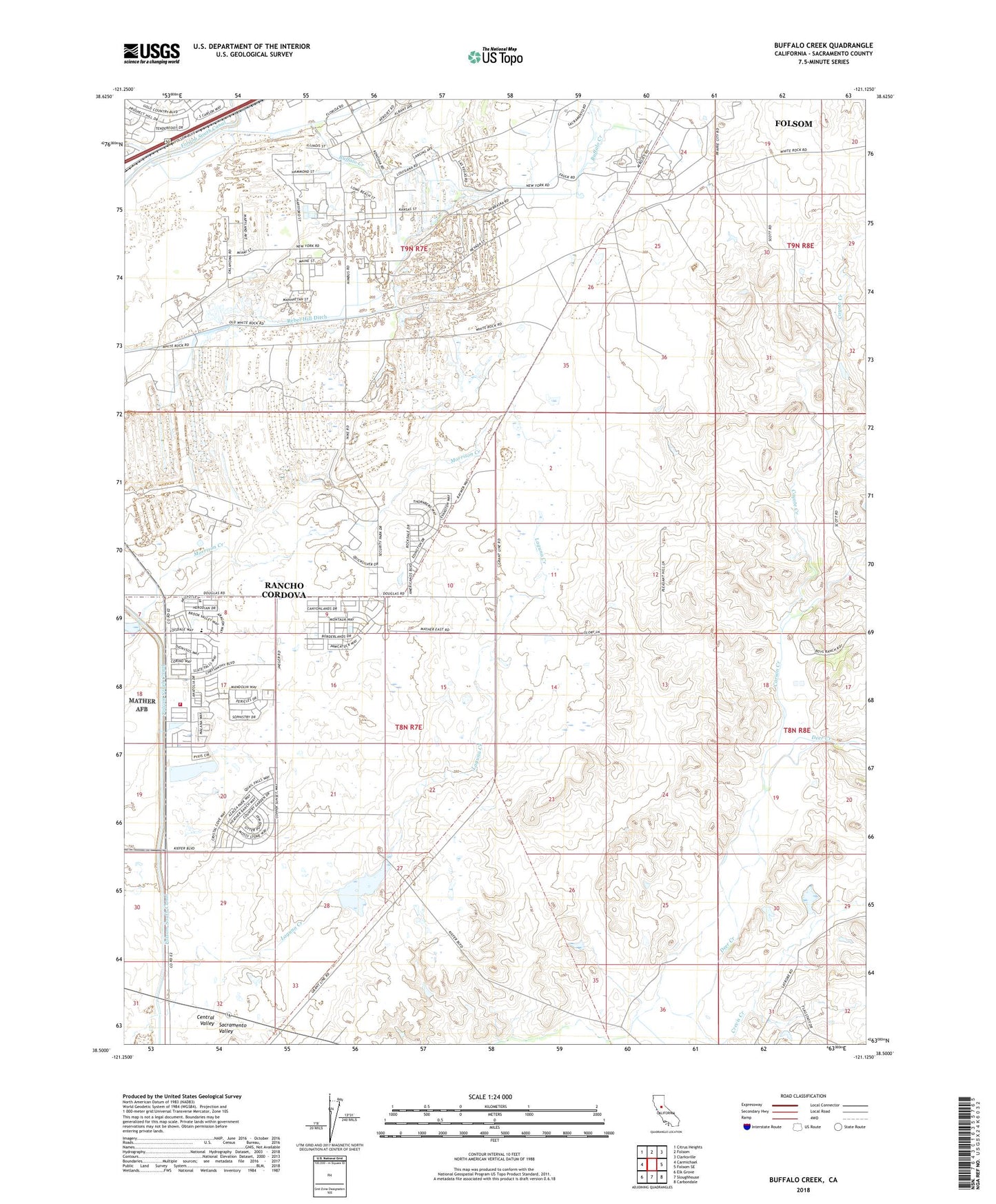
2021 topographic map quadrangle Buffalo Creek in the state of California. Scale: 1:24000. Based on the newly updated USGS 7.5' US Topo map series, this map is in the following counties: Sacramento. The map contains contour data, water features, and other items you are used to seeing on USGS maps, but also has updated roads and other features. This is the next generation of topographic maps. Printed on high-quality waterproof paper with UV fade-resistant inks.
Quads adjacent to this one:
West: Carmichael
Northwest: Citrus Heights
North: Folsom
Northeast: Clarksville
East: Folsom SE
Southeast: Carbondale
South: Sloughhouse
Southwest: Elk Grove
This map covers the same area as the classic USGS quad with code o38121e2.
Contains the following named places: Blodgett 454 Dam, Blodgett Reservoir, Carson Creek, Carson Creek Junior Senior High School, Coyote Creek, Crevis Creek, Kiefer Landfill, KPTO-AM (Sloughhouse), KSMJ-AM (Sacramento), Prairie City State Vehicular Recreation Area, Rebel Hill Ditch, Sacramento County Boy's Ranch, Sacramento Metropolitan Fire District Station 68, ZIP Code: 95742