MyTopo
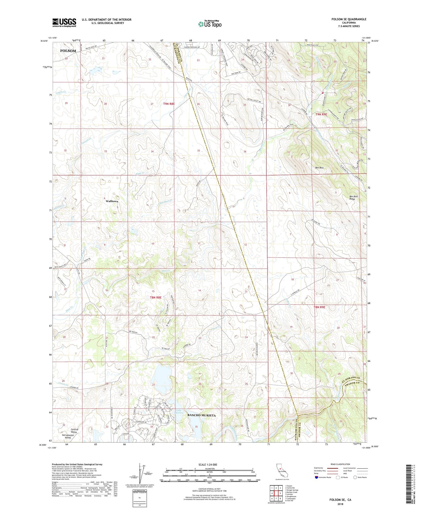
Folsom SE California US Topo Map
Couldn't load pickup availability
2022 topographic map quadrangle Folsom SE in the state of California. Scale: 1:24000. Based on the newly updated USGS 7.5' US Topo map series, this map is in the following counties: Sacramento, El Dorado, Amador. The map contains contour data, water features, and other items you are used to seeing on USGS maps, but also has updated roads and other features. This is the next generation of topographic maps. Printed on high-quality waterproof paper with UV fade-resistant inks.
Quads adjacent to this one:
West: Buffalo Creek
Northwest: Folsom
North: Clarksville
Northeast: Shingle Springs
East: Latrobe
Southeast: Irish Hill
South: Carbondale
Southwest: Sloughhouse
This map covers the same area as the classic USGS quad with code o38121e1.
Contains the following named places: Ben Bolt, Ben Bolt Ridge, Burgoyne Creek, Calero Dam, Carson Creek School, Chesbro Dam, Clementia Dam, Cothrin, Indian Creek, Lake Calero, Lake Chesbro, Lake Clementia, Latrobe Creek, Latrobe Fire Protection District Station 92, Little Deer Creek, Little Indian Creek, Malby Crossing, Plunkett Creek, Rancho Murieta, Rancho Murieta Census Designated Place, Slate Creek, Sloughhouse Division, Strap Miner Creek, Walltown, ZIP Code: 95683