MyTopo
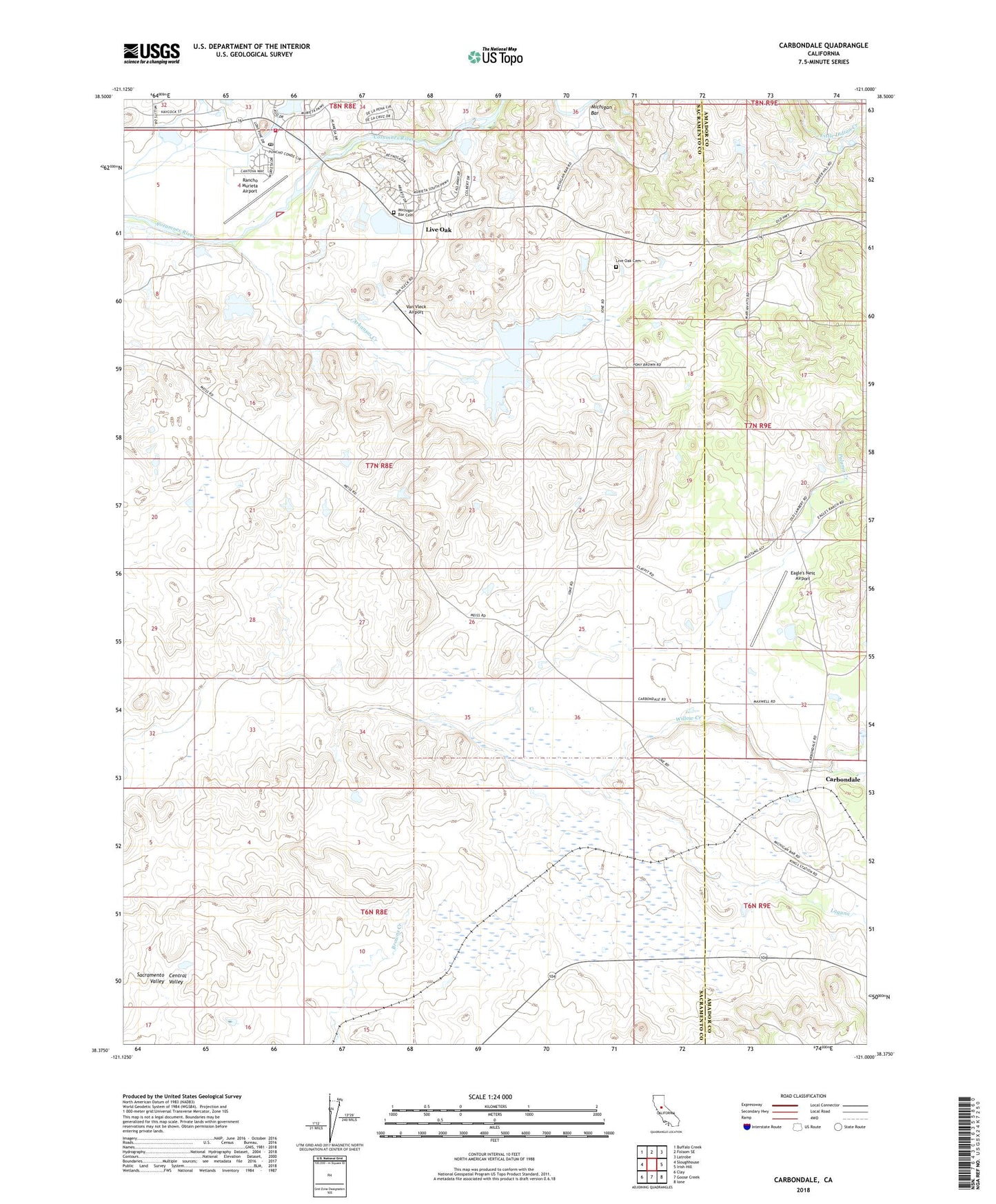
Carbondale California US Topo Map
Couldn't load pickup availability
2022 topographic map quadrangle Carbondale in the state of California. Scale: 1:24000. Based on the newly updated USGS 7.5' US Topo map series, this map is in the following counties: Sacramento, Amador. The map contains contour data, water features, and other items you are used to seeing on USGS maps, but also has updated roads and other features. This is the next generation of topographic maps. Printed on high-quality waterproof paper with UV fade-resistant inks.
Quads adjacent to this one:
West: Sloughhouse
Northwest: Buffalo Creek
North: Folsom SE
Northeast: Latrobe
East: Irish Hill
Southeast: Ione
South: Goose Creek
Southwest: Clay
This map covers the same area as the classic USGS quad with code o38121d1.
Contains the following named places: Alabama House, Arkansas Creek, Bridge House, Buckeye School, Carbondale, Carbondale School, Eagle's Nest Airport, Granlees 451 Dam, Live Oak, Live Oak Cemetery, Lower Bradford Pit, May, McDonnell Pit, Michigan Bar, Michigan Bar Cemetery, Michigan Bar Historical Marker, Michigan Bar Pit, Michigan Bar School, Mills 457 Dam, Palama Creek, Rancho Murieta Airport, Rancho Murieta Golf Course and Country Club, Sacramento Metropolitan Fire District Station 59, Schneider 458 Dam, Sloughhouse Post Office, Stone House School, Van Vleck 456 Dam, Van Vleck Airport, Willow Creek