MyTopo
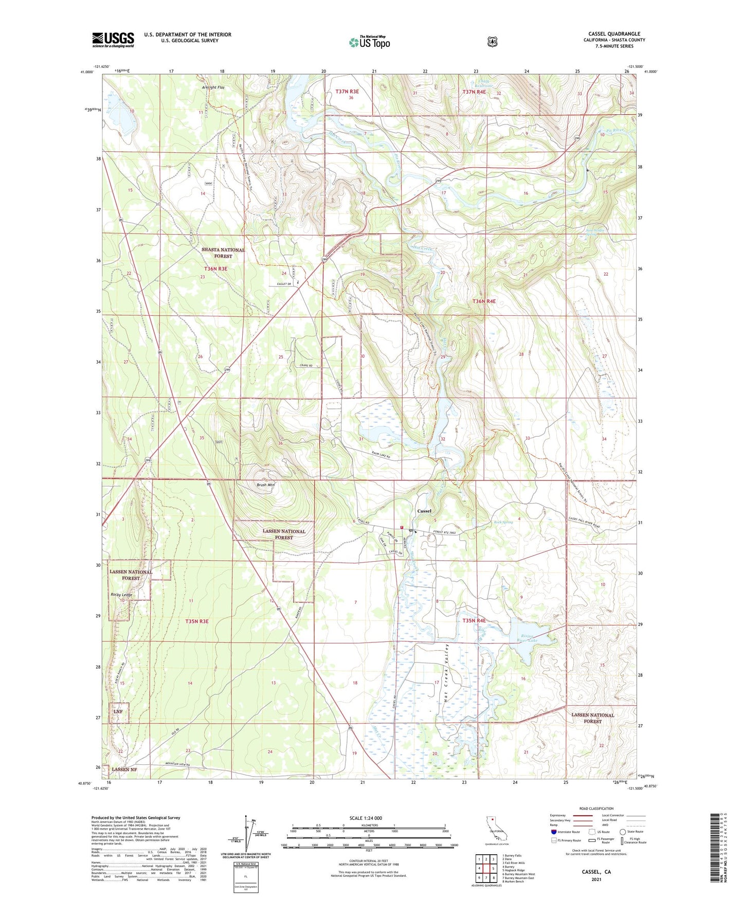
Cassel California US Topo Map
Couldn't load pickup availability
Also explore the Cassel Forest Service Topo of this same quad for updated USFS data
2021 topographic map quadrangle Cassel in the state of California. Scale: 1:24000. Based on the newly updated USGS 7.5' US Topo map series, this map is in the following counties: Shasta. The map contains contour data, water features, and other items you are used to seeing on USGS maps, but also has updated roads and other features. This is the next generation of topographic maps. Printed on high-quality waterproof paper with UV fade-resistant inks.
Quads adjacent to this one:
West: Burney
Northwest: Burney Falls
North: Dana
Northeast: Fall River Mills
East: Hogback Ridge
Southeast: Murken Bench
South: Burney Mountain East
Southwest: Burney Mountain West
This map covers the same area as the classic USGS quad with code o40121h5.
Contains the following named places: Arkright Flat, Baum Lake, Braden Sand Pit, Brush Mountain, Brush Mountain Quarry, Cassel, Cassel Campground, Cassel Census Designated Place, Cassel Post Office, Cassel Volunteer Fire Company 10, Castle Post Office, Chalk Reservoir, Cinder Flats State Wildlife Area, Conrad Ranch, Crystal Lake, Crystal Lake State Fish Hatchery, Doyles Corner, East Shasta Division, Four Corners, Hat Creek, Hat Creek Number 2 Diversion 97-109 Dam, Hat Creek Park, Hat Creek Valley, Hat One Powerhouse, Hat Two Powerhouse, Hidden Valley Ranch, Rising River, Rising River Lake, Rising River Ranch, Rock Spring, Rocky Ledge, Sam Wolfin Spring, Soldier Creek, Sucker Springs Creek, ZIP Code: 96016