MyTopo
Phelan California US Topo Map
Couldn't load pickup availability
Also explore the Phelan Forest Service Topo of this same quad for updated USFS data
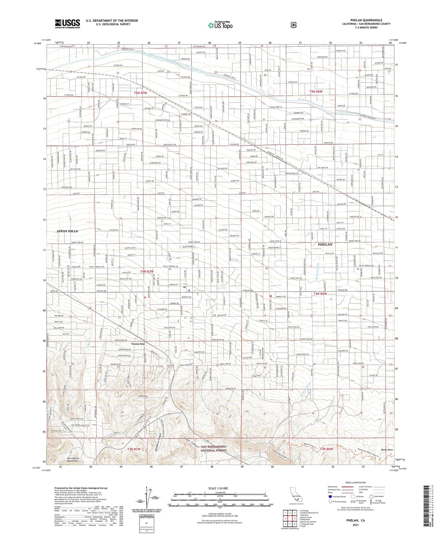
2021 topographic map quadrangle Phelan in the state of California. Scale: 1:24000. Based on the newly updated USGS 7.5' US Topo map series, this map is in the following counties: San Bernardino. The map contains contour data, water features, and other items you are used to seeing on USGS maps, but also has updated roads and other features. This is the next generation of topographic maps. Printed on high-quality waterproof paper with UV fade-resistant inks.
Quads adjacent to this one:
West: Mescal Creek
Northwest: El Mirage
North: Shadow Mountains SE
Northeast: Adelanto
East: Baldy Mesa
Southeast: Cajon
South: Telegraph Peak
Southwest: Mount San Antonio
This map covers the same area as the classic USGS quad with code o34117d5.
Contains the following named places: Buttemer Ranch, California Department of Forestry and Fire Protection Station 10 Phelan, Chaparral High School, Deer Haven, Goss Ranch, Horse Canyon, Johnson Ranch, Mountain Top Junction, Phelan, Phelan Census Designated Place, Phelan Elementary School, Phelan Post Office, Phelan Village Shopping Center, Pinon Hills Census Designated Place, Pinon Mesa Middle School, San Bernardino County Fire Department Station 10 Phelan, San Bernardino County Sheriff's Department Phelan Substation, Serrano High School, Sheep Creek, Wildhorse Canyon, Wilson Ranch, Yucca Inn, ZIP Codes: 92371, 92372