MyTopo
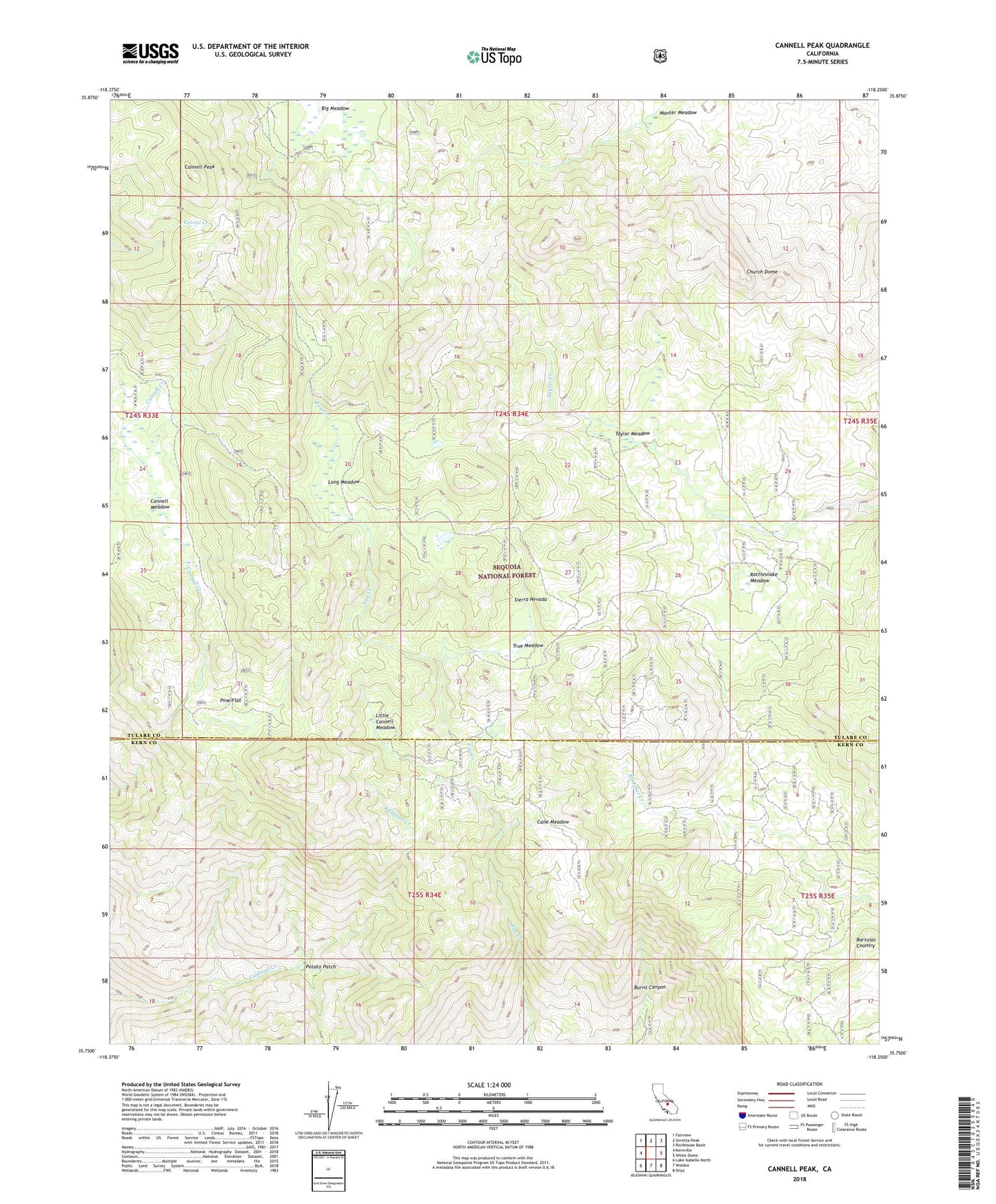
Cannell Peak California US Topo Map
Couldn't load pickup availability
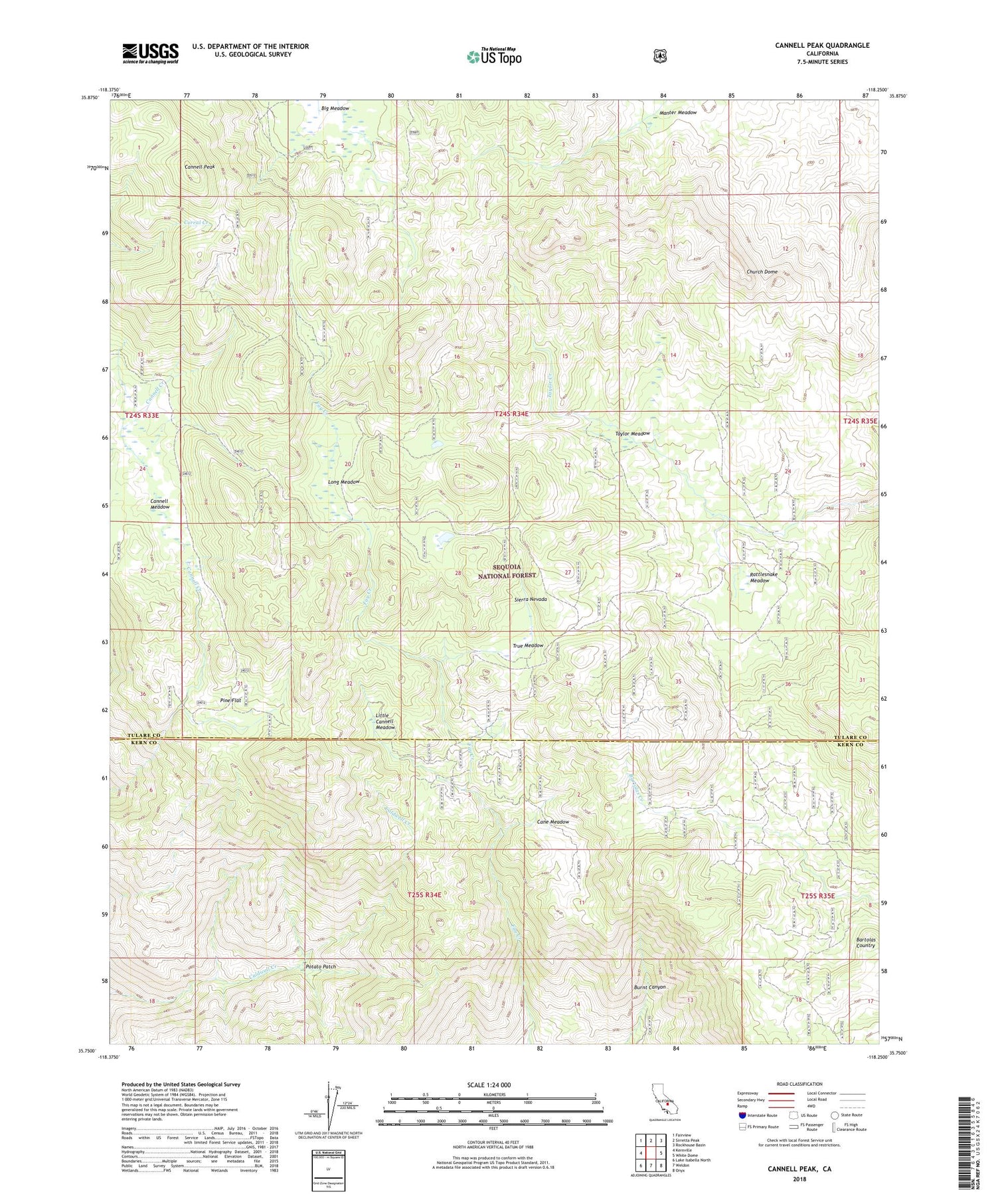
Also explore the Cannell Peak Forest Service Topo of this same quad for updated USFS data
2021 topographic map quadrangle Cannell Peak in the state of California. Scale: 1:24000. Based on the newly updated USGS 7.5' US Topo map series, this map is in the following counties: Tulare, Kern. The map contains contour data, water features, and other items you are used to seeing on USGS maps, but also has updated roads and other features. This is the next generation of topographic maps. Printed on high-quality waterproof paper with UV fade-resistant inks.
Quads adjacent to this one:
West: Kernville
Northwest: Fairview
North: Sirretta Peak
Northeast: Rockhouse Basin
East: White Dome
Southeast: Onyx
South: Weldon
Southwest: Lake Isabella North
This map covers the same area as the classic USGS quad with code o35118g3.
Contains the following named places: Bartolas Country, Cane Meadow, Cannell Meadow, Cannell Meadow Forest Service Station, Cannell Meadow Trail, Cannell Peak, Church Dome, Little Cannell Meadow, Long Meadow, Pine Flat, Potato Patch, Rattlesnake Meadow, Taylor Meadow, True Meadow