MyTopo
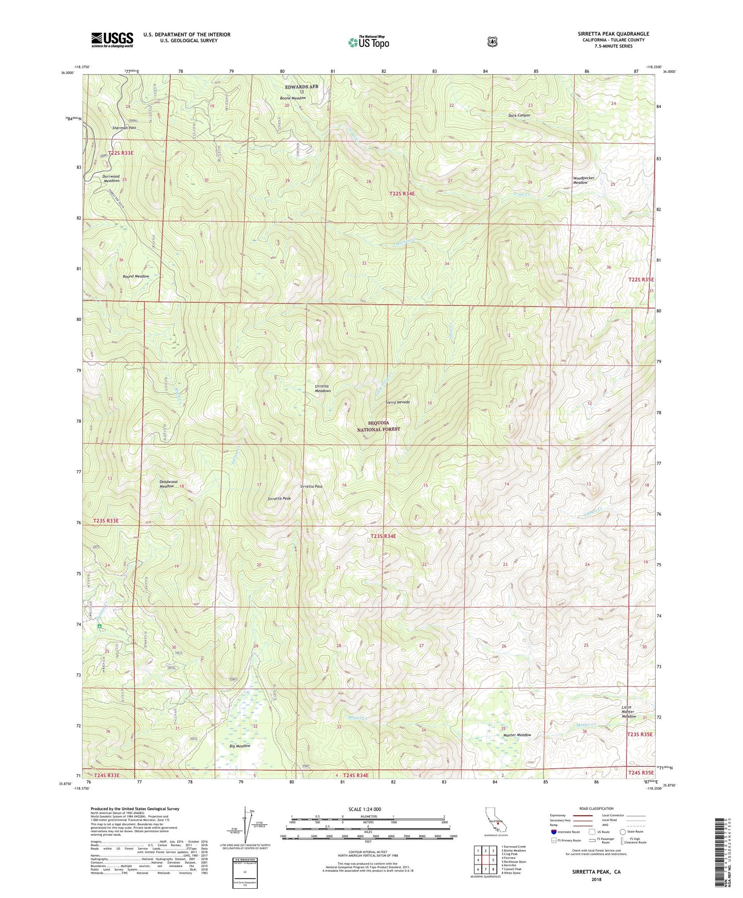
Sirretta Peak California US Topo Map
Couldn't load pickup availability
Also explore the Sirretta Peak Forest Service Topo of this same quad for updated USFS data
2021 topographic map quadrangle Sirretta Peak in the state of California. Scale: 1:24000. Based on the newly updated USGS 7.5' US Topo map series, this map is in the following counties: Tulare. The map contains contour data, water features, and other items you are used to seeing on USGS maps, but also has updated roads and other features. This is the next generation of topographic maps. Printed on high-quality waterproof paper with UV fade-resistant inks.
Quads adjacent to this one:
West: Fairview
Northwest: Durrwood Creek
North: Bonita Meadows
Northeast: Crag Peak
East: Rockhouse Basin
Southeast: White Dome
South: Cannell Peak
Southwest: Kernville
This map covers the same area as the classic USGS quad with code o35118h3.
Contains the following named places: Big Meadow, Boone Meadow, Cherry Hill, Dark Canyon, Deadwood Meadow, Dome Land, Durrwood Meadows, Horse Meadow Campground, Little Manter Meadow, Little Trout Creek, Machine Creek, Manter Meadow, Mosquito Meadow, Round Meadow, Sherman Pass, Sirretta Meadows, Sirretta Pass, Sirretta Peak, Snow Creek, Woodpecker Meadow