
MyTopo
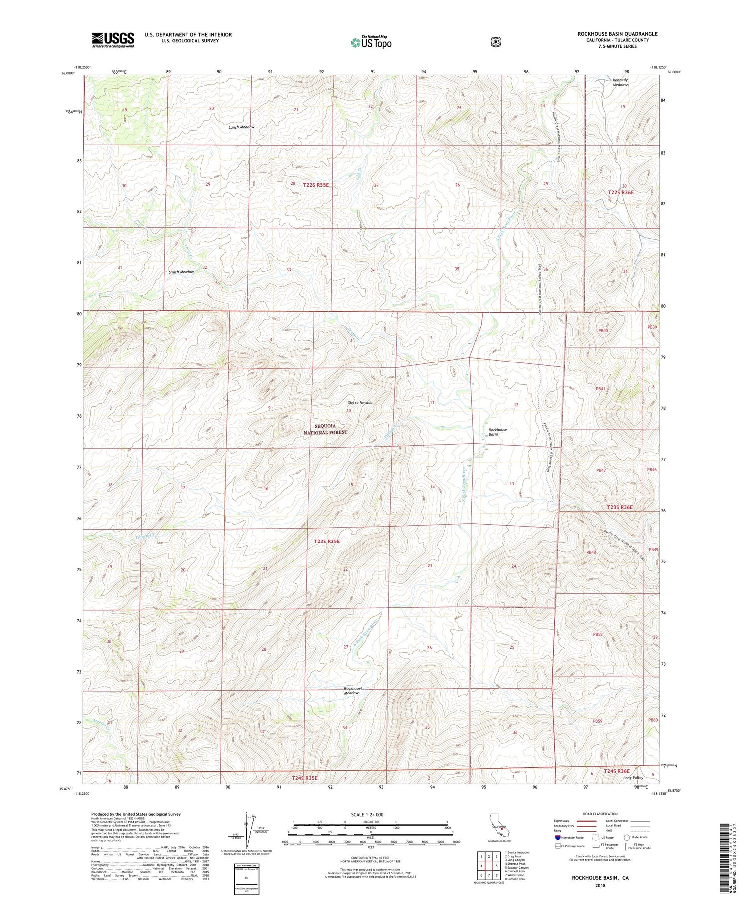
Rockhouse Basin California US Topo Map
Couldn't load pickup availability
Also explore the Rockhouse Basin Forest Service Topo of this same quad for updated USFS data
2021 topographic map quadrangle Rockhouse Basin in the state of California. Scale: 1:24000. Based on the newly updated USGS 7.5' US Topo map series, this map is in the following counties: Tulare. The map contains contour data, water features, and other items you are used to seeing on USGS maps, but also has updated roads and other features. This is the next generation of topographic maps. Printed on high-quality waterproof paper with UV fade-resistant inks.
Quads adjacent to this one:
West: Sirretta Peak
Northwest: Bonita Meadows
North: Crag Peak
Northeast: Long Canyon
East: Sacatar Canyon
Southeast: Lamont Peak
South: White Dome
Southwest: Cannell Peak
This map covers the same area as the classic USGS quad with code o35118h2.
Contains the following named places: Domeland Wilderness, Fish Creek, Lunch Meadow, Rockhouse Basin, Rockhouse Meadow, Smith Meadow, Tibbets Creek, Trout Creek


