MyTopo
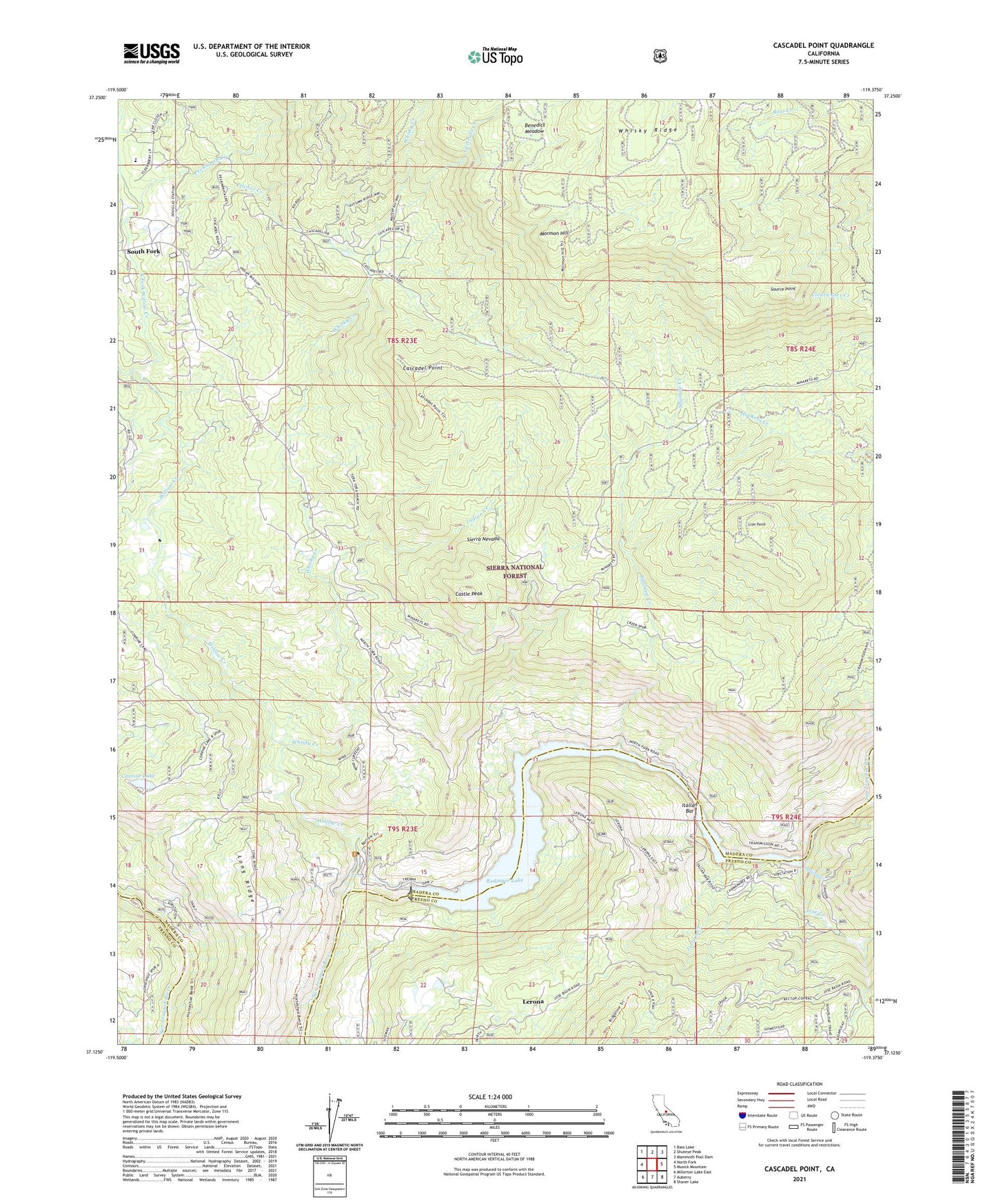
Cascadel Point California US Topo Map
Couldn't load pickup availability
Also explore the Cascadel Point Forest Service Topo of this same quad for updated USFS data
2021 topographic map quadrangle Cascadel Point in the state of California. Scale: 1:24000. Based on the newly updated USGS 7.5' US Topo map series, this map is in the following counties: Madera, Fresno. The map contains contour data, water features, and other items you are used to seeing on USGS maps, but also has updated roads and other features. This is the next generation of topographic maps. Printed on high-quality waterproof paper with UV fade-resistant inks.
Quads adjacent to this one:
West: North Fork
Northwest: Bass Lake
North: Shuteye Peak
Northeast: Mammoth Pool Dam
East: Musick Mountain
Southeast: Shaver Lake
South: Auberry
Southwest: Millerton Lake East
This map covers the same area as the classic USGS quad with code o37119b4.
Contains the following named places: Benedict Meadow, Big Creek Number 7 104-022 Dam, Cascadel Point, Cascadel Ranch, Cascadel Woods, Castle Peak, Chawanakee School, Corrine Lake, Gertrude Creek, Indian Creek, Italian Creek, Itallan Bar, Jose Creek, Lerona, Lion Point, Long Ridge, Mill Creek, Mormon Hill, North Fork Indian Mission, North Fork Recreation Area Memorial Park, North Fork Willow Creek, Number 1 Forebay 95-004 Dam, Peckinpah Creek, Pine Grove Mine, Pitcher Creek, Powerhouse, Powerhouse Number One A, Redinger Boat Ramp, Redinger Lake, Saginaw Creek, Source Point, South Fork, South Fork Willow Creek, Whisky Creek, Willow Creek, ZIP Code: 93643