MyTopo
Bass Lake California US Topo Map
Couldn't load pickup availability
Also explore the Bass Lake Forest Service Topo of this same quad for updated USFS data
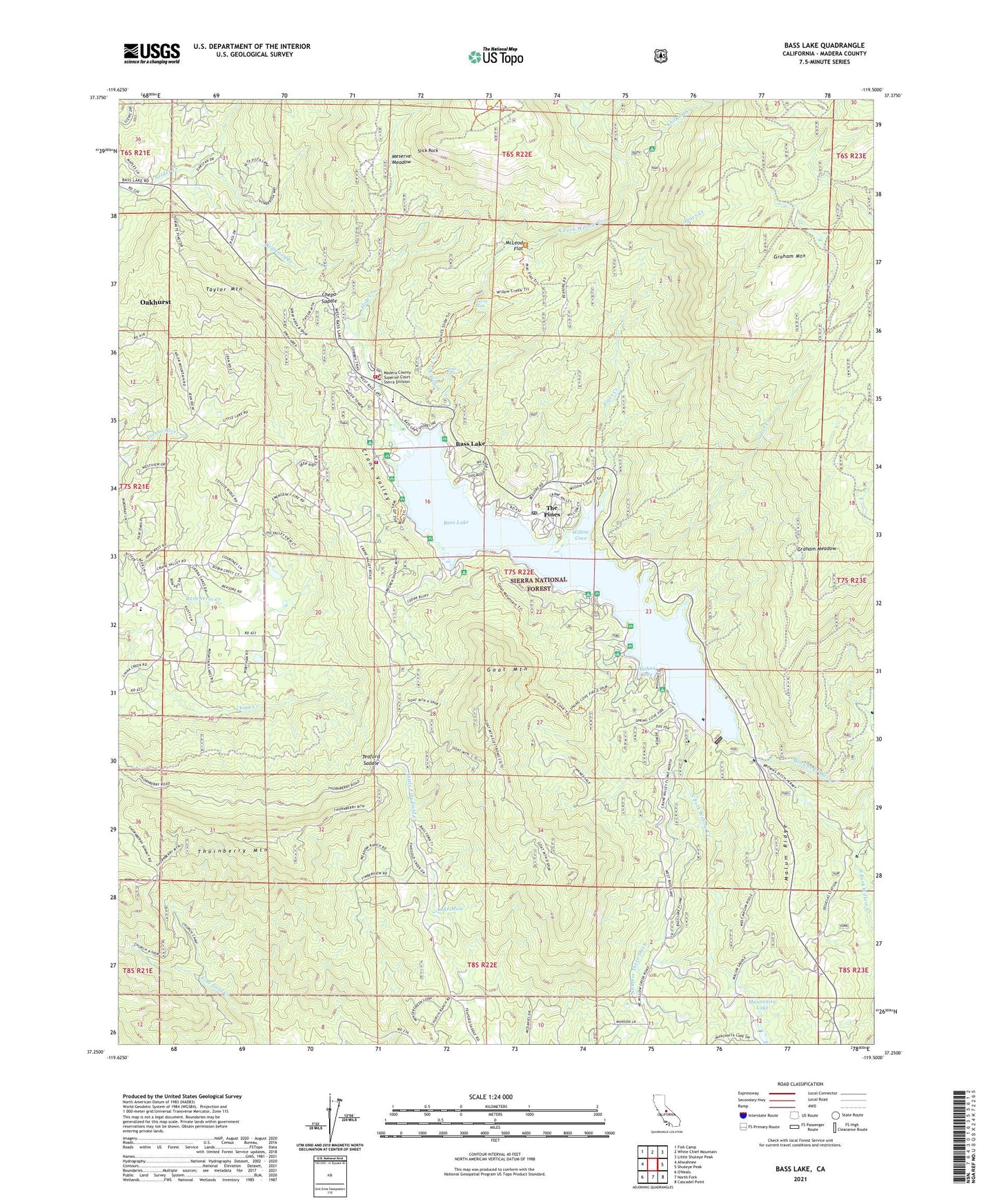
2021 topographic map quadrangle Bass Lake in the state of California. Scale: 1:24000. Based on the newly updated USGS 7.5' US Topo map series, this map is in the following counties: Madera. The map contains contour data, water features, and other items you are used to seeing on USGS maps, but also has updated roads and other features. This is the next generation of topographic maps. Printed on high-quality waterproof paper with UV fade-resistant inks.
Quads adjacent to this one:
West: Ahwahnee
Northwest: Fish Camp
North: White Chief Mountain
Northeast: Little Shuteye Peak
East: Shuteye Peak
Southeast: Cascadel Point
South: North Fork
This map covers the same area as the classic USGS quad with code o37119c5.
Contains the following named places: Angle Falls, Bass Lake, Bass Lake Annex, Bass Lake Census Designated Place, Bass Lake Elementary School, Bass Lake Lodge Resort, Bass Lake Post Office, Bass Lake Station, Bass Lake Vista, Beaver Ponds, Browns Creek Ditch, Camp Santa Teresita, Chepo Saddle, Chilkoot Campground, Chilkoot Creek, Crane Valley, Crane Valley Campground, Crane Valley Powerhouse, Crane Valley Storage 95-003 Dam, Denver Church Campground, Denver Church Picnic Area, Department of Forestry and Fire Protection Bass Lake Station, Devils Slide, Falls Beach Picnic Area, Forks Campground, Forks Resort, Goat Mountain, Goat Mountain Lookout, Goat Mountain Trail, Government Center, Graham Meadow, Graham Mountain, Hole Ranch, KTNS-AM (Oakhurst), Lake Moic, Little Denver Church Campground, Little Denver Church Picnic Area, Lupine-Cedar Bluffs Campground, Madera County Fire Department Station 14, Madera County Sheriff's Office Substation, Malum Ridge, McLeod Flat, Meserve Meadow, Millers Landing Resort, Number 3 Forebay 95-006 Dam, Number Three Ditch, Number Three Forbay Penstock, Oakhurst Census Designated Place, Old Corral, Pine Point Picnic Area, Pine Slope Picnic Area, Pines Creek, Powerhouse Number Three, Rancheria Creek, Recreation Point, Recreation Point Campground, Redwood Creek, Rocky Point Picnic Area, Salter Creek, Sheriffs Tower, Sierra Ambulance Service - Bass Lake Station, Slick Rock, Slide Creek, Spring Cove Campground, Taylor Mountain, Teaford Ranch, Teaford Saddle, The Falls, The Falls Picnic Area, The Forks, The Pines, Thornberry Mountain, Two Springs Campground, Way of the Mono Trail, Willow Cove, Willow Cove Picnic Area, Willow Creek Trail, Wishon Airport, Wishon Cove, Wishon Point Boat Launch, Wishon Point Campground, ZIP Code: 93669