MyTopo
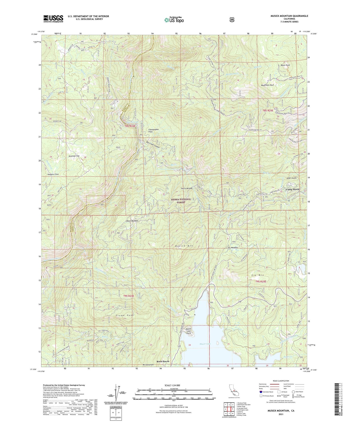
Musick Mountain California US Topo Map
Couldn't load pickup availability
Also explore the Musick Mountain Forest Service Topo of this same quad for updated USFS data
2021 topographic map quadrangle Musick Mountain in the state of California. Scale: 1:24000. Based on the newly updated USGS 7.5' US Topo map series, this map is in the following counties: Fresno, Madera. The map contains contour data, water features, and other items you are used to seeing on USGS maps, but also has updated roads and other features. This is the next generation of topographic maps. Printed on high-quality waterproof paper with UV fade-resistant inks.
Quads adjacent to this one:
West: Cascadel Point
Northwest: Shuteye Peak
North: Mammoth Pool Dam
Northeast: Kaiser Peak
East: Huntington Lake
Southeast: Dinkey Creek
South: Shaver Lake
Southwest: Auberry
This map covers the same area as the classic USGS quad with code o37119b3.
Contains the following named places: Alder Gulch, Azalea Creek, Balsam Creek, Big Creek, Big Creek Administration Station, Big Creek Canyon, Big Creek Helistop, Big Creek Number 5 104-005 Dam, Big Creek Number 6 104-006 Dam, Black Creek, Black Point, Camp Sierra, Camp Sierra Post Office, Chawanakee Flats, Chawanakee School Number One, Clearwater Creek, Clearwater Forest Service Station, Dam Six Lake, Dawn Meadow, Ely Creek, Ely Forest Service Station, Ely Meadow, Ely Mountain, Flume Peak, Hogue Ranch, Hookers Cove, Hookers Creek, Kinsman Flat, Lion Point Fire Lane, Mammoth Pool Powerhouse, Mushroom Creek, Mushroom Rock, Musick Mountain, North Fork Stevenson Creek, Ordinance Creek, Powerhouse Number Eight, Powerhouse Number Two, Rock Haven, Ross Creek, San Joaquin Mines, SCE Shaver Summit Heliport, Shaver Lake, Shaver Lake 104-018 Dam, Shaver Lake Point, Sheep Thief Creek, Stevenson Creek