MyTopo
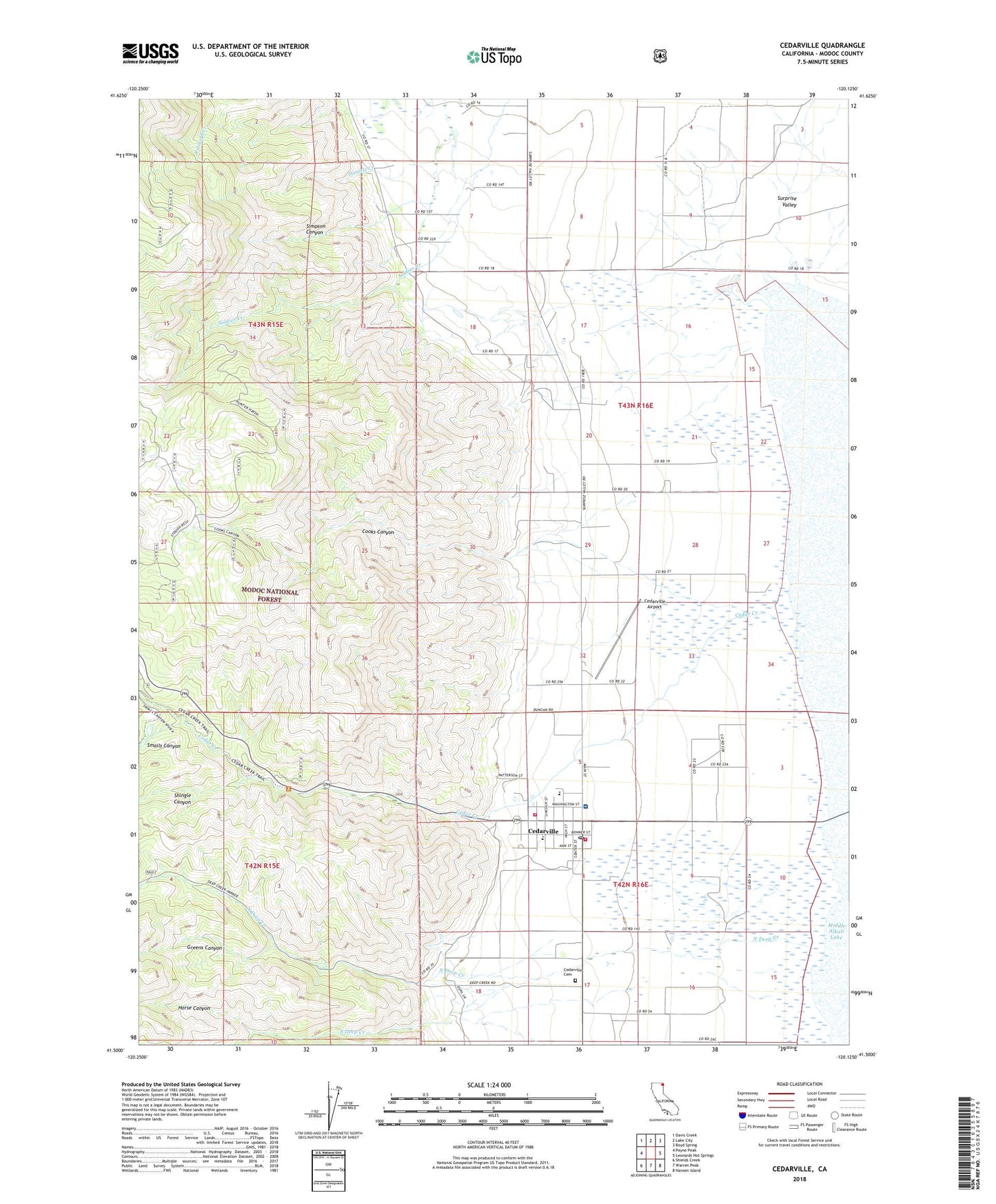
Cedarville California US Topo Map
Couldn't load pickup availability
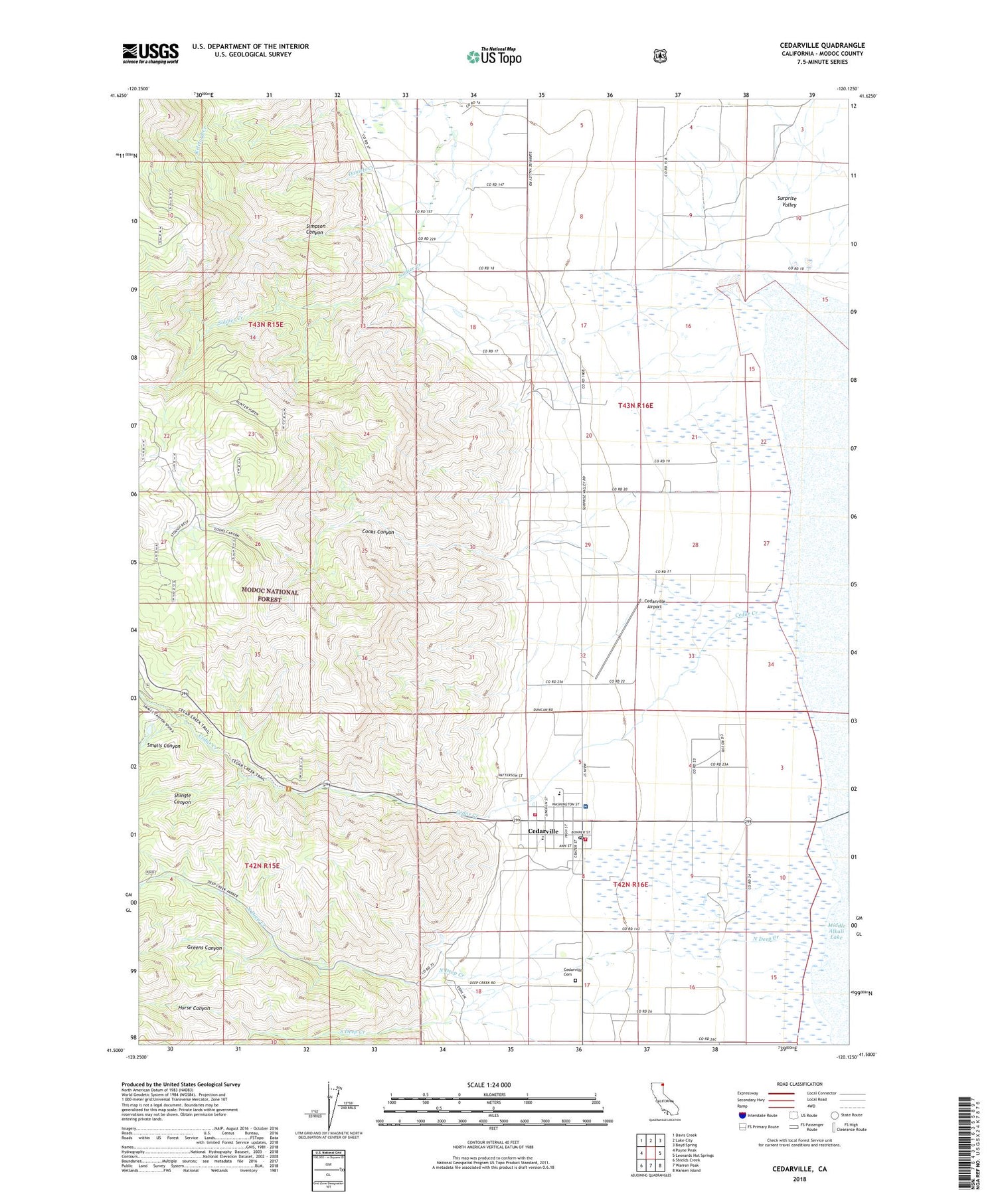
Also explore the Cedarville Forest Service Topo of this same quad for updated USFS data
2021 topographic map quadrangle Cedarville in the state of California. Scale: 1:24000. Based on the newly updated USGS 7.5' US Topo map series, this map is in the following counties: Modoc. The map contains contour data, water features, and other items you are used to seeing on USGS maps, but also has updated roads and other features. This is the next generation of topographic maps. Printed on high-quality waterproof paper with UV fade-resistant inks.
Quads adjacent to this one:
West: Payne Peak
Northwest: Davis Creek
North: Lake City
Northeast: Boyd Spring
East: Leonards Hot Springs
Southeast: Hansen Island
South: Warren Peak
Southwest: Shields Creek
This map covers the same area as the classic USGS quad with code o41120e2.
Contains the following named places: Bunyard Ranch, Bureau of Land Management Fire Guard Station, Bureau of Land Management Surprise Field Office, Cedar Creek, Cedarville, Cedarville Airport, Cedarville Cemetery, Cedarville Census Designated Place, Cedarville Fire Protection District, Cedarville Post Office, Cedarville Rancheria, Cooks Canyon, Greens Canyon, Horse Canyon, Indian Cemetery, Modoc County Fairground, North Deep Creek, Shingle Canyon, Simpson Canyon, Smalls Canyon, South Deep Creek, Surprise Valley Community Hospital, Surprise Valley Elementary School, Surprise Valley High School, Union High School, Warner Mountain Ranger Station, ZIP Code: 96104