MyTopo
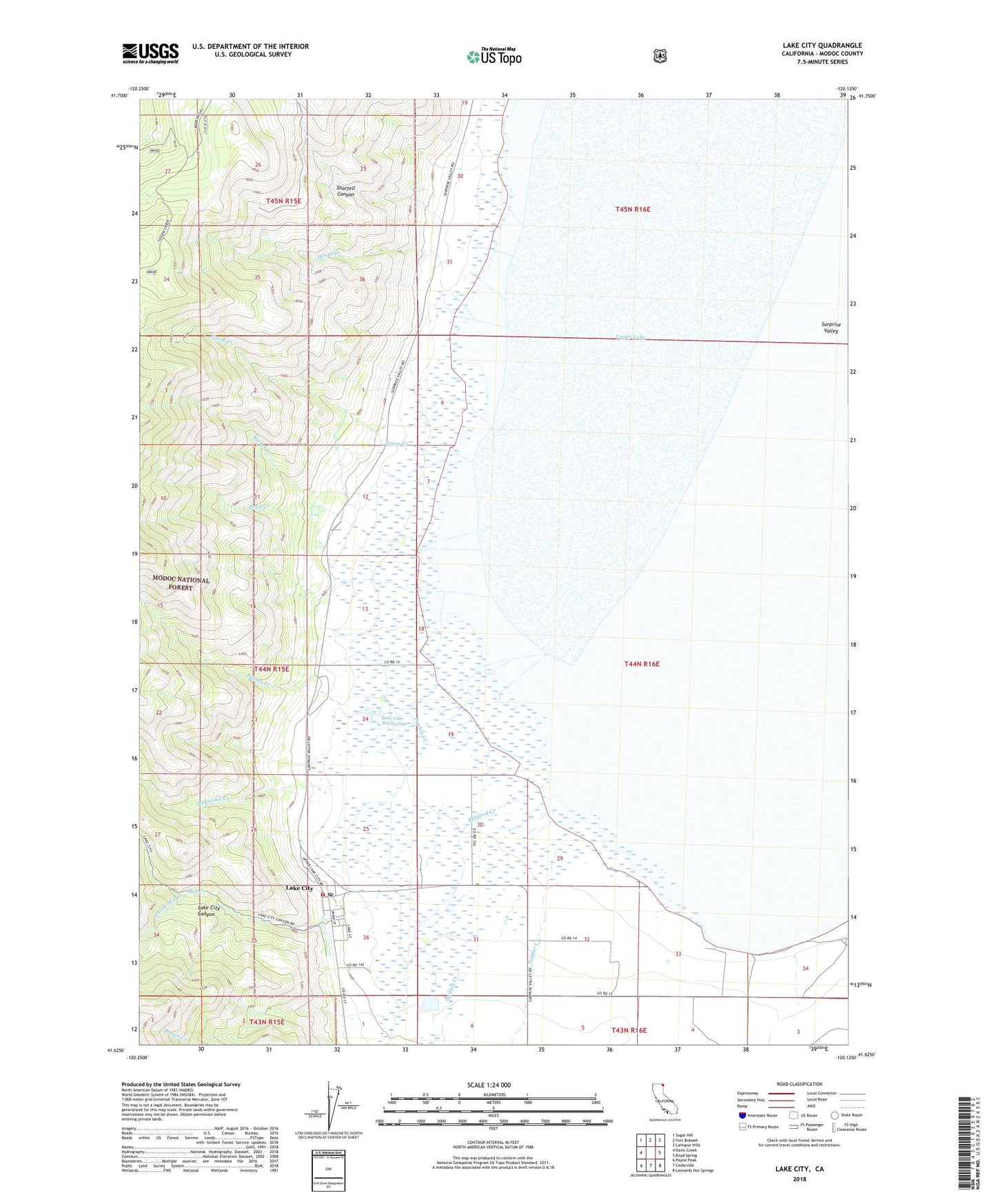
Lake City California US Topo Map
Couldn't load pickup availability
Also explore the Lake City Forest Service Topo of this same quad for updated USFS data
2022 topographic map quadrangle Lake City in the state of California. Scale: 1:24000. Based on the newly updated USGS 7.5' US Topo map series, this map is in the following counties: Modoc. The map contains contour data, water features, and other items you are used to seeing on USGS maps, but also has updated roads and other features. This is the next generation of topographic maps. Printed on high-quality waterproof paper with UV fade-resistant inks.
Quads adjacent to this one:
West: Davis Creek
Northwest: Sugar Hill
North: Fort Bidwell
Northeast: Larkspur Hills
East: Boyd Spring
Southeast: Leonards Hot Springs
South: Cedarville
Southwest: Payne Peak
This map covers the same area as the classic USGS quad with code o41120f2.
Contains the following named places: Boyd Creek, Brown Creek, Bucher Creek, Daniels Creek, Goose Creek, Heath Creek, Hill Ranch, Lake City, Lake City Canyon, Lake City Cemetery, Lake City Census Designated Place, Lake City Fire Protection District, Lake City Hot Springs, Lake City Post Office, Mill Creek, Parman Ranch, Powley Creek, Releford Creek, Shartell Canyon, Soldier Creek, South Fork Mill Creek, Wilkinson Creek, Wilson Patch Ranch, ZIP Code: 96115