MyTopo
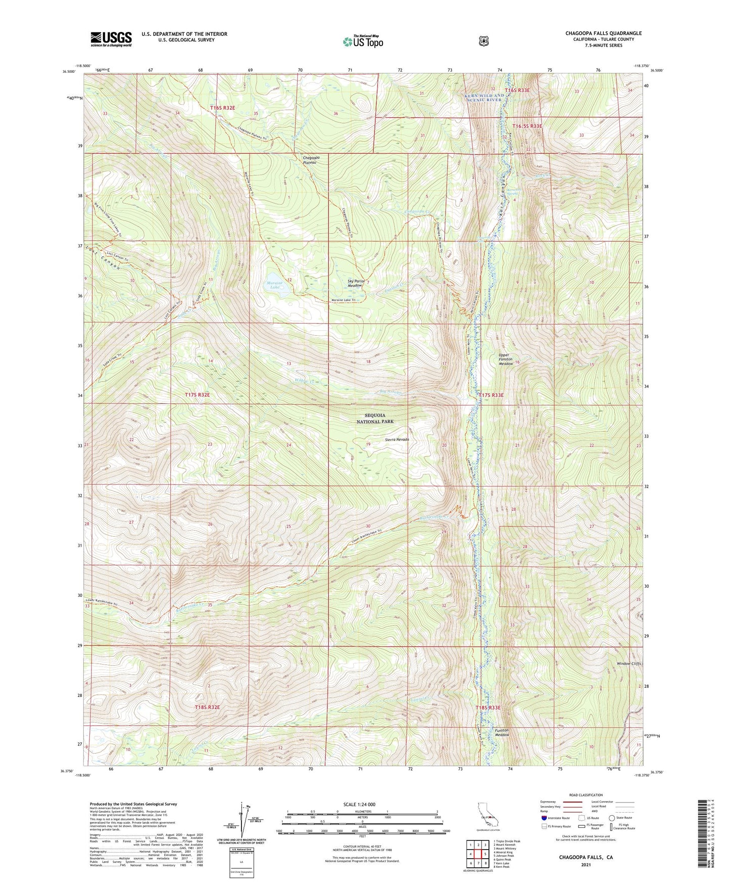
Chagoopa Falls California US Topo Map
Couldn't load pickup availability
Also explore the Chagoopa Falls Forest Service Topo of this same quad for updated USFS data
2021 topographic map quadrangle Chagoopa Falls in the state of California. Scale: 1:24000. Based on the newly updated USGS 7.5' US Topo map series, this map is in the following counties: Tulare. The map contains contour data, water features, and other items you are used to seeing on USGS maps, but also has updated roads and other features. This is the next generation of topographic maps. Printed on high-quality waterproof paper with UV fade-resistant inks.
Quads adjacent to this one:
West: Mineral King
Northwest: Triple Divide Peak
North: Mount Kaweah
Northeast: Mount Whitney
East: Johnson Peak
Southeast: Kern Peak
South: Kern Lake
Southwest: Quinn Peak
This map covers the same area as the classic USGS quad with code o36118d4.
Contains the following named places: Big Arroyo, Chagoopa Creek, Chagoopa Falls, Chagoopa Falls District Ranger Office, Chagoopa Plateau, Funston Creek, Funston Meadow, Kern Hot Spring, Laurel Creek, Lost Canyon, Lost Canyon Creek, Moraine Lake, Rattlesnake Creek, Rattlesnake Point, Red Spur Creek, Rock Creek, Sky Parlor Meadow, Soda Creek, Upper Funston Meadow, Willow Creek, Window Cliffs