MyTopo
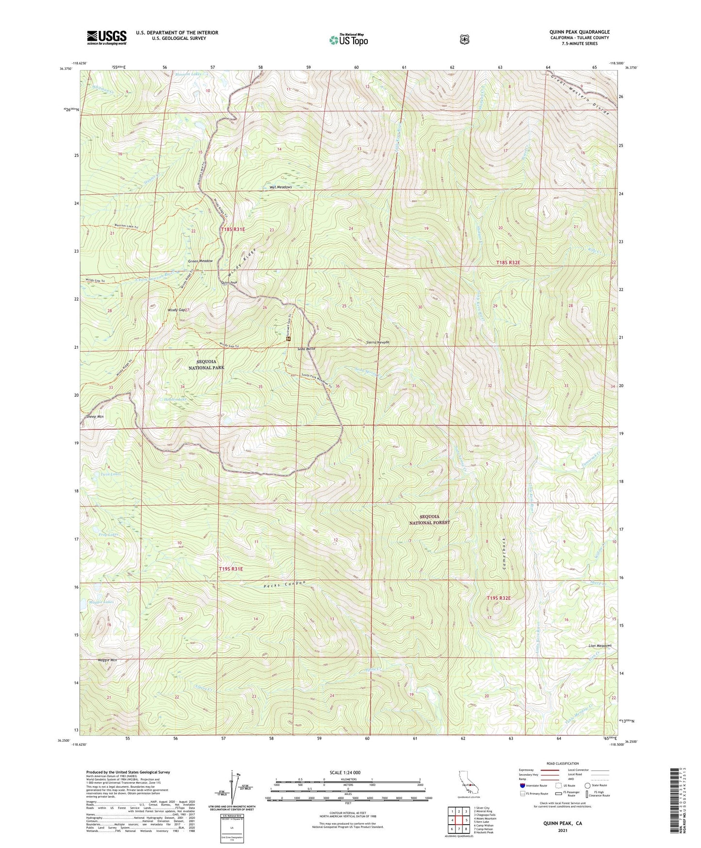
Quinn Peak California US Topo Map
Couldn't load pickup availability
Also explore the Quinn Peak Forest Service Topo of this same quad for updated USFS data
2021 topographic map quadrangle Quinn Peak in the state of California. Scale: 1:24000. Based on the newly updated USGS 7.5' US Topo map series, this map is in the following counties: Tulare. The map contains contour data, water features, and other items you are used to seeing on USGS maps, but also has updated roads and other features. This is the next generation of topographic maps. Printed on high-quality waterproof paper with UV fade-resistant inks.
Quads adjacent to this one:
West: Moses Mountain
Northwest: Silver City
North: Mineral King
Northeast: Chagoopa Falls
East: Kern Lake
Southeast: Hockett Peak
South: Camp Nelson
Southwest: Camp Wishon
This map covers the same area as the classic USGS quad with code o36118c5.
Contains the following named places: Blossom Lakes, Broders Cabin, Camelback, Frog Lakes, Green Meadow, Hidden Lake, Lion Creek, Maggie Lakes, Maggie Mountain, Nelson Cabin, Newlywed, No Name Creek, Pecks Cabin, Pecks Canyon, Pine Tree Mine, Pistol Creek, Quinn Peak, Quinn Snow Survey Cabin, Rifle Creek, Sheep Creek, Shotgun Creek, Soda Butte, Soda Spring Creek, Table Meadow, Tamarack Creek, Twin Lakes, Walkers Cabin, Wet Meadows, Willow Creek, Windy Gap, Windy Ridge