MyTopo
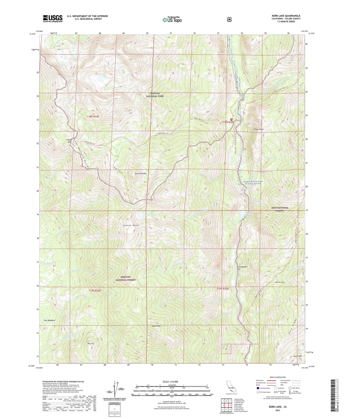
Kern Lake California US Topo Map
Couldn't load pickup availability
Also explore the Kern Lake Forest Service Topo of this same quad for updated USFS data
2021 topographic map quadrangle Kern Lake in the state of California. Scale: 1:24000. Based on the newly updated USGS 7.5' US Topo map series, this map is in the following counties: Tulare. The map contains contour data, water features, and other items you are used to seeing on USGS maps, but also has updated roads and other features. This is the next generation of topographic maps. Printed on high-quality waterproof paper with UV fade-resistant inks.
Quads adjacent to this one:
West: Quinn Peak
Northwest: Mineral King
North: Chagoopa Falls
Northeast: Johnson Peak
East: Kern Peak
Southeast: Casa Vieja Meadows
South: Hockett Peak
Southwest: Camp Nelson
This map covers the same area as the classic USGS quad with code o36118c4.
Contains the following named places: Angora Creek, Angora Mountain, BIg Kern Lake Creek, Coyote Creek, Coyote Lakes, Coyote Pass, Coyote Peaks, Golden Trout Creek, Grasshopper Creek, Grasshopper Flat, Hansen Dam Park, Hell for Sure, Hell for Sure Creek, Kern Canyon Ranger Station, Kern Lake, Leggett Creek, Lion Meadows, Little Kern Lake, Little Kern Lake Creek, Malpais Creek, Rough Creek, Soda Spring, Tower Rock, Volcano Falls, White Mountain