MyTopo
Chalfant Valley California US Topo Map
Couldn't load pickup availability
Also explore the Chalfant Valley Forest Service Topo of this same quad for updated USFS data
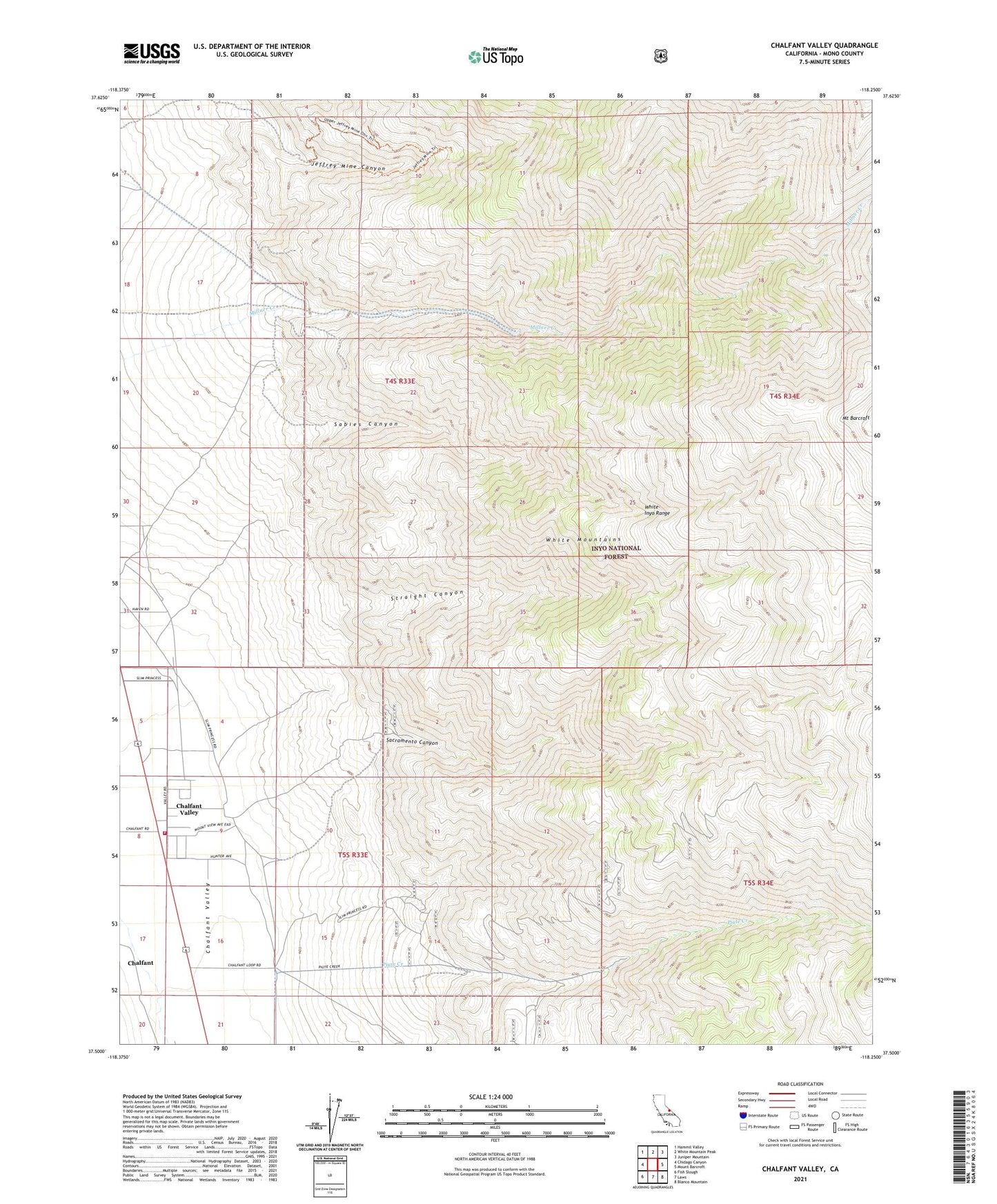
2021 topographic map quadrangle Chalfant Valley in the state of California. Scale: 1:24000. Based on the newly updated USGS 7.5' US Topo map series, this map is in the following counties: Mono. The map contains contour data, water features, and other items you are used to seeing on USGS maps, but also has updated roads and other features. This is the next generation of topographic maps. Printed on high-quality waterproof paper with UV fade-resistant inks.
Quads adjacent to this one:
West: Chidago Canyon
Northwest: Hammil Valley
North: White Mountain Peak
Northeast: Juniper Mountain
East: Mount Barcroft
Southeast: Blanco Mountain
South: Laws
Southwest: Fish Slough
This map covers the same area as the classic USGS quad with code o37118e3.
Contains the following named places: Chalfant Valley, Chalfant Valley Fire Department, Copper Queen Mine, Jeffrey Mine, Jeffrey Mine Canyon, Monoco Mine, Moulas Mine, Piute Creek, Piute Mine, Sabies Canyon, Sacramento Canyon, Sacramento Mine, Straight Canyon, Z and S Mine