MyTopo
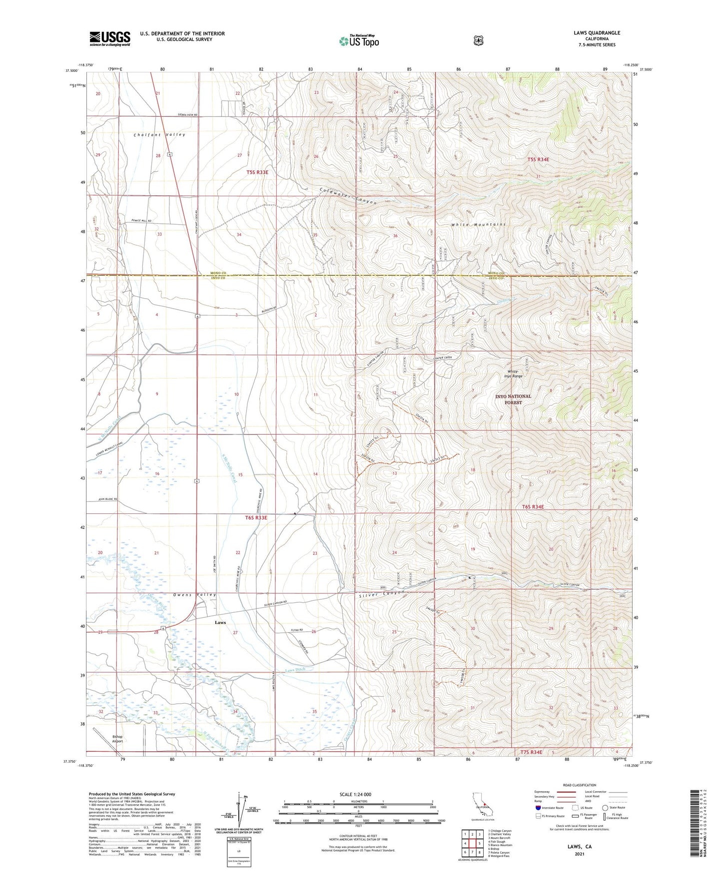
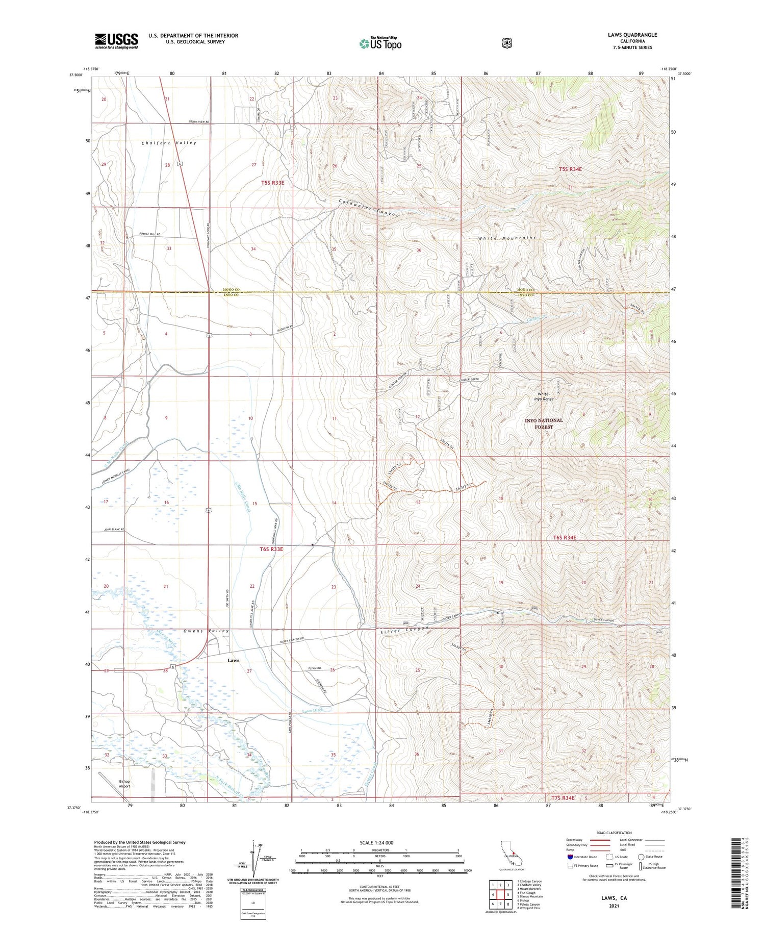
Laws California US Topo Map
Couldn't load pickup availability
Also explore the Laws Forest Service Topo of this same quad for updated USFS data
2021 topographic map quadrangle Laws in the state of California. Scale: 1:24000. Based on the newly updated USGS 7.5' US Topo map series, this map is in the following counties: Inyo, Mono. The map contains contour data, water features, and other items you are used to seeing on USGS maps, but also has updated roads and other features. This is the next generation of topographic maps. Printed on high-quality waterproof paper with UV fade-resistant inks.
Quads adjacent to this one:
West: Fish Slough
Northwest: Chidago Canyon
North: Chalfant Valley
Northeast: Mount Barcroft
East: Blanco Mountain
Southeast: Westgard Pass
South: Poleta Canyon
Southwest: Bishop
This map covers the same area as the classic USGS quad with code o37118d3.
Contains the following named places: Chalfant Valley, Churchill Pit, Coldwater Canyon, Gunter Canyon Mine, Gunter Creek, Laws, Laws Ditch, North End School, North Fork Bishop Creek, North McNally Canal, Railroad Museum, Silver Canyon, South McNally Canal, Southern Belle Mine, White Gull Pit