MyTopo
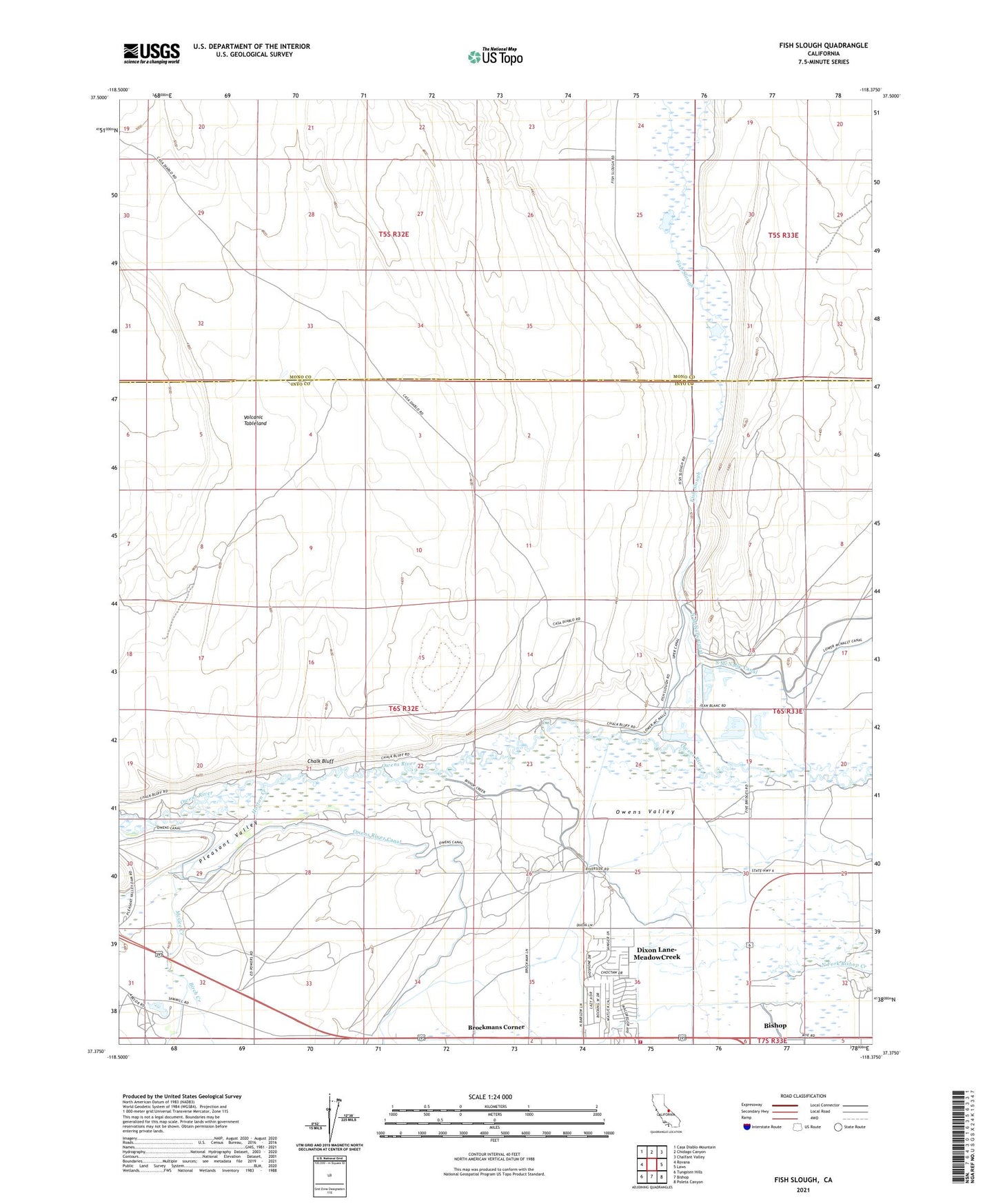
Fish Slough California US Topo Map
Couldn't load pickup availability
Also explore the Fish Slough Forest Service Topo of this same quad for updated USFS data
2021 topographic map quadrangle Fish Slough in the state of California. Scale: 1:24000. Based on the newly updated USGS 7.5' US Topo map series, this map is in the following counties: Inyo, Mono. The map contains contour data, water features, and other items you are used to seeing on USGS maps, but also has updated roads and other features. This is the next generation of topographic maps. Printed on high-quality waterproof paper with UV fade-resistant inks.
Quads adjacent to this one:
West: Rovana
Northwest: Casa Diablo Mountain
North: Chidago Canyon
Northeast: Chalfant Valley
East: Laws
Southeast: Poleta Canyon
South: Bishop
Southwest: Tungsten Hills
This map covers the same area as the classic USGS quad with code o37118d4.
Contains the following named places: Brockman Pit, Brockmans Corner, Chalk Bluff, Dixon Lane-MeadowCreek Census Designated Place, Fish Slough, Five Bridge, Five Bridges Pit Number 1, Glenwood Mobile Estates, Highlands Mobile Home Park, Horton Creek, McGee Creek, Meadow Farms Fire Department Station 3, Meadow Farms Trailer Park, Millpond, Millpond Recreation Area, Owens Valley, Pleasant Valley, Riverside School, Van Loon Pit, Volcanic Tableland, ZIP Code: 93514