MyTopo
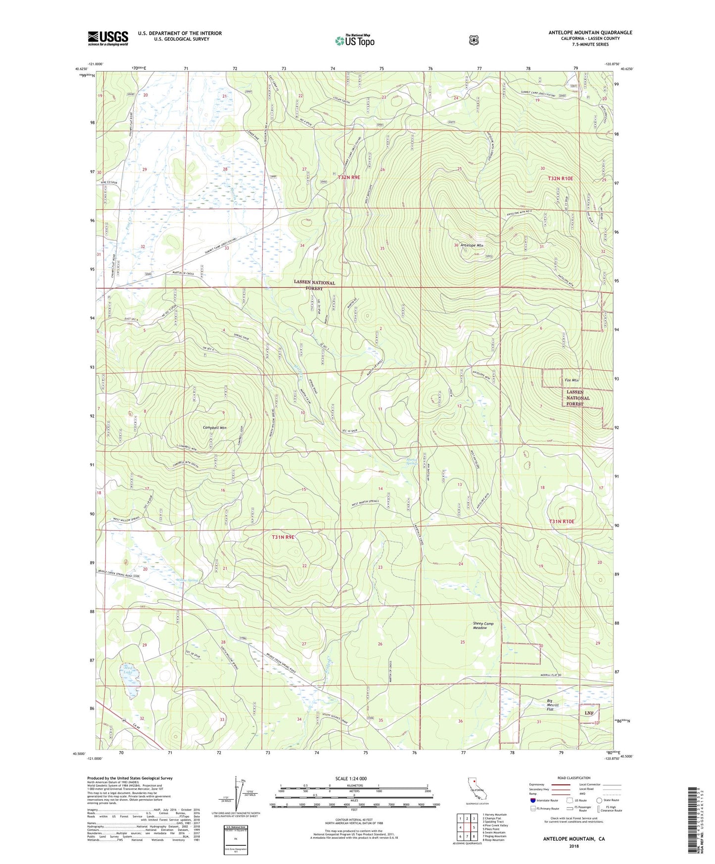
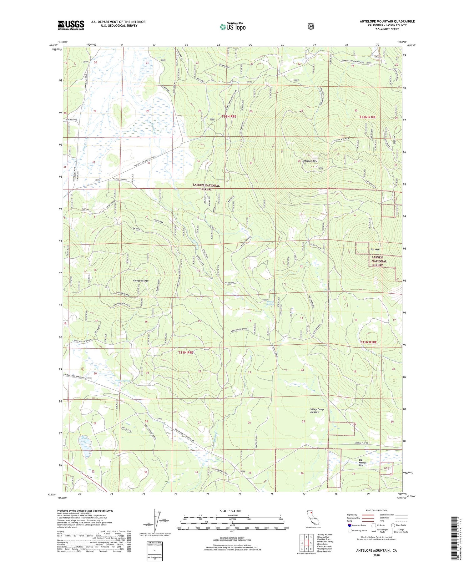
Antelope Mountain California US Topo Map
Couldn't load pickup availability
Also explore the Antelope Mountain Forest Service Topo of this same quad for updated USFS data
2022 topographic map quadrangle Antelope Mountain in the state of California. Scale: 1:24000. Based on the newly updated USGS 7.5' US Topo map series, this map is in the following counties: Lassen. The map contains contour data, water features, and other items you are used to seeing on USGS maps, but also has updated roads and other features. This is the next generation of topographic maps. Printed on high-quality waterproof paper with UV fade-resistant inks.
Quads adjacent to this one:
West: Pine Creek Valley
Northwest: Harvey Mountain
North: Champs Flat
Northeast: Spalding Tract
East: Pikes Point
Southeast: Roop Mountain
South: Pegleg Mountain
Southwest: Swain Mountain
This map covers the same area as the classic USGS quad with code o40120e8.
Contains the following named places: Antelope Mountain, Antelope Mountain Lookout, Big Merrill Flat, Campbell Mountain, Fox Mountain, Fox Mountain Burn, Mapes Cow Camp, Martin Creek, Martin Springs, Mud Lake, Sheep Camp Meadow, Summit Camp, Westwood Division, Willow Spring