MyTopo
Lake Berryessa California US Topo Map
Couldn't load pickup availability
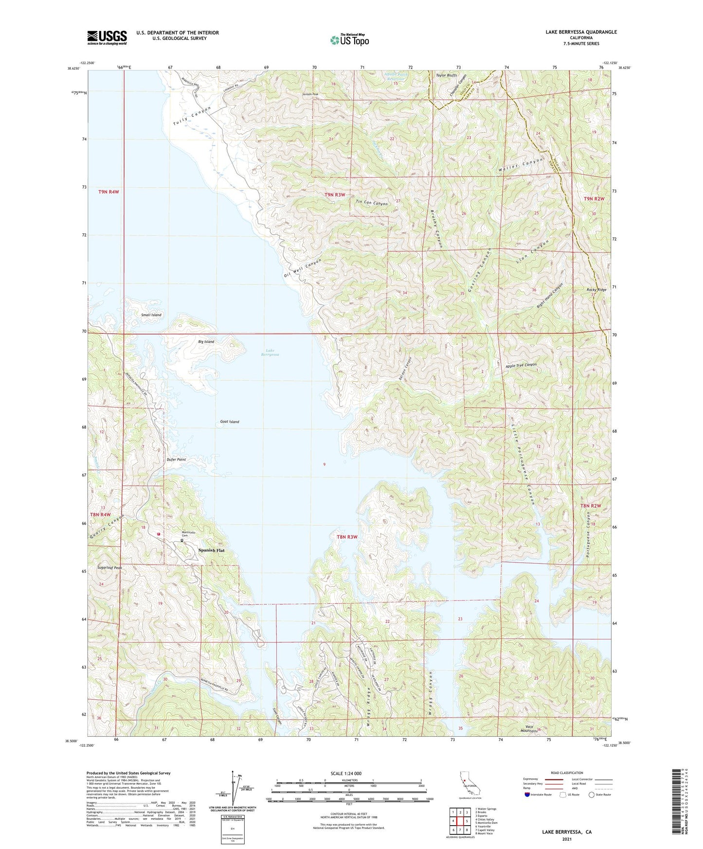
2021 topographic map quadrangle Lake Berryessa in the state of California. Scale: 1:24000. Based on the newly updated USGS 7.5' US Topo map series, this map is in the following counties: Napa, Yolo. The map contains contour data, water features, and other items you are used to seeing on USGS maps, but also has updated roads and other features. This is the next generation of topographic maps. Printed on high-quality waterproof paper with UV fade-resistant inks.
Quads adjacent to this one:
West: Chiles Valley
Northwest: Walter Springs
North: Brooks
Northeast: Esparto
East: Monticello Dam
Southeast: Mount Vaca
South: Capell Valley
Southwest: Yountville
This map covers the same area as the classic USGS quad with code o38122e2.
Contains the following named places: Alfalfa Patch Reservoir, Apple Tree Canyon, Berryessa Highlands, Berryessa Marina, Big Island, Brushy Canyon, Camp North, Capell Cove Boat Ramp, Dardon Canyon, Dufer Point, Goat Island, Gosling Canyon, Gunn Ranch, Jackson Creek, Jackson Peak, Lake Berryessa, Lake Berryessa Park Headquarters, Lake Berryessa Recreation Area, Las Putas, Lion Canyon, Little Portuguese Canyon, Meeks Ranch, Monticello, Monticello Cemetery, Napa County Fire Department Station 24 Spanish Flat, Oak Shores Park, Oil Well Canyon, Portuguese Canyon, Quarry Canyon, Redbud Park, Right-Hand Canyon, Rocky Ridge, Sidwell Ranch, Small Island, Smittle Creek Picnic Area, South Shore Resort, Spanish Flat, Spanish Flat Resort, Steel Canyon, Steel Canyon Resort, Sugarloaf Hunting Club, Sugarloaf Park, Sugarloaf Peak, Tibipa Ranch, Tin Can Canyon, Tully Canyon, Wallet Canyon, Weiss Ranch, Wragg Canyon