MyTopo
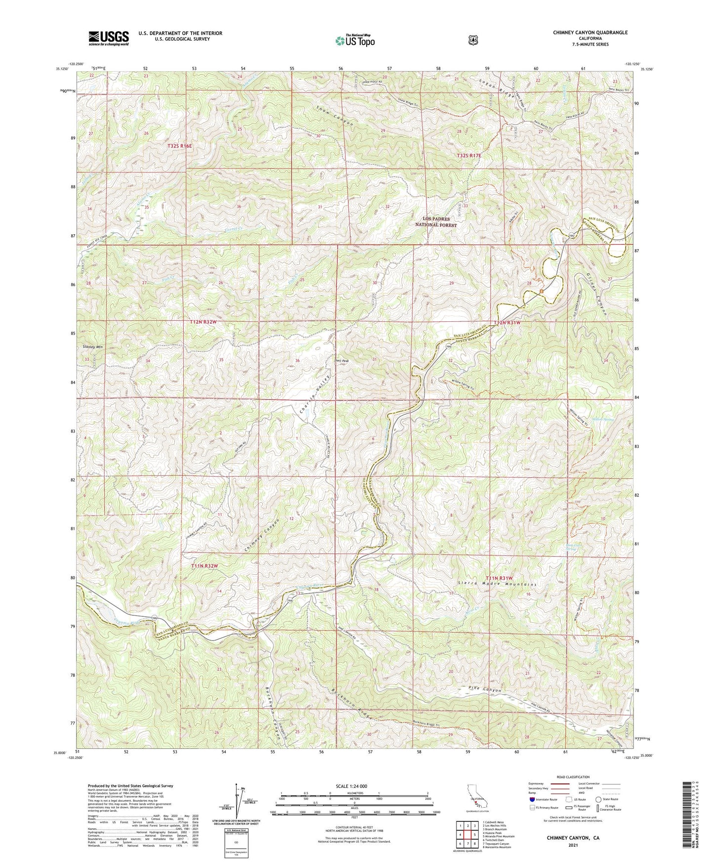
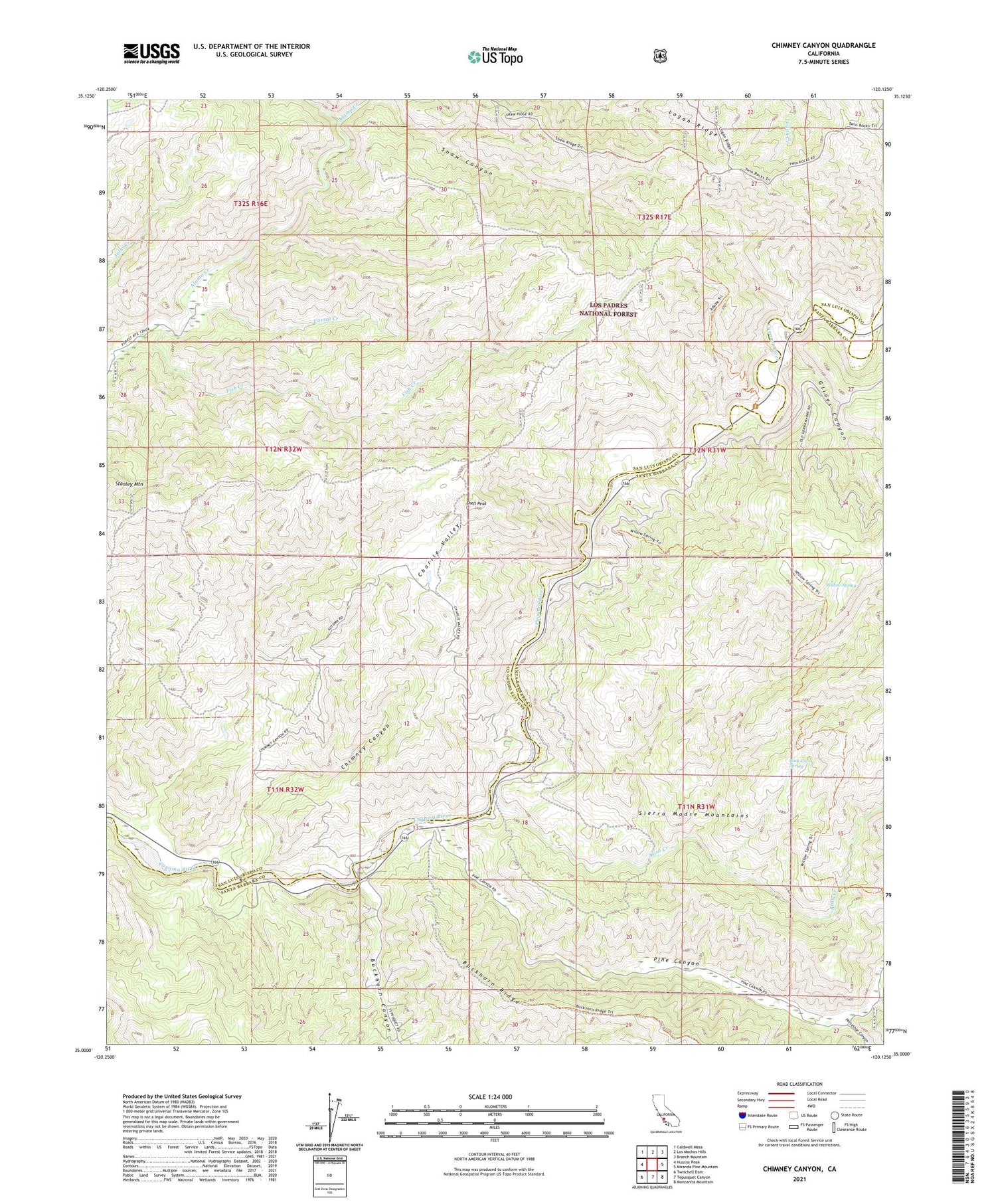
Chimney Canyon California US Topo Map
Couldn't load pickup availability
Also explore the Chimney Canyon Forest Service Topo of this same quad for updated USFS data
2021 topographic map quadrangle Chimney Canyon in the state of California. Scale: 1:24000. Based on the newly updated USGS 7.5' US Topo map series, this map is in the following counties: San Luis Obispo, Santa Barbara. The map contains contour data, water features, and other items you are used to seeing on USGS maps, but also has updated roads and other features. This is the next generation of topographic maps. Printed on high-quality waterproof paper with UV fade-resistant inks.
Quads adjacent to this one:
West: Huasna Peak
Northwest: Caldwell Mesa
North: Los Machos Hills
Northeast: Branch Mountain
East: Miranda Pine Mountain
Southeast: Manzanita Mountain
South: Tepusquet Canyon
Southwest: Twitchell Dam
This map covers the same area as the classic USGS quad with code o35120a2.
Contains the following named places: Aliso Creek, Buck Cove Spring, Buckhorn Canyon, Charlie Valley, Chimney Canyon, Clear Creek, Corral Creek, Fish Creek, Garcin, Glines Canyon, Glines Ranch, Horseshoe Canyon, Little Jollo Creek, Logan Ridge, Morris Ranch, Permasse Ranch, Pine Canyon, Pine Canyon Station, Rice Ranch, Shell Peak, Sierra Madre Picnic Area, Twin Rocks Trail, Willow Spring, Willow Spring Trail