MyTopo
Chualar California US Topo Map
Couldn't load pickup availability
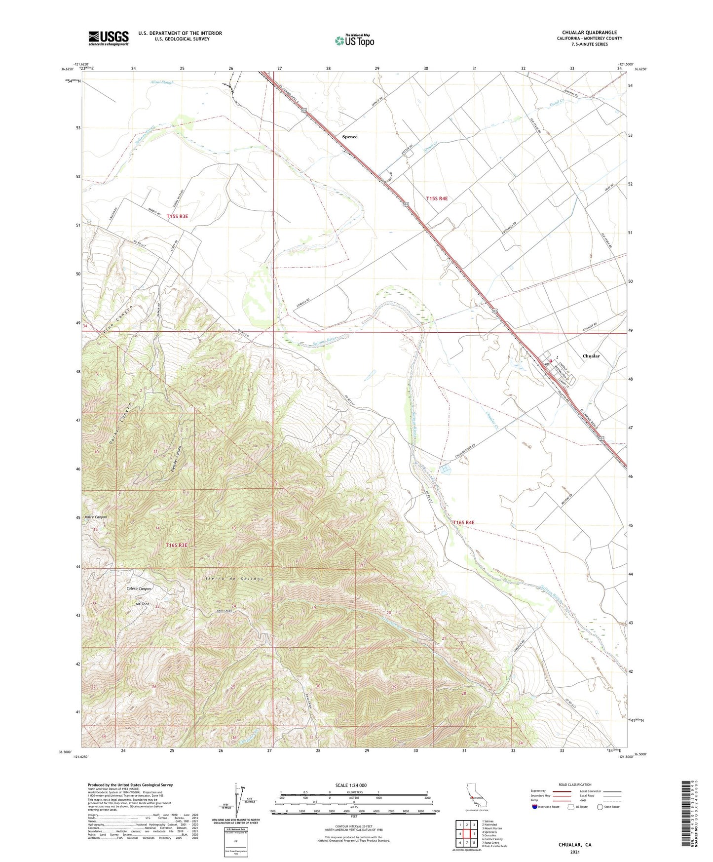
2021 topographic map quadrangle Chualar in the state of California. Scale: 1:24000. Based on the newly updated USGS 7.5' US Topo map series, this map is in the following counties: Monterey. The map contains contour data, water features, and other items you are used to seeing on USGS maps, but also has updated roads and other features. This is the next generation of topographic maps. Printed on high-quality waterproof paper with UV fade-resistant inks.
Quads adjacent to this one:
West: Spreckels
Northwest: Salinas
North: Natividad
Northeast: Mount Harlan
East: Gonzales
Southeast: Palo Escrito Peak
South: Rana Creek
Southwest: Carmel Valley
This map covers the same area as the classic USGS quad with code o36121e5.
Contains the following named places: Buena Vista School, Chualar, Chualar Census Designated Place, Chualar Creek, Chualar Elementary School, Chualar Post Office, Fletcher Canyon, Guadalupe Y Llanitos de los Correos, KMST-TV (Monterey), KTOM-FM (Salinas), KUSP-FM (Santa Cruz), KWAV-FM (Monterey), Limekiln Creek, Mount Toro, Parker Canyon, Pine Canyon, Quail Creek, Salinas Rural Fire Protection District Station 2 Chualar Station, Somavia School, Spence