MyTopo
Palo Escrito Peak California US Topo Map
Couldn't load pickup availability
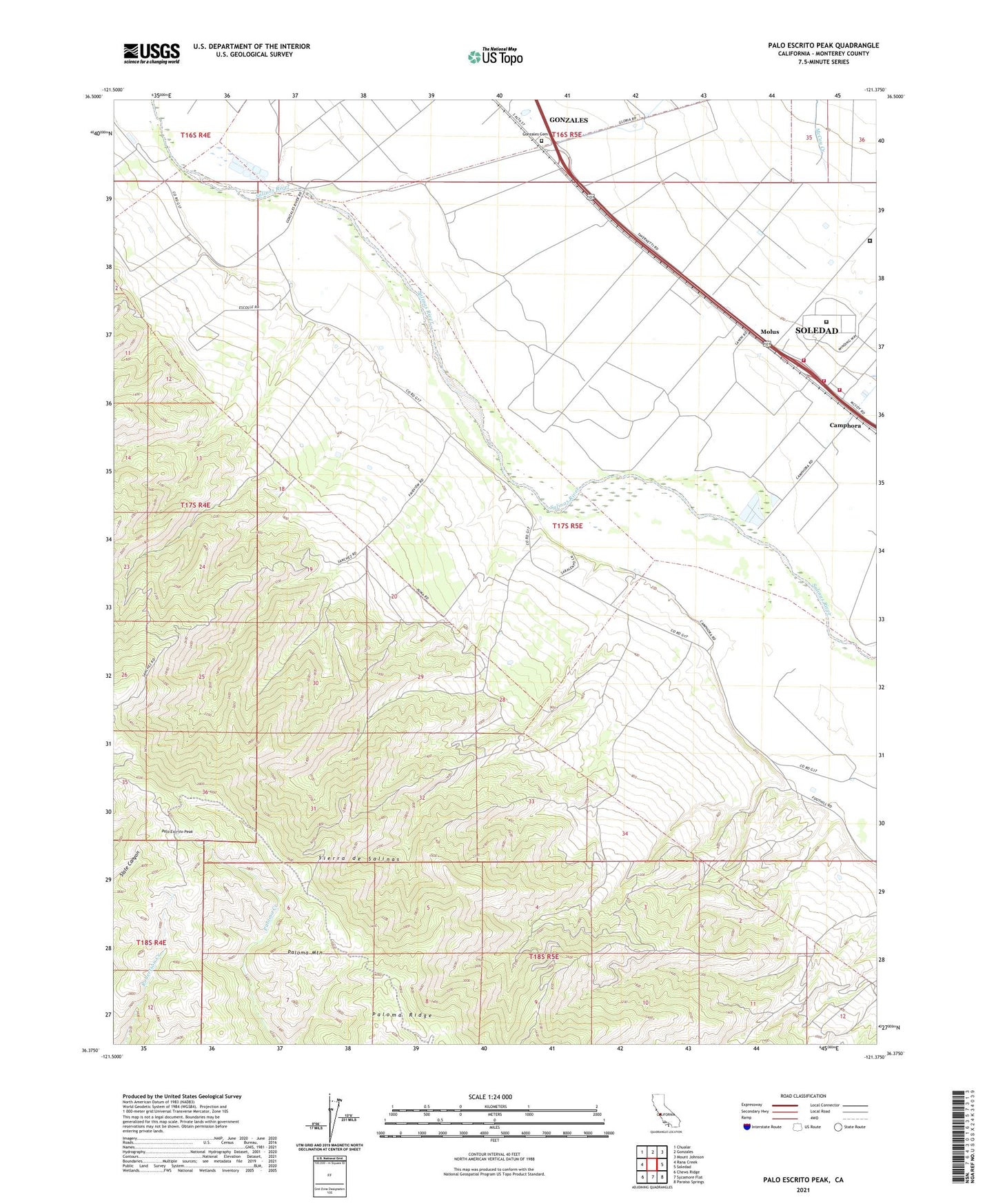
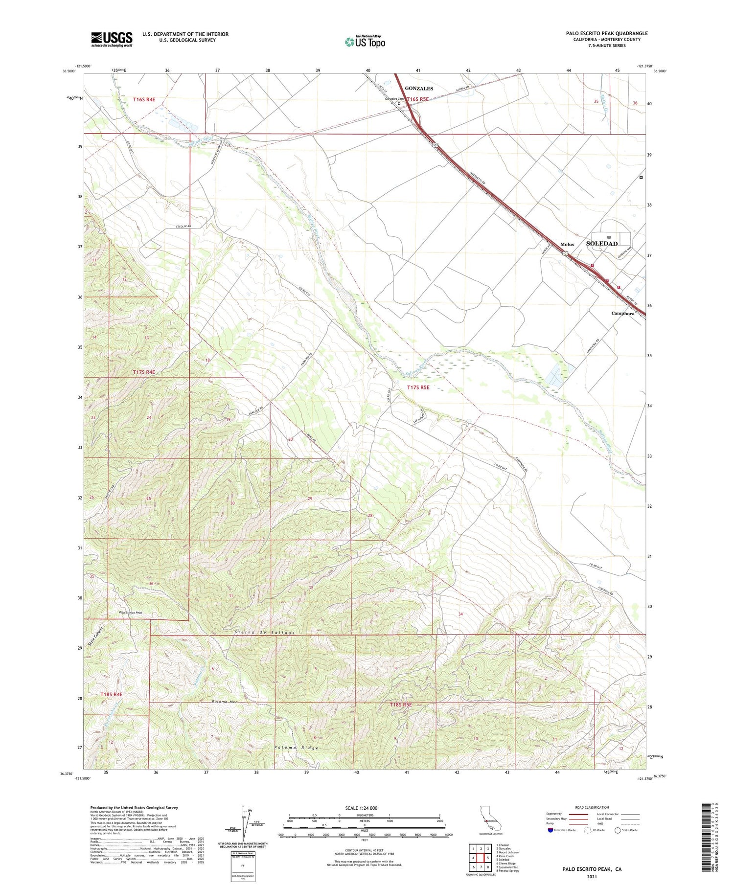
2021 topographic map quadrangle Palo Escrito Peak in the state of California. Scale: 1:24000. Based on the newly updated USGS 7.5' US Topo map series, this map is in the following counties: Monterey. The map contains contour data, water features, and other items you are used to seeing on USGS maps, but also has updated roads and other features. This is the next generation of topographic maps. Printed on high-quality waterproof paper with UV fade-resistant inks.
Quads adjacent to this one:
West: Rana Creek
Northwest: Chualar
North: Gonzales
Northeast: Mount Johnson
East: Soledad
Southeast: Paraiso Springs
South: Sycamore Flat
Southwest: Chews Ridge
This map covers the same area as the classic USGS quad with code o36121d4.
Contains the following named places: Camphora School, Correctional Training Facility, Correctional Training Facility Fire Department, Department of Forestry and Fire Protection Gabilan Unit, Department of Forestry and Fire Protection Gonzales Unit, Ex Mission Soledad, Fairview School, Gonzales Cemetery, Gonzales Fire Station, McCoy Creek, Molus, Palo Escrito Peak, Paloma Mountain, Paraje de Sanchez, Salinas Valley State Prison, Sierra de Salinas, Soberanes School, The Monterey Vineyard