MyTopo
Rana Creek California US Topo Map
Couldn't load pickup availability
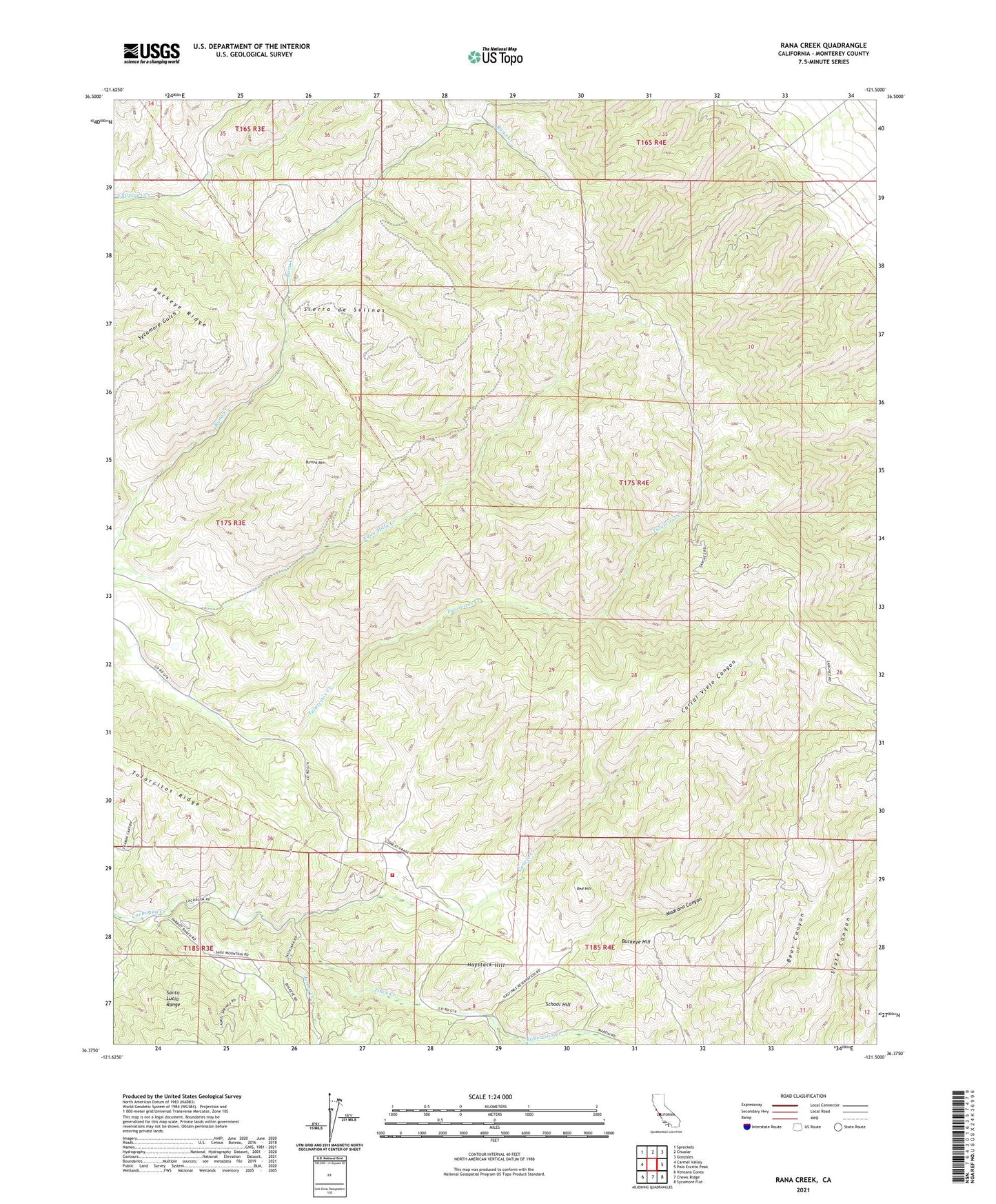
2021 topographic map quadrangle Rana Creek in the state of California. Scale: 1:24000. Based on the newly updated USGS 7.5' US Topo map series, this map is in the following counties: Monterey. The map contains contour data, water features, and other items you are used to seeing on USGS maps, but also has updated roads and other features. This is the next generation of topographic maps. Printed on high-quality waterproof paper with UV fade-resistant inks.
Quads adjacent to this one:
West: Carmel Valley
Northwest: Spreckels
North: Chualar
Northeast: Gonzales
East: Palo Escrito Peak
Southeast: Sycamore Flat
South: Chews Ridge
Southwest: Ventana Cones
This map covers the same area as the classic USGS quad with code o36121d5.
Contains the following named places: Big Creek, Buckeye Hill, Buckeye Ridge, Burned Mountain, Cachagua Fire Protection District Station 3 Tassajara Road, Casa Verde Gun Club, Conejo Creek, Corral Viejo Canyon, Finch Creek, Haystack Hill, James Creek, Los Tularcitos, Madrona Canyon, Red Hill, Robertson Creek, School Hill